

Easy Hiking In Skagway?

Recently we did some hiking in Alaska and in Skagway things went somewhat sideways. Just outside of town and past the airport is a pedestrian bridge that takes you to several trailheads. On our first day we added a short hike to Smugglers Cove to our afternoon and started out.

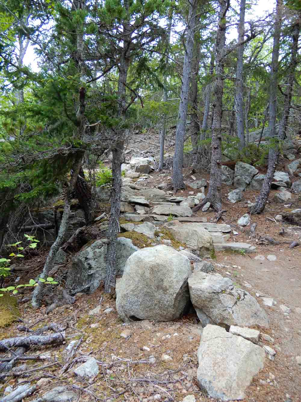
Smugglers Cove is rated easy and the trail is around a mile round trip. After crossing the pedestrian bridge we started up a wide trail. A few hundred feet in we came to a marker post with arrows pointing off to the right for Smugglers Cove and an obvious path into the woods. Ten to fifteen minutes into the hike this trail began to climb at least 30° into a rocky area. Thinking that we had to cross a ridge we kept walking and every few minutes the trail got harder. After a half mile it was becoming obvious that we weren’t heading toward a cove as our trail kept on climbing.


The A.B. Mountain Trail
The climbing got more difficult and being worried about time we gave up. It was also odd that we hadn’t passed anyone else on the hike. Back in town we stopped in at the National Park Service to get some trail maps and suggestions. Explaining that the trails over at Smuggler’s Cove were managed by the town of Skagway and there was a lot of controversy regarding trail markers, they explained that we probably had taken the A.B. Mountain trail by mistake and it was 4 miles long and rated as strenuous.
Several days later we returned to that trail with some friends and when we reached the marker where we took a wrong turn it was apparent what had happened. The markers were attached to a 4×4” post that was just sitting in a hole. It was easy to just rotate the post. Looking around we found the markers for Smuggler’s Cove and Yukatania Point up a small incline through some rocks behind the post.

Smuggler’s Cove

Alaska has some incredible hiking trails with many managed by the National Park Service with one of their more challenging hikes being the Chilkoot Trail. It traverses Alaska and British Columbia for about 33 miles, half in Alaska, and half in British Columbia. The Alaskan portion of the trail, which is a unit of Klondike Gold Rush National Historical Park, was recently designated as Chilkoot National Historic Trail. Unfortunately major flooding caused extensive trail damage on the U.S. side in October of 2022. NPS employees are working to repair the damage and some sections are hoped to be open later in summer 2023. Through hiking of the entire 33 miles of trail will not be possible until Spring of 2024.
