A Beautiful Mistake
Not all mistakes made by man turn out to be serious disasters. Two hundred years ago in Southwest Georgia poor farming practices helped create a “natural” wonder.
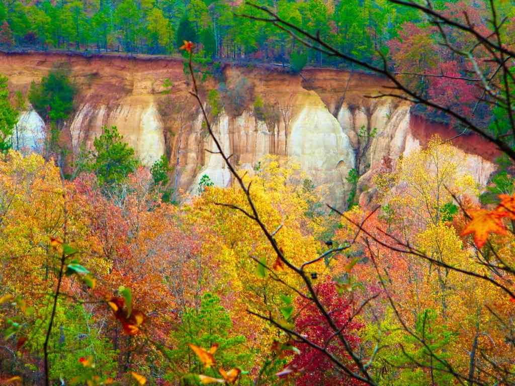
Providence Canyon is a network of gorges, gullies and a plateau created by erosion through multicolored layers of clays and soils. Referred to as “Georgia’s Little Grand Canyon,” Providence Canyon consists of an area of plateaus, cliffs, and narrow pinnacles where erosion has exposed a geologic record going back several million years.
Historical accounts show that the canyon was formed initially in the early 1800s as the result of poor farming practices. The original forest cover was cleared so it could be farmed. Gullies formed and soon grew deeper and by 1850 eroded pathways as deep as a dozen feet crisscrossed the area. From there additional runoff dramatically increased the erosion.
The area gets its name from Providence Methodist Church, established in 1832. By 1859 the church building and a schoolhouse were relocated and where they originally stood the land has washed into the canyon. The second church building still stands just northwest of the canyon.
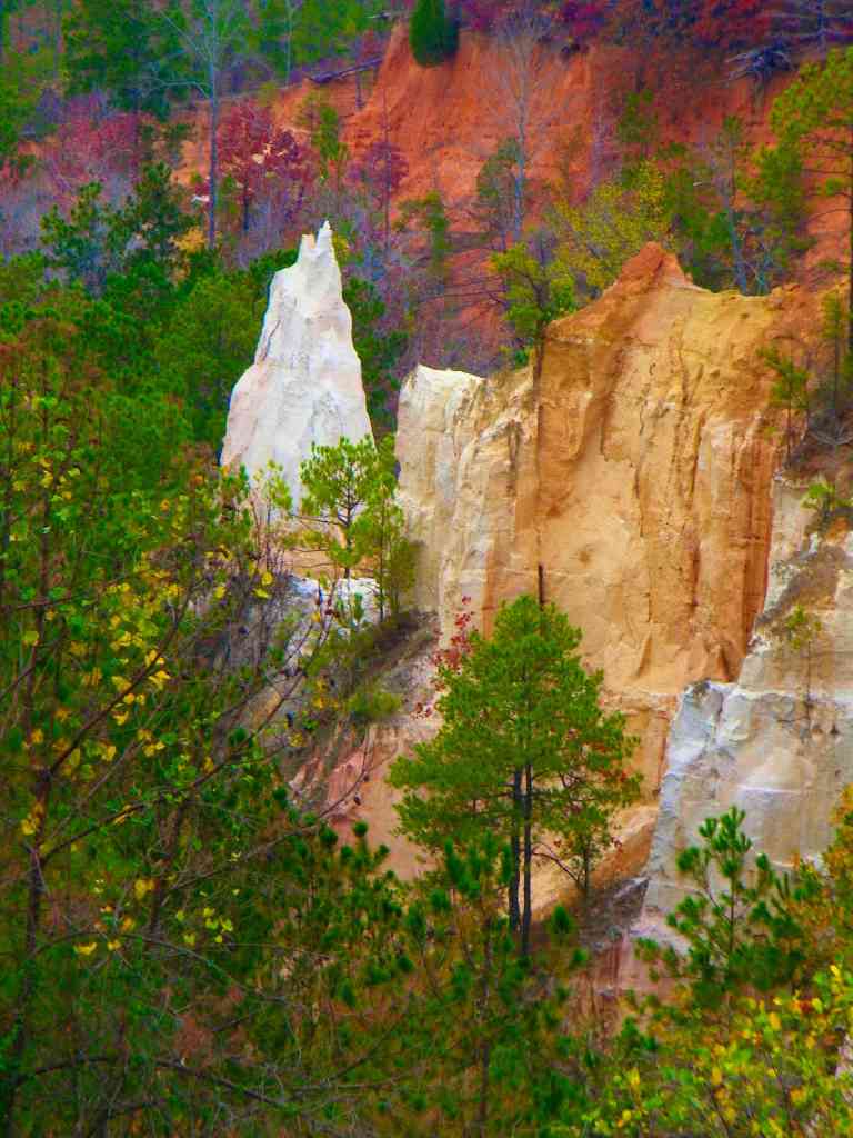
The Georgia Department of Natural Resources now operates Providence Canyon State Park. The 1,109-acre park encompasses the canyon rim and 16 separate canyons, as deep as 150 feet. From a trail along the rim, several overlooks offer views of the canyon walls, in which forty-three different colors of sands have been identified. Inside the canyon are a number of hiking trails.
Geology
Providence Canyon, lies in the Georgia Coastal Plain region, and is composed of sediments deposited by ancient streams, seas, deltas, and coastal beaches some 65 million years ago. The sediments forming the canyon form four geologic formations: Baker Hill, Clayton, Providence, and Ripley.
The Baker Hill formation is the youngest and forms the uppermost part of soils in Providence Canyon State Park. Deposited during the Paleogene period, this formation sits just under the the canyon’s rim.

The Clayton formation, in the top of the canyon walls, was also deposited during the Paleogene period, 65 million years ago,at the end of the age of the dinosaurs. It’s composed of coarse reddish sand colored by iron oxide. At the base of this formation, iron oxides have precipitated into a thin, dark layer of iron ore, which was mined in areas outside the park.
The Providence formation makes up most of the canyon walls. One hundred and nineteen feet thick, it was deposited during the Cretaceous period, about 70 million years ago. The upper layer of this formation consists of very fine sand mixed with a white clay called kaolin. The middle layer is coarser-grained and more colorful, with crossbeds stained yellow by limonite and purple by manganese. The lowest and oldest layer is a black and yellow mica thick clay deposit. This part of the formation is known as the Perote member and is visible at the bottom of the canyon.


The canyon floor is the Ripley formation deposited during the Cretaceous period, about 75 million years ago, it is orange in color with a composition of clay sand. This formation includes layers of fossils.
Providence Canyon is still eroding and from water runoff and is being undercut by the force of groundwater. The clay content of sediments in the floor of the canyon makes it more resistant, and the growth of pine trees, laurel bushes, and other vegetation helps to stabilize the soil, reducing the rate of vertical erosion.
