Trails in Tierra Del Fuego National Park, Argentina

To The Ends Of The Earth
The Pan American Highway begins in Alaska and with only a small break in southern Panama goes all the way to the end of the Earth in southern Argentina. In Argentina the Pan American Highway continues on Argentina National Route 7 south to the capital of Buenos Aires. where the main highway ends. The Pan American Highway route continues south out of Buenos Aires along Argentina National Route 3 along the coast. It goes further south to the city of Ushuaia in Tierra del Fuego where it comes to its ends in a dirt two lane road inside Tierra del Fuego National Park.
More and more people are coming to explore Tierra del Fuego National Park in recent years as the city of Ushuaia has greatly expanded. Not just a major embarkation port for Antarctic expedition tours, With financial support from the Argentina government Ushuaia is developing new industry along with a thriving tourist economy. Today Ushuaia has much to offer in its own right.
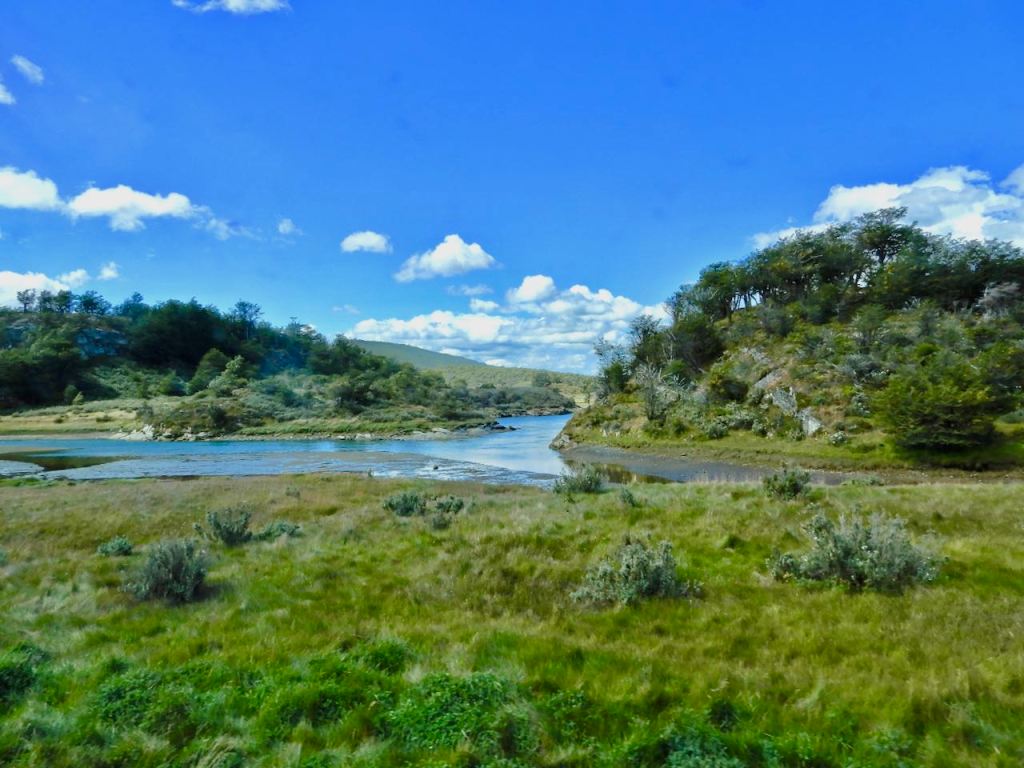
Argentina’s Tierra del Fuego National Park is at the tail end of the Andes Mountains and, with the exception of Antarctica, is at the end of the world. The park covers just under 250 square miles, extending along the southern coast bordering with Chile to its west. The hiking trails in Parque Nacional Tierra del Fuego are the park’s top attractions, but since all except roughly 5,000 acres of the park are closed to entry as a nature reserve, the number of hiking trails for the public is limited.
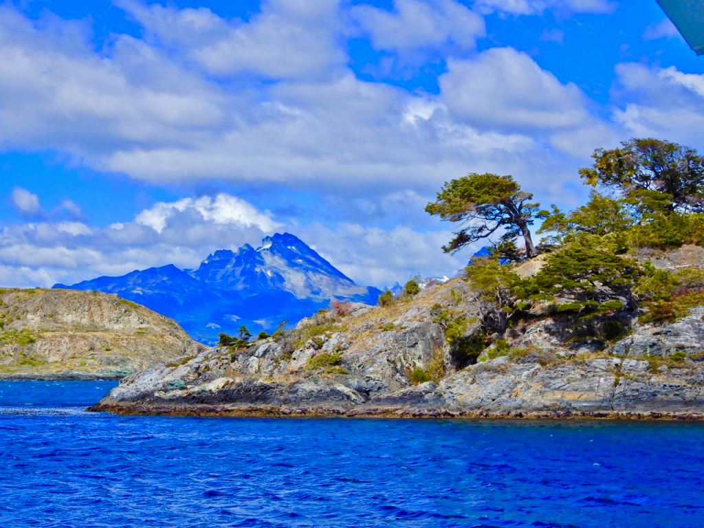
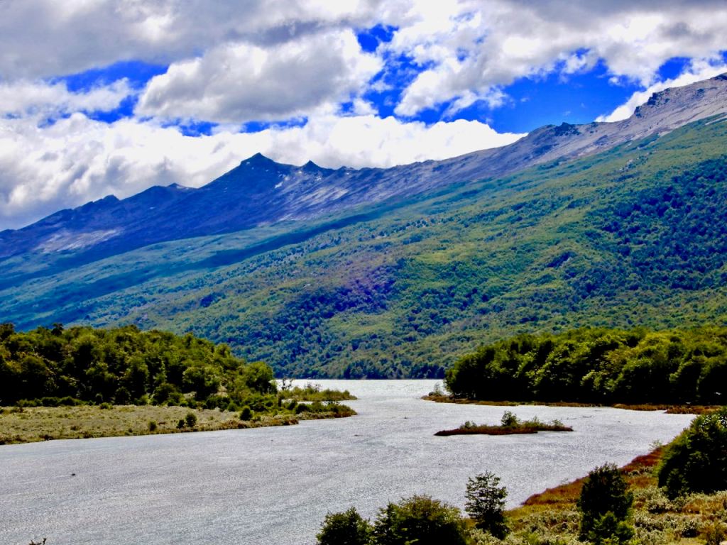
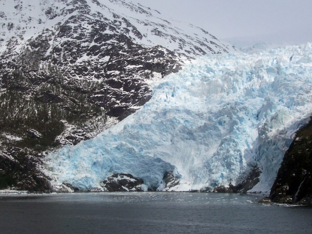
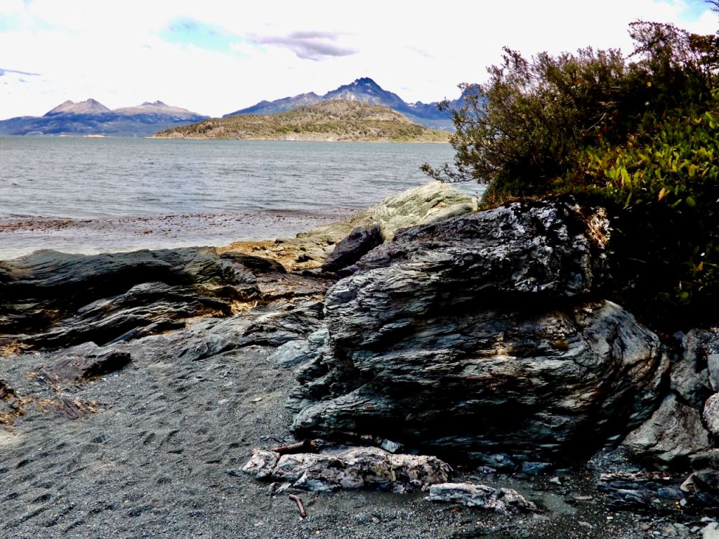
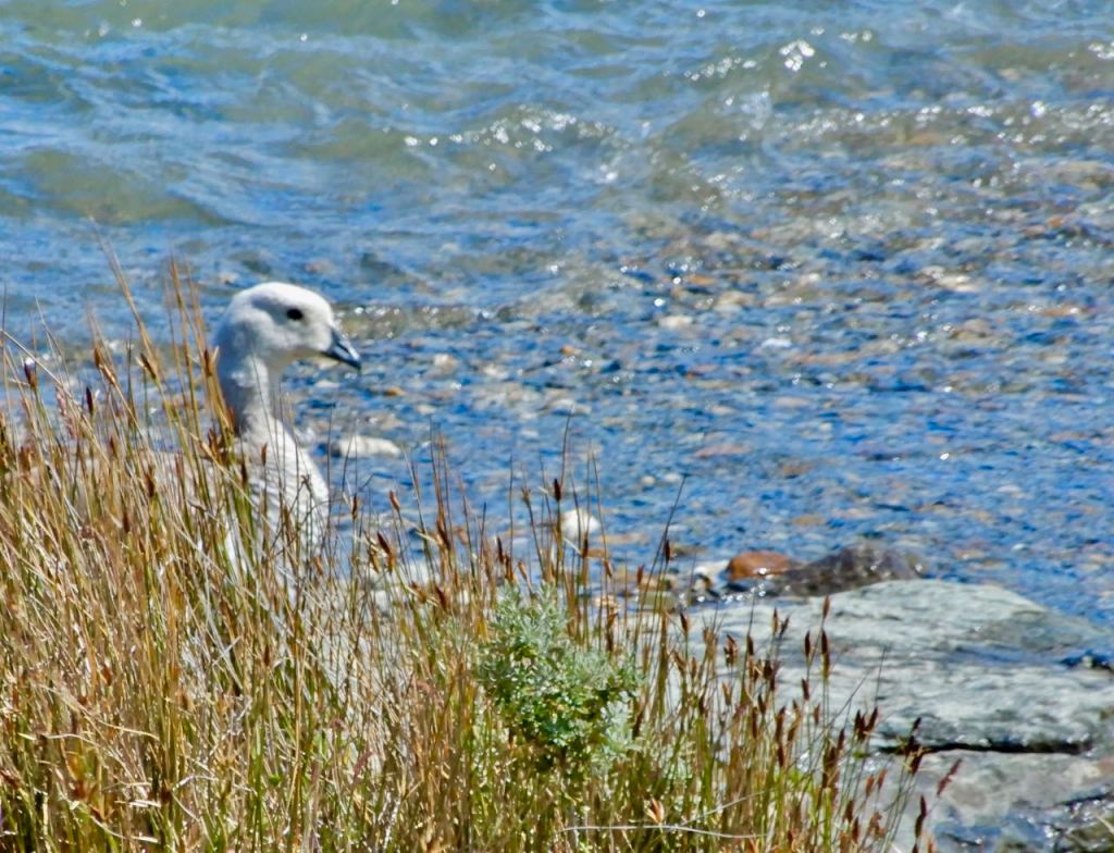
The geology of the park finds peaks alternating with valleys where there are rivers, glaciers and glacial lakes. Two types of forests predominate with Lenga and Guindo trees, with an open under layer of mainly moss and fern. There is also plenty of peat and flooded areas where sphagnum moss grows. On the sea shore, there are two great bays (Lapataia and Ensenada) interspersed with gorges and beaches that are full of waterfowl. There are black eyebrowed albatross (over two meters wing span) who cohabit with the steam duck and the diving petrel. There is also a rare kind of otter in the area named chungungo with other species being the guanaco and a unique variety of red fox.
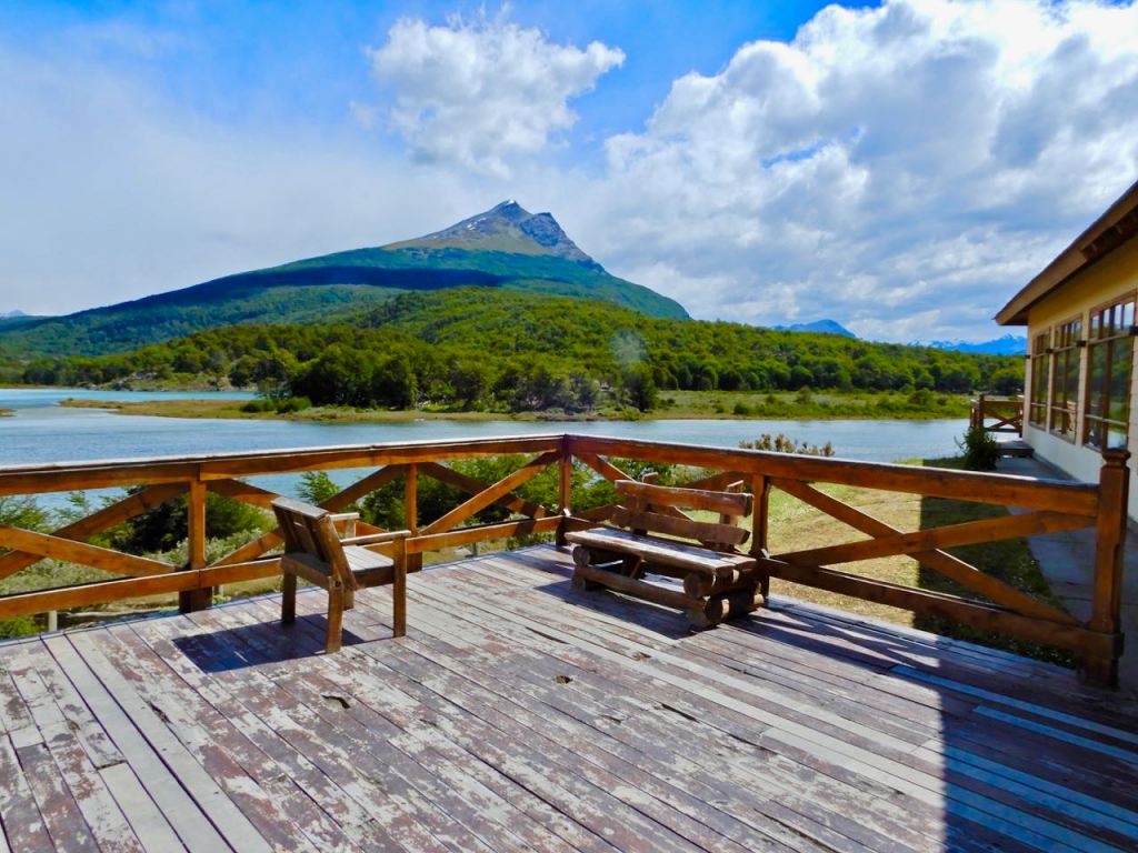
Access to the Park is via National Route 3, 7 miles to the west of the city of Ushuaia. A couple of miles inside the parks main entrance is the visitors center with guidebooks and maps in a number of languages.
Easy Walking Trails
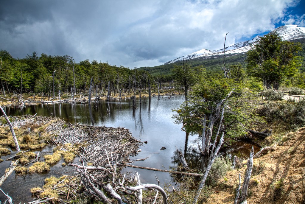
Within the park’s Lapataia area, day visitors will find some easy walking paths. Several paths main draw are the colonies of very recognizable North American beavers. The del Turbal, Castorera and de la Baliza trails run alongside a number of both active and abandoned beaver colonies. Beavers have inhabited Tierra del Fuego for over 50 years, with their populations exploding since they have no natural predators in the region. They were originally introduced to provide hunting for pelts but The trails also pass along side some wetlands and peat bogs, across Archipelago Cormoranes and along the edge of the restricted area.
Medium Difficulty Hiking Trails
Tierra del Fuego’s three major hiking trails — Hito 24, Pampa Alta and Costera — are all medium difficulty trails that take between two to four hours to complete. The Hito 24 trail runs for just over six miles around the forested northeast shore of Lago Roca to the Argentina-Chile border. The three-mile Pampa Alta trail features panoramic views across Beagle Channel and Rio Pipo. Farther along, the trail runs alongside the Rio Pipo and some nice waterfalls. The Costera trail runs for approximately five miles along the coast past the grass-covered remains of middens or native mounds of shells left behind by the Yaghan, the indigenous peoples of the Tierra del Fuego.
One of the more popular hikes is Martial Glacier at 3.9 miles out and back located near Ushuaia, Tierra Del Fuego that offers impressive scenic views and is rated as moderate. The trail is primarily used for day hiking and walking.
Additional trails for more experienced hikers include:
- 7.7 miles #2 Cañadon de la Oveja Very Difficult
- 0.8 miles #3 Laguna del Caminante Trail Difficult
- 7.2 miles #4 Valle de Andorra Trail Very Difficult
- 3.1 miles #5 Laguna de les Tempanos Difficult
patagonia-argentina.com/en/tierra-del-fuego-national-park
Where the highway ends this park is literally at the end of world. Located on the Beagle Channel and home to huge numbers of sea birds and waterfowl, it is a naturalist’s paradise.
