

A Journey Into America’s Past
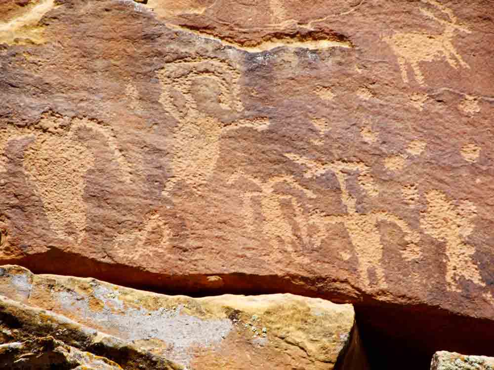
In the remote Utah desert, about 125 miles south from Salt Lake City, is Nine Mile Canyon. The area is filled with tens of thousands of petroglyphs and pictographs, some thousands of years old. The earliest were produced by hunter-gatherer cultures of the mid-to-late Archaic periods from almost 7,000 years ago, more were produced by members of the Fremont culture from 500 BC to 1200 AD, and the protohistoric Ute and Shoshone tribes 1200 BC to 1850 AD. The artists who created these rock images were witness to dramatic environmental shifts. Lake Bonneville shrank into todays Great Salt Lake while lush vegetation and plentiful wildlife vanished into desert. The creators of 9 Mile Canyon petroglyphs are numerous indigenous people who lived in these canyons for thousands of years. These petroglyphs are considered a window into America’s distant past.

The area of the canyon is remote with only a few ranches and little signs of habitation. It won’t be unusual to find cattle roaming down the road. To get into the canyon from the south, along a paved, 21 mile road from US 191. From there it’s another 25 miles to the east end of the rock art sites near the Great Hunt Panel. Getting to the canyon from Price go east on Highway 50-6 through Wellington, It is a total of 7.5 miles to the Nine Mile Canyon turn-off at Soldier Creek Road. Next turn left, or north. Oddly, Utah’s 9 Mile Canyon is approximately 46 miles long and located in Carbon and Duchesne counties.

The Bureau of Land Management (BLM) manages the area and allows visitors on their own to explore the canyon’s many petroglyphs and other historical sites during daylight hours only. It’s important to note that visitors should “Leave No Trace” of their visit and respect the cultural and historical significance of the area when hiking. See BLM 9 Mile Canyon site HERE.
There are no consistent markers indicating various petroglyph locations and few turnoffs or designated parking. You’ll need to keep an eye out for small, often hand made signs marking some trail entry points with many partially hidden by brush. The best way to find these sites is by keeping track of car milage as you drive the road.
Driving Instructions To Explore Te\he Canyon
From the state road onto 9 Mile Canyon Road it is 21.1 miles to the bridge over Minnie Maude Creek. Starting at the highway turn off, drive on paved road through sagebrush and juniper country. In the spring you may see deer down from the hills feeding in the alfalfa fields.
At 12.2 miles you’ll pass through the Soldier Creek Mine parking lot. The road climbs slightly to the summit of the hills. The creek running to the west is Minnie Maude Creek.
A half a mile after the bridge is a BLM sign with information about the canyon.
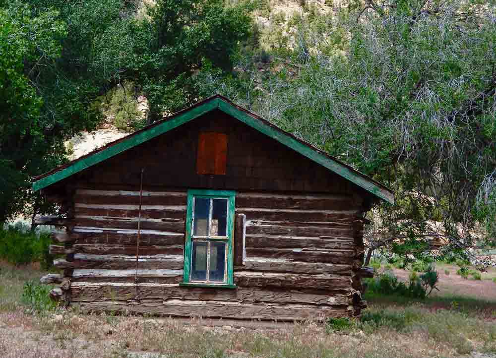
It’s 1.5 miles from the bridge to the old homestead on the left side of the road.
Another 3.3 miles from the homestead are the first major panels of petroglyphs. The first panel is a good opportunity to view some petroglyphs up close. The rock art is on a rocky point to the left of the road. If you stand back from the petroglyph rock and look over your head. You will see an excellent panel of petroglyphs just above a narrow ledge. If you are careful, you can climb up to the ledge for a closer look.
Another 3.2 miles from this first location is the first structure created by the Fremont culture. On your left is a large, sagebrush-covered hill. Locate a flat-topped rock on top of the hill. Several hundred yards below that rock and slightly to the left, there is a rock cliff with several long cracks in it. With your binoculars, examine the base of the largest crack. You will see the remains of a round structure. On the low ridge to your right are pit houses.
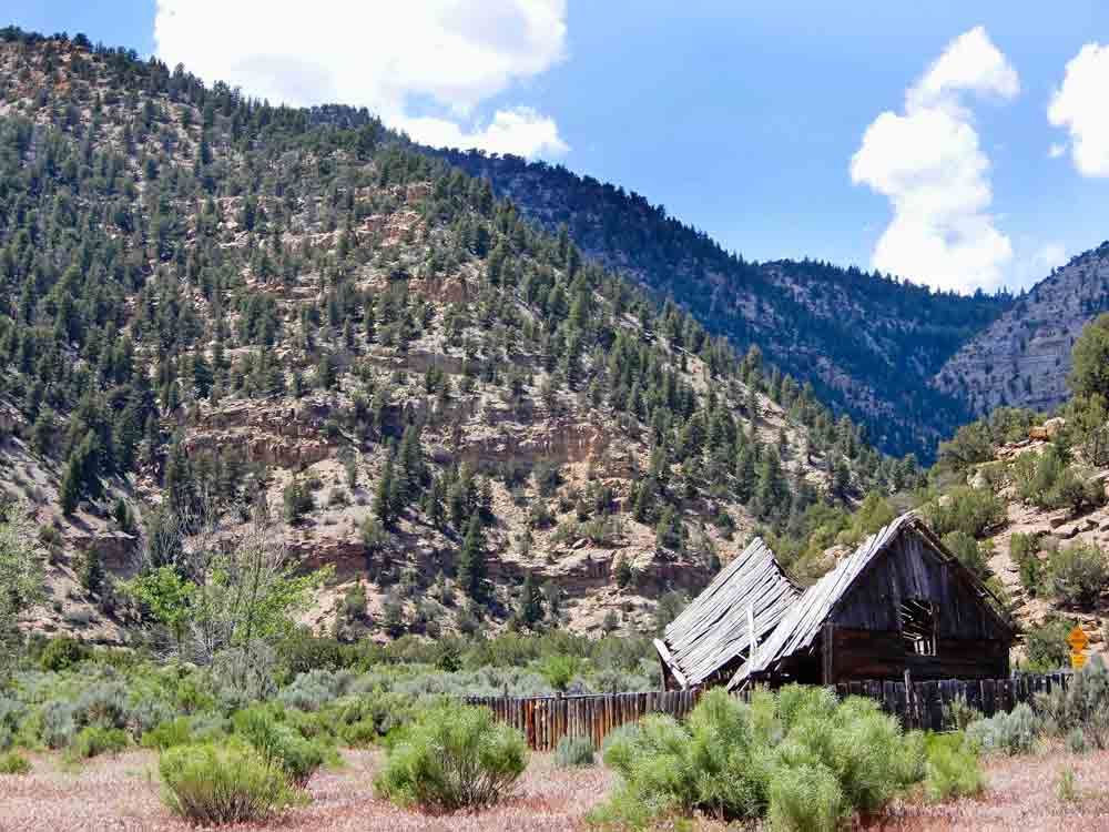
Going another 1.0 miles you will come upon the remains of the ghost town of Harper. It was once a stagecoach stop and a sheep ranch.
Near here is a BLM provided parking lot with picnic tables and rest rooms. There are additional restrooms in about 12 miles
After another 1.4 miles the road curves around a balanced rock near the left edge of the road. Stop just around the corner from the balanced rock. To the left of the road is an excellent panel with a variety of figures. You can climb up to the ledge, but be careful of loose, falling rock.
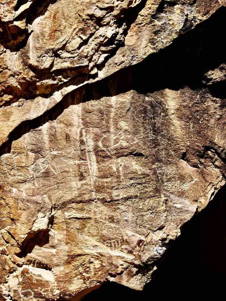
Go another 1.4 miles and look for smooth sections of rock covered with black patina, to the left of the road halfway up the hill. There are carvings all along this section. In particular, note the excellent panel with some unusual figures of human shapes with headdresses and toes and fingers, there are lines of deer, and some designs with squares created from dots. You’ll need binoculars for a better view of the petroglyphs, or you can climb up to these panels.
Another 1.4 miles on the right next to a line of tall cottonwood trees. To your left, look halfway up the hills at a design of a large snake. With binoculars find the rock faces on both sides of the snake. To the right is a rock covered with trees, birds, and human figures with distinct hands and feet.
It’s 3.5 miles to the remains of an ancient granary are visibly. Get out and look back and up at a 45-degree angle. The front of the granary is washed away, but the floor, ceiling, and walls are clearly visible.
Another 1.0 mile to see an intact granary. Cross the cattle guard, look to your left. Locate the large, lone cedar tree just at the base of the rock cliff. There is a lot of sagebrush in this area, but the tree is alone at the cliff base. Follow the ledge the tree is on to the right, about halfway across the face of the cliff. Locate a light-colored area of rock above that ledge. The granary is there; with light-colored mortar and appears to be perched on the rock face.
Another granery structure is after 1.5 miles. Look straight ahead up the road to the high cliff. There’s a long slit in the rock that looks greenish. Sllightly below this rock and to the right is a hole in some light-colored rock. You’ll need binoculars and the granary can be seen in the crevice.
After another 2.5 miles Rassmussen’s Cave is marked and it’s the location of some really good pictographs.

Another 1.0 mile the road forks – take the right fork. After 0.9 miles on the ridge you’ve just circled is the remains of a Fremont Village. It’s an easy walk up the hill to the west to visit the rocks that outline several pit houses. From there look to the north across the canyon for a long greenish ledge; with binoculars, you can see it is lined with structures.
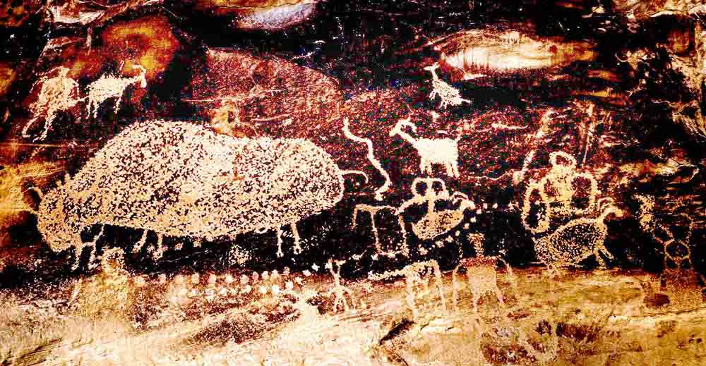
After another 0.3 miles there’s a rock outcropping to the right, about 10 feet above the road is a famous hunting scene that is the subject of one of the murals in the Price Prehistoric Museum.
Go back to the forks in the main road and turn right. Go 0.5 miles on that road to an alcove of white rock about a third of the way up the hill. To the left are both petroglyphs and pictographs. The pictographs use colors applied to the rock instead of carving.
Go 1.8 more miles to another petroglyph panel showing men, women, a turkey, a scorpion, a bird and abstract sketches.
The canyon and surrounding landscape literally has thousands of petroglyphs to discover along with several good hiking trails.At times BLM offers guided tours into the canyon. Check with there website.
