Visiting Štúrovo, Slovakia From Budapest

A Day Trip To Štúrovo and Esztergom By Train From Budapest

Esztergom looking up at “Castle Hill”

Maybe it was wanting to see some of the countryside or maybe it was adding another pin to our map but on a beautiful Saturday morning we set off from Budapest to visit Štúrovo, Slovakia.

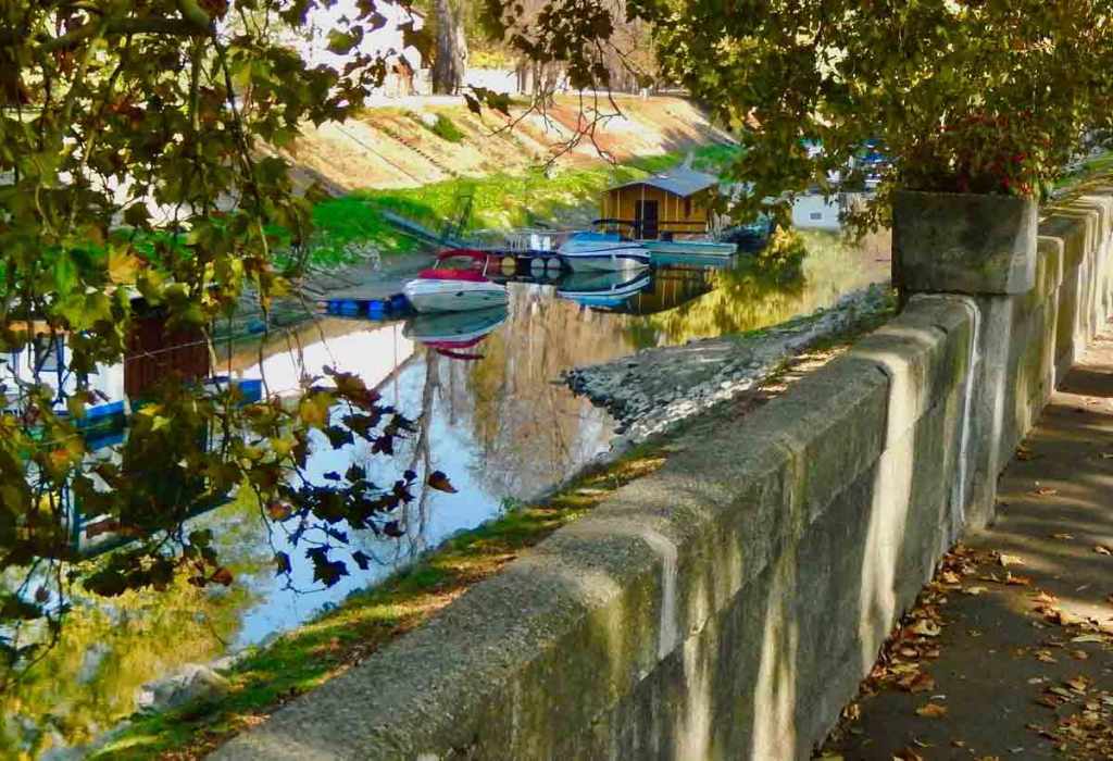
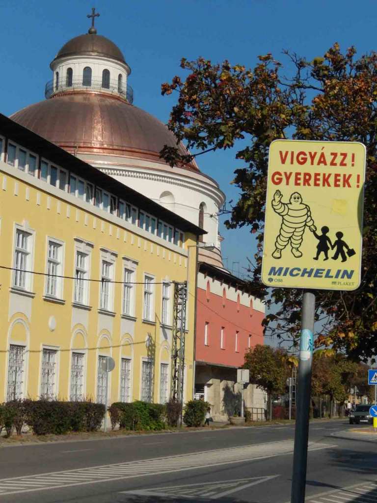
Štúrovo is a town situated on the River Danube. The town sits opposite the Hungarian city of Esztergom. The Mária Valéria bridge across the Danube connects the towns was reconstructed and only opened in 2001 joining the two towns again after 57 years. The bridge was destroyed by fleeing Nazi’s in 1944 during World War II by detonating a truck load of explosives in the middle of the bridge.

Esztergom Station

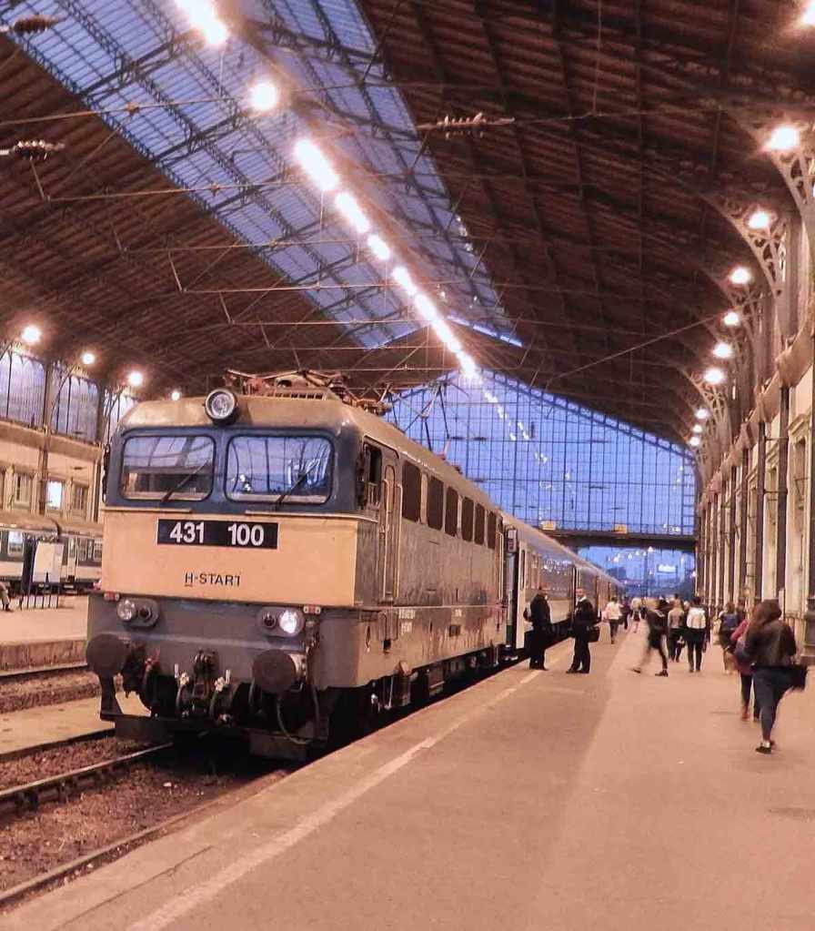
If you are staying in Budapest the best way to visit the area is to catch a train to Esztergom. Take a train from the Budapest with a round trip ticket costing only about $8 and the trip taking a little over one hour. The trains run at least every hour with busy periods more often. The Esztergom station is the end of the most direct line. We walked from the station thru Esztergom to the Mária Valéria bridge in only about a half hour but if you’re not up for a hike there is a tourist bus that goes out to the Slovic side of the bridge from the bus depot.

View Ftrom The Bridge

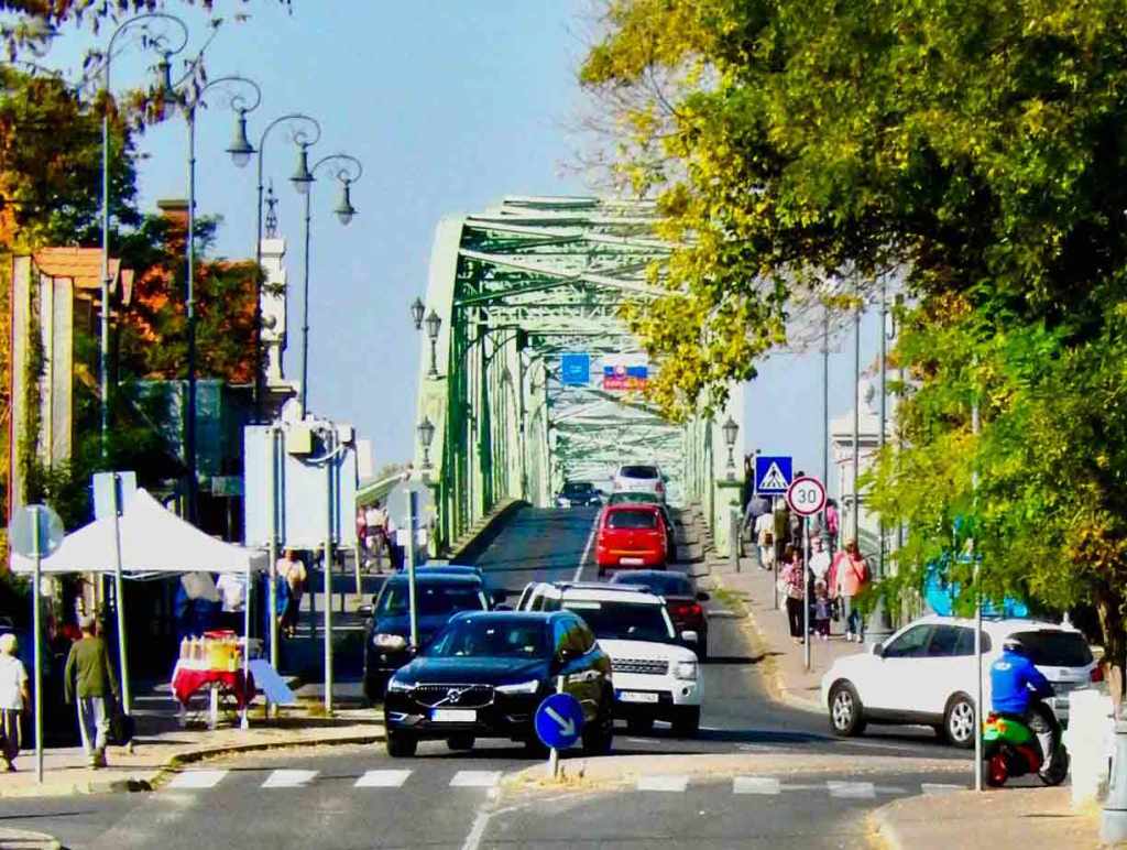
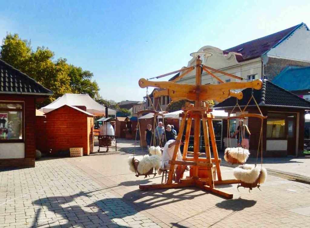
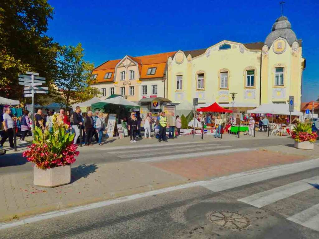
When we got to the bridge there was heavy foot traffic going both ways across the bridge. A lot of people from the Hungarian side were going over to do there shopping as there are better values on the Slovakian side. Also on Saturdays in Štúrovo there is a large open air market featuring lots of crafts and food.

There are a number of cafes and other locations for music especially on Saturdays. While visiting we learned that the Slovakians have a tradition of making and playing bagpipes. In Slovakia they are known as “gajdy” and what we heard was a completely different style and tempo than we have been used to hearing in Scotland.

The Market in Štúrovo

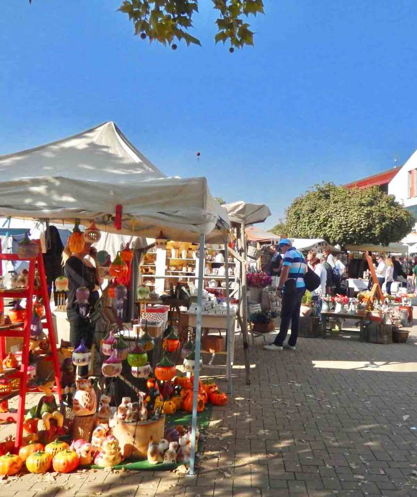
We spent some time shopping in the market and grabbing something in a cafe. The preferred money being the Euro and often credit cards are accepted. The market offered a lot of great local crafts and it was difficult to walk away without buying more than we could pack to carry home.

A kiddie ride at the market

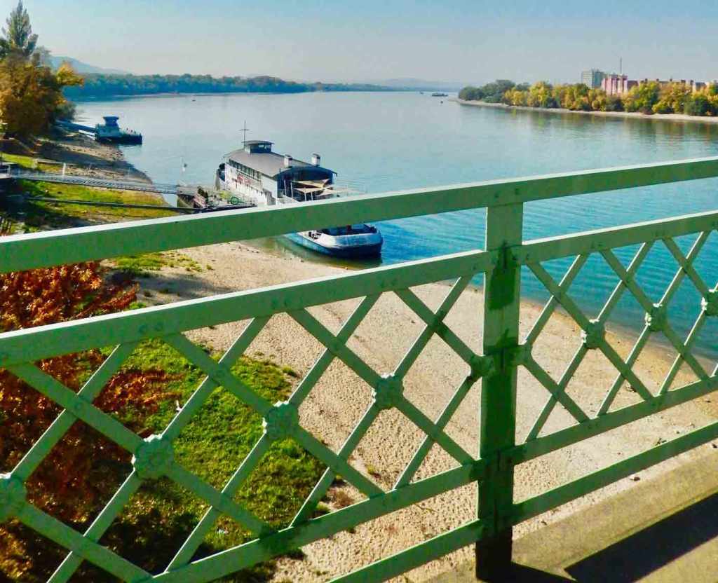
Crossing back over the bridge into Esztergom you get a great view of the “Castle Hill” and the cathedral that dominates the city. It is obvious just looking across the river that Esztergom was once an important city in Hungary.

“Castle Hill” overlooking the Danube

Historically Esztergom is one of the oldest towns in Hungary and was a thriving city in the Middle Ages. Archeological excavations have revealed that the Castle Hill has been inhabited since the end of the Ice Age 20,000 years ago. It was an important Celtic settlement in 350 BC and was later conquered by Rome.

At about 500 AD, Slavic peoples immigrated into the area. In the 9th century, the territory was mostly under Frankish control. In 960, the ruling prince of the Hungarians, Géza, chose Esztergom as his residence. His son, Vajk, who was later called Saint Stephen of Hungary, was born in his palace built on the Roman castrum on Castle Hill around 969-975.

The Hungarian prince’s residence was built on the northern side of the fortified hill. The center of the hill was occupied by a great basilica dedicated to St. Adalbert, who baptised St. Stephen. The Church of St. Adalbert was the seat of the archbishop of Esztergom, the head of the Roman Catholic Church in Hungary.

St. Stephen’s coronation took place in Esztergom on Christmas Day 1000 AD. From that time to the beginning of the 13th century it served as the royal residence of the Hungarian kings until the Mongol siege in 1241.

The capital of Hungary was finally moved to Buda in 1354 and in 1873 the two cities of Buda and Pest were combined and Budapest became the nations capital.

Major Sites In The Area

Esztergom Basilica – The largest church in Hungary sits on Castle Hill, and its 72m-high central dome can be seen for many miles away.

Öziçeli Hacci Ibrahim Mosque – This 400-year-old mosque was built in the 17th century, during the Ottoman occupation of Esztergom.

Castle Museum – The Castle Museum is housed in the former Royal Palace, built mostly by French architects in the 12th century during Esztergom’s golden age.Danube Museum – Several miles west on the river is the interesting and high-tech museum with great exhibits on the history of Hungary’s greatest river.

Puppy Love In The Beagle Channel

Newborn sea lion pups get to know each other on a rocky islet in the Beagle Channel. The channel is named after the HMS Beagle and runs through the middle of Terra del Fuego in Argentina from the Atlantic to the Pacific. In January you’ll discover large colonies of sea lions caring for their pups along with vast numbers of nesting seabirds.

The HMS Beagle sailed from Plymouth Sound on 27 December 1831 under the command of Captain Robert FitzRoy. While the expedition was originally planned to last two years, it lasted almost five returning on 2 October 1836. The ship and this cruise are mostly known because Charles Darwin was part of the expedition. He spent most of this time exploring on land and it resulted in him offering up his theory on the origin of species.

Join us as we visit historic treasures, natural wonders and vibrant cities set against backdrops that are endlessly changing and visually magnificent. Interested in copies of some of our prints? Over the next month we will be moving our photo collection over to Etsy and making them available in digital downloads and prints. Join our mailing list over at The Crafts Mart HERE and receive notices of images when they become available.

Join Us – We understand that the last thing you may want is more emails cluttering up your inbox, but we promise we’ll work hard to make this worth your while. Our mailing list is managed by WordPress and you’ll receive an email every time we create or update an article. Give us a try and if we don’t live up to our promise all you need do is click the unsubscribe link in those emails.

Port of Call Ushuaia Argentina

Ushuaia, Tierra del Fuego the Gateway to Antarctica

Introduction

Ushuaia is often referred to as the end of the world and is the capital of Tierra del Fuego, Argentina. It is recognized as the southernmost city in the world. It’s located in a wide bay on the southern coast of Isla Grande de Tierra del Fuego, bounded on the north by the Martial mountain range, and on the south by the Beagle Channel. It is a popular port of departure for ships and expeditions headed to Antarctica. A little over a decade ago the cities population was less than 10,000 while today it is approaching 100,000. This is partly due to the growing popularity of Antarctic tourism but equally because the Argentinian government has encouraged manufacturing with special tax breaks as well as subsidies for people living here.

The Beagle Channel is the most southern natural channel connecting the Atlantic with the Pacific and has been a popular shipping lane in the past. Split by the Beagle Channel is Tierra del Fuego which means land of fire. Because the area was often shrouded in fog early explorers called it the land of smoke which was exaggerated in Europe for advertising purposes into land of fire. A large part of Tierra del Fuego is an Argentine national park but the region is shared with Chile.

Where Your Ship Dock

Ushuaia has a large pier right at the cities waterfront capable of handling most ships. It is usually busy in season with expedition boats getting ready for Antarctic tours along with large cruise ships rounding the Horn or setting out for Antarctic waters. Right at the end of the pier is the cities visitor center with facilities and information on tours and the city. Also along the waterfront are a number of tour booking offices.

Wheelchair Accessibility

Disembarking – This port has a developed cruise ship pier but the ease of disembarking varies by the individual ships gangway designs. For passengers using wheelchairs there can be a moderate ramp incline to deal with.

Port City Characteristics – This port has average wheelchair infrastructure typical of moderate sized cities. The port area has modest inclines in sidewalks. Intersection crosswalks may have curbs or other wheelchair obstacles.

Transportation

While the city has a population of almost 100,000 it is geographically compact with most restaurants, cafes and shops located within a ten by six block area. While the Pan-American Highway passes right through the city the area is really isolated with no other towns or cities within hundreds of miles. The areas big attractions for visitors is the Tierra del Fuego National Park and the incredible animal life on islands in the Beagle Channel. Both are best visited on a guided tour or boat tour.

Currency

At this writing the exchange rate is about 38 Argentine Pesos to one US Dollar. Because of inflation rates over the past several years buying Pesos before leaving the United States is almost impossible. In the city many shops will accept Euros and American Dollars but it is advisable to exchange some currency for convenience. Credit cards are welcome and it is recommended to keep the charges in local currency to avoid unusual charges.

Attractions

Parque Nacional Tierra del Fuego (Tierra del Fuego National Park) is probably one of the major attractions in the area. It is also the terminus of the Pan-American Highway that ends in a narrow dirt road inside the park. There are also a number of islands near the city in the Beagle Channel that are popular with penguins, seals, sea lions, cormorants along with whales depending on the season. There are a number of tour boats along the waterfront that you can book.

Martial Glacier – This glacier is located just outside of Ushuaia and offers hiking trails with beautiful views of the Beagle Channel.

End of the World Train – This historic train takes visitors on a scenic journey through the Tierra del Fuego National Park.

Ushuaia Lighthouse – This iconic lighthouse is located at the end of the world and offers stunning views of the Beagle Channel with a number of boat excursions available.

In town there are a number of excellent restaurants, cafes, and chocolate shops along with interesting gift shops. Terra del Fuego and Antarctic T-shirts are very popular. The city also can boast that they are home to the most Southern Hard Rock Cafe in the world.

Dusk At Plaza de Armas, Cusco Peru

Strolling through the Plaza de Armas in the center of the historic district of Cusco, Peru near dusk. This is an amazing location filled with museums, historic architecture, cafes, restaurants and shops. If you are thinking of visiting Machu Picchu be sure to schedule a few days for Cusco. This neighborhood was the original site of the capital of the Inca Empire and many of the Spanish era buildings were erected on the foundations of Inca temples, palaces and defenses.

Join us as we visit historic treasures, natural wonders and vibrant cities set against backdrops that are endlessly changing and visually magnificent.

Join Us – We understand that the last thing you may want is more emails cluttering up your inbox, but we promise we’ll work hard to make this worth your while. Give us a try and if we don’t live up to our promise all you need do is click the unsubscribe link in our emails.

The Discovery Of Machu Picchu

A BIT OF HISTORY

In the mountains of northern Peru where the Urubamba River flows through a valley flanked by steep peaks is a remarkable place. It is a strange collection of stone buildings sitting on a narrow saddle between two mountain peaks. The area is remote and the stone buildings were completely overgrown. At the beginning of the last century only a few locals living in this remote area were aware of it and one family actually lived there. They tended their gardens growing on the steep terraces built across the mountains face.

The First American Expedition

Hiram Bingham was a lecturer at Yale University, although not an archaeologist in 1909 he travelled through Peru and was invited to explore the Inca ruins at Choqquequirau in the Apurímac Valley. He was so intrigued that he organized a 1911 Yale Peruvian Expedition to search for the Inca capital. In Cusco, Bingham asked about places rumored to exist along the Urubamba River. According to Bingham, “one old prospector said there were interesting ruins at a place near Machu Picchu. Later Bingham learned that a Charles Wiener was looking for the ruins at Huayna Picchu and Machu Picchu, but was unsuccessful.

Armed with this information the expedition went down the Urubamba River. At Mandor Pampa, Bingham asked local farmer and innkeeper Melchor Arteaga if he knew of any nearby ruins. Arteaga said he knew of excellent ruins on the top of Huayna Picchu. The next day, 24 July, 2011 Arteaga led Bingham up to the Machu Picchu location. At the top of the mountain there was a small hut occupied by a couple who were farming some of the original Machu Picchu agricultural terraces that they had cleared several years earlier. Alvarez’s 11-year-old son, Pablito, took Bingham across the ridge to the main ruins.

The ruins were mostly covered with vegetation except for the cleared agricultural terraces and clearings used by the farmers as vegetable gardens. Because of the vegetation, Bingham was not able to observe the full extent of the site. He took preliminary notes, measurements, and photographs, noting the fine quality of Inca stonework of several principal buildings.

The expedition continued down the Urubamba and up the Vilcabamba Rivers exploring Inca sites. Bingham rediscovered and identified the site of the old Inca capital, Vitcos, and the nearby temple of Chuquipalta. He then crossed a pass and into the Pampaconas Valley where he found more ruins heavily buried in the jungle at Espíritu Pampa, which he named “Trombone Pampa”. As was the case with Machu Picchu, the site was so heavily overgrown that Bingham could only note a few of the buildings. In 1964, Gene Savoy further explored the ruins at Espiritu Pampa and identified it as Vilcabamba Viejo, where the Incas fled after the Spanish drove them from Vitcos.

Bingham went back to Machu Picchu in 1912 under the sponsorship of Yale University and National Geographic and with the full support of Peruvian President Leguia. The expedition undertook a four-month clearing of the site with local labor, with further excavations undertaken in 1914 and 1915. Bingham focused on Machu Picchu because of its fine Inca stonework and well-preserved state, which had lain undisturbed since the site was abandoned 1532. He carried various artifacts back to Yale with one being a set of 15th-century, ceremonial Incan knives made from bismuth bronze; they are still the oldest known artifact containing this metal alloy.

Guayaquil, Ecuador

The City Built On Chocolate

Guayaquil, Ecuador – The Countries Largest Seaport


First, A Word Of Caution* We flew to Guayaquil from San Cristóbal, Galapagos and even on the island we were being cautioned about the terrible crime in the city. We were warned to never go out alone and to not go out on the streets after the sun goes down. Once in Guayaquil we were informed that even in the CBD and the tourist areas most restaurants closed before sunset because of curfews and a lack of customers out at night. If things are truly this bad it is a tragedy because there is much to recommend this city.


Most people believe that chocolate was discovered by Mayans in Central America some twenty five hundred years ago. New evidence suggests that chocolate’s origin goes back over four thousand years and is traced to Ecuador. Perhaps that’s why Guayaquil’s nickname is ciudad de cacao, the chocolate city. The name is traced to the mid 1700’s when Ecuadorian chocolate was first offered to the outside world and demand was immediate and overwhelming. Shortly thereafter Guayaquil became the world’s first cacao port. For over 150 years, Guayaquil got rich controlling a monopoly on the exportation of cacao.

Guayaquil is formally Santiago de Guayaquil, and the second largest city in Ecuador. It is the most prosperous city in the country and the nations main seaport. Located on the west bank of the Guayas River, that flows into the Pacific Ocean through the Gulf of Guayaquil.

Our first impression of Guayaquil is that it is a remarkably modern city with numerous skyscrapers, an amazing river walk known as Malecón 2000, a favorite destination for local residents, stretching for several miles down the Guayas River. It starts at an amusement area featuring La Perla a giant ferris wheel and at the other end is the tallest building in Ecuador. The Point, a modern skyscraper of unique design, somewhat like a long tube twisted so that it looks like a corkscrew and is the design of Ecuadorian architect Christian Wiese.

One of the least expensive and most amazing rides to be found anywhere is the new Aerovia, Guayaquil’s cable car system now operating between Durán and Guayaquil. For only US$1.70 round trip you can travel above the city for over 4 km, through 5 stations using 154 cars. The line connects the business heart of Guayaquil to the residential area of Durán across the Guayas river in just 15 minutes (compared to one hour using the only bridge at rush hour).

The most famous park in Guayaquil is often referred to as Iguana Park, officially it’s Parque Seminario, located in front of the Catedral Municipal. While most famous for its iguanas, it is actually a memorial to Simón Bolivar, the South American hero of independence from Spain.

If you are interested in pre-Columbian history visit Museum of Anthropology and Modern Art (M.A.A.C). It houses one of the best artifact collections of ancient Ecuadorian cultures located along the coast.

The Presley Norton Museum offers a collection of some 8,000 pieces of art from the pre-Columbian Valdivia culture. Donated along with their home by local Guayaquil businessman and his wife to the Ministry of Culture and Heritage for the enrichment of the Ecuadorian people.

Another popular destination is the colorfully-painted homes of the Calle Numa Pompilio Llona part of the neighborhood known as Las Peñas. Stroll the areas historic streets past pastel painted homes visiting art galleries and cafes.

Where We Stayed

Our accommodations where in the four star plus River Garden Hotel + Suites located in the central business district across the street from Malecón 2000. The modern room featured a king bed, desk and a private bathroom. The hotel has a friendly and attentive staff with great views of the city from the top floor. It features an open air rooftop pool and hot tub along with a bar and an excellent formal restaurant with incredible views. Included with the room that was under $100 a night was a buffet breakfast offering made to order omeletsof . Popular points of interest near the hotel include Saint Francis Church, the Artisan Market Guayaquil and the Malecón 2000 with the Botanical Garden right across the street.


*Looking into the issue of crime in Guayaquil it seems that the city wasn’t prepared for the impact of the Covid epidemic and civil order broke down. Guayaquil is still working to control crime and there were a large number of police patrolling on foot as we walked around the city during the day. Looking into international crime statistics per 100,000 population, it appears that for murder, car jacking, robbery and other violent crimes, Guayaquil rated slightly better off than Chicago in 2022. This raising the questionIs Guayaquil crime being overly hyped or is Chicago maybe worse than we think?