
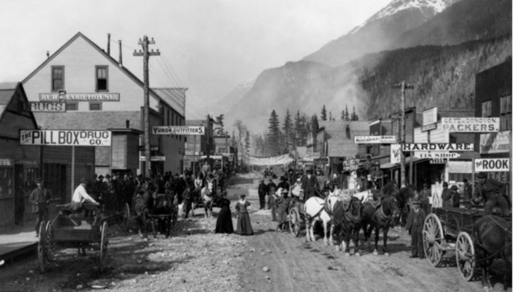
The Tongass (Tongas) National Forest, Alaska
The Tongass (Tongas) National Forest in Alaska is the largest U.S. National Forest with 16.7 million acres (26,100 sq mi). Most of its area is temperate rain forest and remote from population centers. The Tongass, which is managed by the United States Forest Service, encompasses islands of the Alexander Archipelago, fjords and glaciers, and peaks of the Alaska Coast Mountains. Alaska cities and towns with access to the Tongass include Craig, Hoonah, Juneau, Ketchikan, Petersburg, Skagway, Sitka, Thorne Bay, Wrangell, and Yakutat and all have United States Forest Service Ranger Offices except Skagway which provides a National Park Service Visitors Center.
Tongass Forest Hiking Trails Near Skagway Alaska

If you are cruising Alaska and making a port call on Skagway, there are a number of good hiking trails to take advantage of with great scenery to explore only short distances from the cruise dock.
The Chilkoot Trail is the most well know Skagway trail following the gold miners route over the mountains into the Klondike gold fields. Currently (Early 2023) the trail is closed, having been washed out by floods and may take over a year to restore.

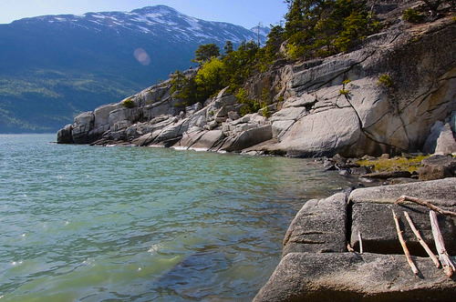
Yakutania Point Distance: 1 – 2 miles round trip, Rated Easy. (This trail connects to the Smuggler’s Cove trail.) To get to the trailhead walk west along 1st Ave., turn left at Main St. and travel south two blocks. Follow the sidewalk west past the airport terminal. Start by crossing the Skagway River footbridge and turn left, following the clearly marked trail into the forest and past a number of exercise stations. After exercise station #4 the footpath narrows and ascends rock steps. Continue along past the restroom and down more rock steps, past a picnic shelter where a rock outcropping provides a view looking down the Lynn Canal toward the Chilkat Mountains.
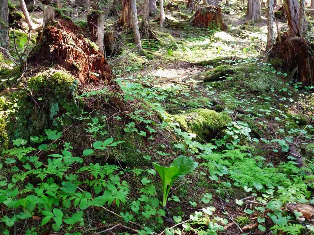
Smuggler’s Cove Distance: 4 miles. Time: 1-2 hours round trip, rated Easy. To get to the trail follow the Yakutania Point route to the rocky plateau and follow the trail off to the right. This trail goes through mixed coastal forest to a tidal inlet with the legendary name of “Smuggler’s Cove.” There is a picnic shelter and a restroom at the cove. Return to Skagway by the route back through the forest or walk up the grassy slope to a dirt road.
Lower Dewey Lake Distance: 0.9 mile to the lake and 3.6 miles around lake. To get to the trailhead go east on 2nd Ave. past the railroad depot. Where the railroad tracks cross the road turn left and follow the tracks 500 feet north to the trailhead. A short distance up the hill the trail branches off to the right (continuing straight up the hill is a steep power company maintenance road). Descend the wooden staircase, duck under the water pipe, and continue up the hill. The trail jogs left and crosses a short footbridge. Here the trail continues on a steep main uphill for about 300 feet. There is a clearing and rock bench at the top of this incline with a view of town and the harbor. Continue up the steep switchback trail staying to the right at each fork. Notice where the trail appears to be going straight ahead but actually turns sharply right. Going straight here leads to a reservoir and trail to the north end of the lake. It is advised to take the sharp right to access the lake. Shortly ahead at the junction sign the terrain levels out. At the lake turn right and walk along the west shore of the lake. Follow the rolling trail to the south end of the lake. Turn left here across the earthen levy and spillway to hike the rougher trail around the east side of the lake, where you will have to scramble over a few rocks before bearing left to rejoin the main trail and return to the trailhead.

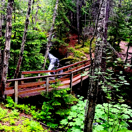
Gold Rush Cemetery and Lower Reid Falls Distance 4 miles round trip Rated Easy. To get to the trailhead follow Main St. or Alaska St. north, cross over S. Klondike hwy and follow the gravel road around behind the railroad yards. Continue following the road and across the railroad tracks. The cemetery is located in the woods just beyond the parking area. A short forest trail behind the cemetery leads to a spectacular view of Lower Reid Falls. Beware of vehicles and trains when walking to the cemetery! There is a restroom located at the parking area.

The Tongass National Forest sounds like a great place to spend a day hiking, and there are plenty of trails to choose from.
Charlotte 🌿
http://www.arvorlife.com 🌊
LikeLike