Short Hikes In Ketchikan, Alaska

The Tongass (Tongas) National Forest

The Tongass (Tongas) National Forest in Alaska is the largest U.S. National Forest with 16.7 million acres (26,100 sq mi). Most of its area is temperate rain forest and remote from population centers. The Tongass, which is managed by the United States Forest Service, encompasses islands of the Alexander Archipelago, fjords and glaciers, and peaks of the Alaska Coast Mountains. Alaska cities and towns with access to the Tongass include Craig, Hoonah, Juneau, Ketchikan, Petersburg, Skagway, Sitka, Thorne Bay, Wrangell, and Yakutat and all have United States Forest Service Ranger Offices except Skagway which provides a National Park Service Visitors Center.

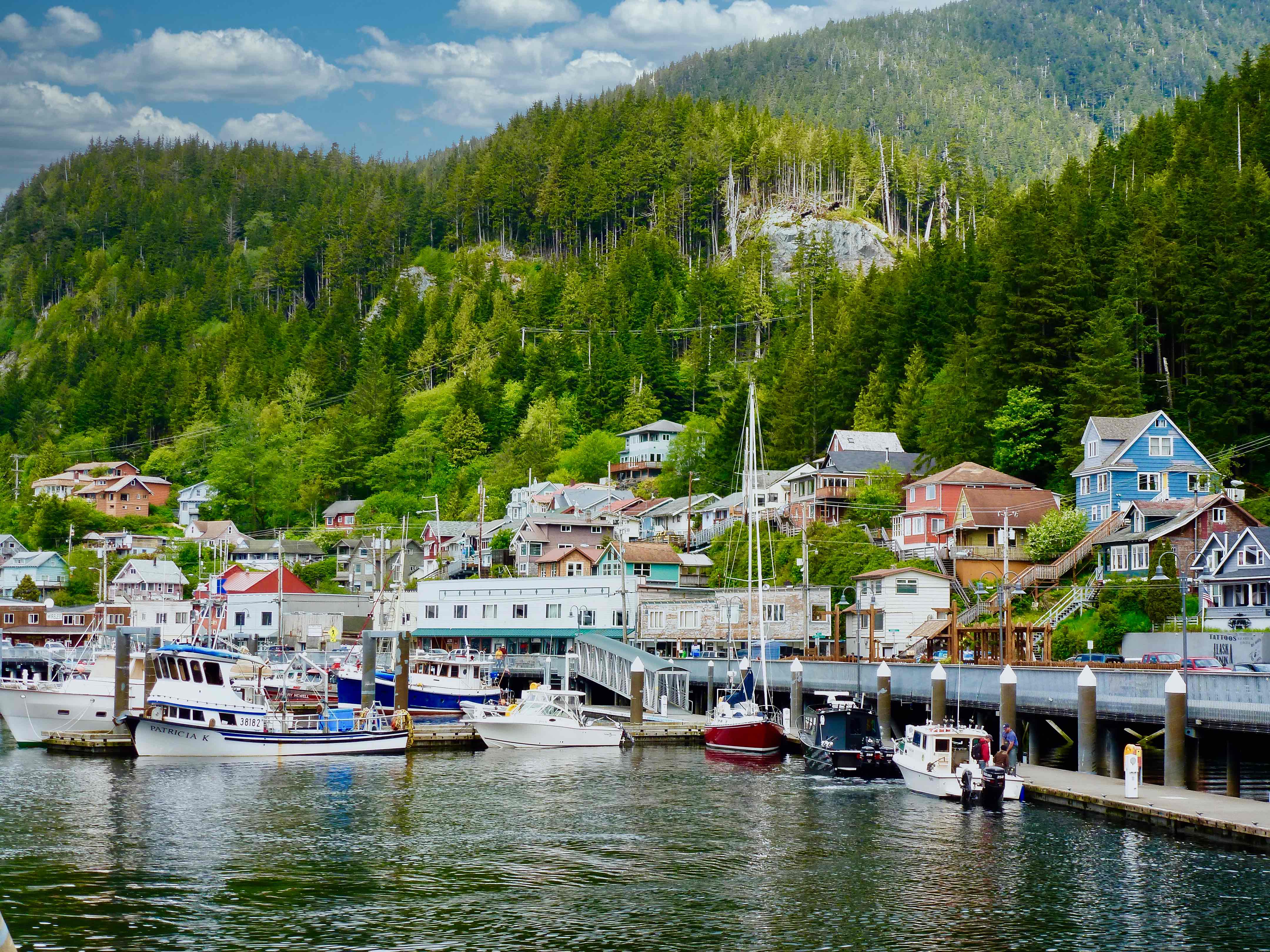
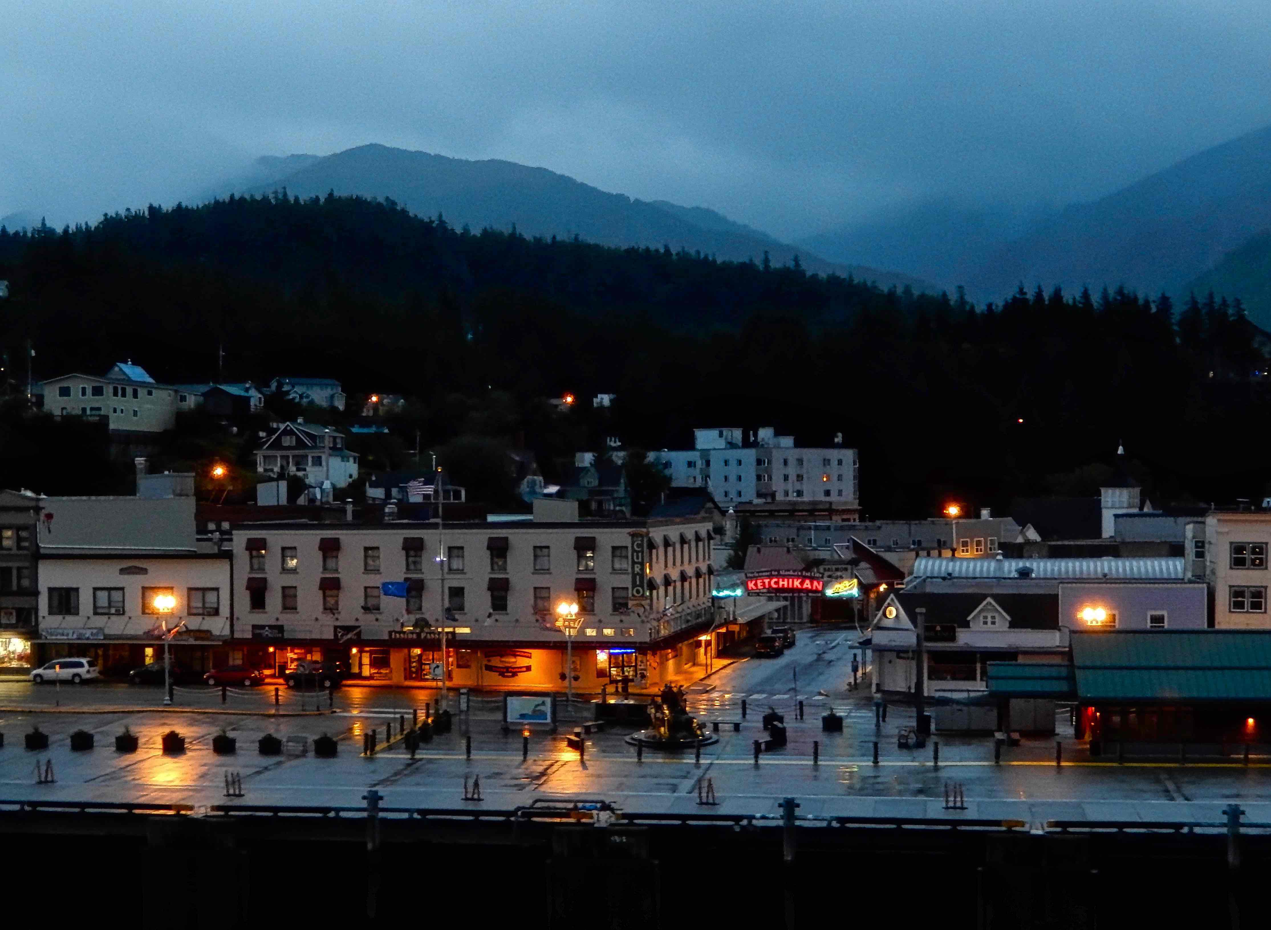
Ketchikan Hiking Trails

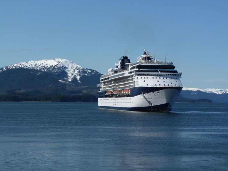
Ketchikan is a great location to access a number of great hiking trails in the Tongas National Forest. The town is also a popular cruise port of call. Below are a few trails near to downtown to consider if your cruise ship stops for a day.

In just two or three hours you can hike through some fantastic forests, explore local history and have an opportunity to take in some fantastic vistas. Below are maps and descriptions of four trails in or near town.

Schoenbar Trail (0.25 miles) Description: This trail goes through the Ketchikan Park District which contains City Park and the Totem Heritage Center. The trail connects Schoenbar Road to both Harris Street and Grant Street, providing a pleasant forested walk. This trail offers a forest experience right in town with access to Ketchikan Creek between from Harris Street Bridge and the trailhead parking lot.

Married Man Trail (0.20 miles) – A historic trail used by men to get to Ketchikan’s historic red-light district on Creek Street without being seen. It is now a nice walk around the rocky gorge area of Ketchikan Creek. Just before the Creek Street trailhead is a viewing platform looking up the narrow, rock gorge of Ketchikan Creek. The trail ends at Park Avenue and has nice views of the roaring creek and the fish ladder. It’s a nice walk through a dense, shaded forest right in town.

Rainbird Trail (1.3 miles, one way), 1 hour (one way). This is a more Difficult hike starting on Water Street, near the Berth 4 dock, follow Jefferson Street up a steep hill to Madison Street (6th Ave). Once you have reached the top, head west (left) onto Third Avenue and follow to the trailhead on the north side of the road. Another trailhead is located at the University of Alaska Southeast parking lot, accessed by following Jefferson Street up from Tongass Avenue past Ketchikan High School to College Avenue. The trail starts at the rear of the parking lot. The trail is a natural path with some sections of stairs and boardwalk. Access via the UAS and Third Avenue trailheads will have a steep climb, but then levels off with several small stream crossings on the trail route. The trail offers easily access to the rainforest close to downtown Ketchikan. A number of places along the trail offer great view of Ketchikan and surrounding area.

Waterfront Promenade (1.3 miles (one way) 1 hour (one way) The waterfront promenade can be accessed from a variety of locations in the downtown Ketchikan area. This trail passes two boat harbors (Thomas Basin and the Casey Moran Harbor) with moorage for numerous commercial and recreational boats. There are great shopping opportunities for locally-crafted items along the Promenade, including with native, marine and wildlife themes. Two visitor information centers are along the trail, as well as the Southeast Alaska Discovery Center. It features interpretive signs with information on Ketchikan’s past and businesses along the Promenade offer items of interest to visitors.

Drawn To Falling Water Part 2

There is something about the sights and sounds of falling water in nature that seems to attract us. It isn’t unusual for us to have hiked for miles and even taken long air trips just to experience a particular waterfall. Maybe it is a combination of the pure power of falling water combined with a feeling of its endurance and consistency that draws us to the spectacle. Here we take this opportunity to offer a few of our favorites.

KATOOMBA FALLS in the Blue Mountains of Australia can be seen easily from the Katoomba Cascades walk as well as the Scenic World overlook.


GIBBON FALLS Yellowstone. Located in an environment of rocky cliffs and scrubby pines. It’s just off the road between Madison and Norris Junctions, the stunning Gibbon Falls is an easy drive from the park’s entrance at West Yellowstone. If you’re lucky, you may be able to glimpse (and hear) the falls from your vehicle. But do yourself a favor and park. It only takes a few steps into the woods to reveal the full beauty of the falls, which cascade 84 feet into a small, clear pool.


HICKORY NUT FALLS, Chimney Rock, North Carolina is a 404 ft. tall falls at Chimney Rock State Park is one of the highest waterfalls east of the Mississippi. Take a woodland hike on an easy 3/4-mile trail to enjoy an up-close view at its base from a platform.


TRAFALAGRAR FALLS, Dominica, W.I. These famous twin waterfalls are a 20-minute drive from Roseau. It’s a short 10 to 15 minute walk along a well-maintained path to the visitor reception area, where you can photograph both falls from a viewing platform. As you walk the path, be sure to stop at the warm spring that flows across the trail.


SNOQUALMIE FALLS Washington state is a 270 foot waterfall and the state’s most popular natural attraction. The falls is a two-acre park with observation deck along with the Salish Lodge.


SLIDE ROCK CASCADE in Slide Rock State Park, Arizona. It features a natural rock water slide located in Oak Creek Canyon and is just 15 minutes from the town of Sedona. Probably the most fun you can have outside an amusement park.


MONTMORENCY FALLS, Canada. The falls are at the mouth of the Montmorency River where it puts on a major show as it drops over the cliff into the Saint Lawrence River. It’s opposite the western end of the Île d’Orleans where the waterfall drops 272 feet.

Port of Call Skagway, Alaska

Spend a Day in a Gold Rush Town

Skagway is a popular port of call on many Alaska cruise itineraries. With a population that fluctuates between 700 in winter and 2,000 in summer it is easy to see what drives the economy. While Skagway is small and a bit isolated that doesn’t mean there isn’t anything to do. Historically Skagway has its beginnings in the Yukon gold rush when it was established as the port of entry for the famous Chilkoot trail leading up to the Yukon gold fields. Today it is a tourist destination with a lot of interesting options for spending a day off a cruise ship from shopping, riding a train or helicopter to even wilderness adventures.

Where Your Ship Docks

Cruise pier Skagway
Cruise pier Skagway
Ships tag the rocks above the pier

There are several modern docks right near town with specific docks designated for different cruise lines. While there are no facilities right on the docks it is a short walk to public facilities going into town near the Marina with more available near the foot of State Street in town.

Wheelchair Accessibility

Disembarking – This port has a developed cruise ship pier but the ease of disembarking varies by the individual ships gangway designs. For passengers using wheelchairs there can be a moderate ramp incline to deal with.

Port City Characteristics – This port itself is mostly flat with no serious issues. It has an average wheelchair infrastructure with only moderate inclines in sidewalks. Intersection crosswalks may have curbs or other wheelchair obstacles.

Transportation

Taxis are available but the town itself can be walked in a short time. There are locations to visit on the outskirts of town like the gold mine where a taxi would be your best option. There are also Pedi cabs and a number of tour operators that offer short excursions around the area.

Currency

Riding The White Pass & Yukon RR

Alaska is a U.S. state and the U.S. Dollar is the preferred currency with most major credit cards accepted as well as ATM machines in town.

A Bit Of History

With a growing population of over 10,000 people, Skagway, Alaska, was on many peoples minds as word of the Klondike Gold Rush spread in 1897 – 98. They called the town Skagway for the Tlingit Indian name “Skagua,” which means “the place where the north wind blows.”

The town was founded in 1895 by Captain William Moore, a former steamboat captain, who traveled north from British Columbia to work for a surveyor. He is credited with discovering the White Pass route through the Coastal Mountain Range. He selected a site where the Skagway River entered into the salt-water Lynn Fjord. He filed a 160-acre homestead claim at the head of the White Pass Trail in 1887, and he and his son, Ben, built a cabin, a wharf and sawmill. He began to chart and mark the White Pass Trail in expectation of a flood of miners to the gold rush. The first rush of prospectors landed at Skagway in the summer of 1897. After all of his planning Captain Moore was pushed aside and ignored by the newcomers who took over the Moore homestead and the surrounding area and laid out a townsite without consulting him. They even forced Moore to relocate his cabin since it stood in the way of a newly plotted street.

Downtown Skagway 1898

Between 1897 and 1898, Skagway became a lawless town, described by the Canadian North-West Mounted Police as “little better than hell on earth.” Gun fights, prostitutes, and liquor were ever-present on Skagway’s streets, and the towns leader was a con man named “Soapy” Smith, who became the boss of a pack of robbers, gamblers and swindlers who ran the town.

The National Park Service Visitor Center at 2nd Avenue and Broadway in Skagway is a place to begin your exploration of the area’s rich gold rush heritage. Preserving History & Becoming an International Historical Park in 1997 with the park celebrating the centennial of the Klondike Gold Rush.

Attractions

If you are looking for a scenic excursion The White Pass and Yukon Railroad provides train rides up thru the mountains to the White Pass and back. Their station is right in town and tickets are usually readily available. There is also a gold mining attraction near town where you can pan for gold. There are a number of whale watching boat trips and a helicopter tour that will take you up to land on a glacier.

State Street also has the usual lineup of tourist retail stores with an emphasis on jewelry. For some unique items look for local artists and crafters gift items.

Helicopters heading for a glacier
Helicopters heading for the glacier fields

If you are looking to book a tour our suggestion is to book on your own instead of through the ship. You will have a whole day in Skagway with plenty of time to set something up. By calling the helicopter tour service in Skagway the day before arriving in Skagway you can save almost fifty percent on booking a helicopter flight up to a glacier.

Tip: Most U.S. and Canadian cell services do not have any surcharge for using you phones in Alaska. Just make sure you have a land based signal and are not on the ships cellular service.

Todays Poster • The Magic Kingdom WDW

It truly is a kingdom unto itself located near Orlando, Florida. Larger than the island of Manhattan, Walt Disney World encompasses four them parks, two water parks, a shopping/entertainment complex and countless hotels, resorts, restaurants, and also sports complexes four golf courses.

These giclée prints are available in several sizes, custom printed for each individual order on archival, museum grade paper using fade resistant inks.

Join us as we visit historic treasures, natural wonders and vibrant cities set against backdrops that are endlessly changing and visually magnificent. Celebrate a world of travel experiences with these decorating accessories that are perfect for framing.

Cruise Port Icy Strait Point (ISP), Alaska

Icy Straight Point

Icy Strait Point is a popular nature port of call on Chichagof Island that opened in 2004. The facilities are only open when cruise ships are visiting. It was developed by the native Tlingits and is focused on celebrating the areas history, nature and the Tlingit culture. It is the ideal location for exploring wildlife and sea life. Hoonah, the only town on the island is described as the largest Tlingit Village in the state of Alaska.

Where You’re Ship Docks

The Cannery Complex

Depending on tides and the number of ships, cruise ships either dock or tender in. Often you will find that your ship is tied up to the pier in the morning and using tenders to return to the ship in the afternoon. In either case, arrival is a pier near the Adventure Center and the starting point for land tours. Walking past the Adventure Center away from the pier a boardwalk takes you to the old cannery complex which now houses a museum, local shops, snack bar and a display of the original cannery operation. The Fish House restaurant is also located on the boardwalk and this is also where most of the marine tours depart.

Transportation – There are very limited car rentals or taxi services. A sightseeing trolley is operational only part of the time. If you plan to do more then a walking exploration, it is probably best to book a tour through the ship.

Money – The US dollar is used here, credit cards are welcome and there is an ATM machine.

Nearby Trips:

The largest and highest zipline in North America is located at ISP. It runs 5330 feet and includes a 1300 foot drop. There are also kayak rentals and tours and the Hoonah Village is a short ride from where you come ashore. If the Hoonah trolley is running the Nature Center will be one of its stops. It is a very small community with only a few shops and restaurants.

The nature trail provides an opportunity to see some great scenery, a virgin Alaska rain forest and possibly brown bears, bald eagles and the Sitka black tailed deer. If the weather is wet, trails can be very muddy so hiking boots are recommended.

Humpback Whale at Icy Straight Point

Porpoises and whales have been sighted from shore and from anchored ships and several excursions visit the Point Adolphus area, which is a prime location for whale watching.

  • NOTE: Cruise ships do not dock near town but dock or tender to a pier near the Adventure Center.
A Celebrity ship anchors off Icy Straight Point

Todays Poster • Belize City

Belize sits on the east coast of Central America behind the worlds second largest coral reef. The official language is English and its institutions and language reflect its history as a British colony. Founded on a system of basic democracy formally called the Public Meeting with a set of regulations referred to as Burnaby’s Code formalized in 1765. Historically it was a major part of the Maya civilization between 1500 BC to 1200 BC. The Maya left behind numerous sites, including Cahal Pech, Caracol, Lamanai, Lubaantun, Altun Ha, and Xunantunich. If you visit try and get out into the rain forest and visit a Mayan site.

These giclée prints are available in several sizes, custom printed for each individual order on archival, museum grade paper using fade resistant inks.

Join us as we visit historic treasures, natural wonders and vibrant cities set against backdrops that are endlessly changing and visually magnificent. Celebrate a world of travel experiences with these decorating accessories that are perfect for framing.