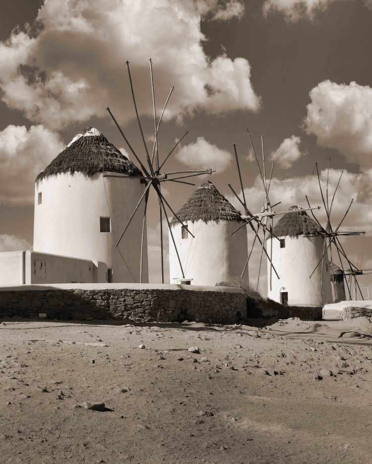
The windmills of Mykonos are the historic landmarks of this Greek island, known for their unique architecture and historical significance. These windmills were initially constructed in the 16th century by the Venetians, who ruled Mykonos at the time. They were primarily used for grinding wheat and other grains, playing a vital role in the island’s economy and sustenance.
The windmills of Mykonos are characterized by their cylindrical stone towers, whitewashed exteriors, and thatched roofs. They typically have two or three floors, with the lower levels used for storage and the upper levels for milling. The windmills operate on a vertical axis, with large wooden blades attached to the tower’s exterior. These blades capture the strong winds that frequently blow across the island, causing the millstones inside to rotate and grind the grain.
Looking for good information on ports of call? Descriptions on using public transportation or visiting international cities? Sign up and follow us as we explore the world.
Join Us • We understand that the last thing you want is more emails cluttering up your inbox, but we promise we’ll work hard to make this worth while. Give us a try and if we don’t live up to our promise all you need do is click the unsubscribe link in our emails.
Don’t Miss Out, SubscribeNow!
You’ll receive notices of new posts, special features and updates right in your inbox…
What, you don’t have a pin map? Well, let’s fix that…
If you love travel, keeping a travel pin map is a great way to keep track of where you’ve been while also a fantastic decorating accent. We started ours years ago and even today it is a fantastic conversation piece.
Years ago we started getting requests from family and friends to make one for them. It became a favorite gift item and after a few dozen maps we decided we’d try selling them online.
We started selling on Etsy with a few world map color versions and added a United States map. We offered a selection of titles and provided personalization included (all our friends and relatives wanted theirs personalized). Within a couple of months sales took off and soon I was spending hours printing and shipping maps. A few dozen a week wasn’t going to make me rich but it was eating up a lot of my week. After about six months I shut it down because it was just too much work…
After a lot of prodding we’ve decided to put in some more time exploring our travel pin maps again. After talking to a number of friends about the process and discussing options we’ve started developing a plan.
This time we’re using a do-it-yourself approach and if you follow our steps you’ll have a decorating accent to be proud of!
Making Your Custom Travel Pin Map
Here’s how to create your very own custom 16×20″ pin map for under US$50 in five simple steps:
Remove glass in frame and back up with a sheet of foam board
Get a set of map push pins
Do It Yourself Instructions For Our Travel Pin Map
Download Our Map And Make It Your Own
Customizing Your Map
Microsoft
Microsoft offers several software tools and services that can be used for annotating our JPG map file that include:
Our files are formatted in a 4:5 ratio that will produce prints from 4×5” through 16×20” and are provided in an open jpg file format that can be customized using many standard applications in computers using MS, Apple and Google operating systems by following the steps outlined here.
• Microsoft Paint: A basic image editing program included with Windows that allows users to add simple annotations such as text, lines, and shapes to images.
• Microsoft Office Picture Manager: A more advanced image editing program that comes with Microsoft Office and provides more features for annotating images, including the ability to add captions, watermarks, and other effects.
• Microsoft OneNote: A digital note-taking application that allows users to insert and annotate images, including JPG files.
• Microsoft SharePoint: A cloud-based collaboration platform that allows users to store, share, and annotate images, in JPG files.
Apple Macintosh
Using the Preview application:
• Open the JPG image in Preview.
• Click the “Markup Toolbar” button in the toolbar.
• Select the annotation tool you want to use, such as the “Text” tool, “Shape” tool, or “Arrow” tool.
• Click and drag on the image to create your annotation.
• Adjust the properties of the annotation, such as font, color, and size, using the options in the Markup Toolbar.
• Save the finished file for printing.
Google Operating Systems
With a Google computer using Google Cloud, This system offers a comprehensive platform for image annotation. It provides a suite of tools and services that enable users to annotate JPG images efficiently and accurately providing powerful image editing tools that facilitate the annotation process. Users can easily draw bounding boxes around objects, add polygons, or even create 3D annotations. These tools ensure precise and consistent annotation, which is essential for high-quality machine learning models.
Printing Your Map
If you have access to a printer that can print to a sheet size of 13×19 you can print your map yourself at either 11×14 (standard frame size) or use 13×19 paper trimmed to 13×16.
Large prints can be ordered from a number of sites including Office Depot and Walmart. If you have a wide format (13×19) you can of course print it yourself.
Print yours with Walmart Custom Prints. The 16×20” print is the best format at under $14.00 and the order can be placed with your local Walmart online at the web page below.
Our maps when printed can be formatted to fit a 16×20” standard size frame, or 11×14”, 8.5×11” and 8×10”that are available nationwide from many stores like Michaels or Walmart as well as online. In order to convert the frame to a pin map all need to do is to remove the plastic or glass front, back up the map with a sheet of foam board and reassemble. See a good choice from Michaels HERE.
Pushpins
Hopefully you’ll be adding a lot of pins to your map and while you can find push pins in most office supply departments we recommend a smaller headed shorter pin made for that purpose and recommend Yalis Push Pins 600-count Map Tacks available from Amazon HERE.
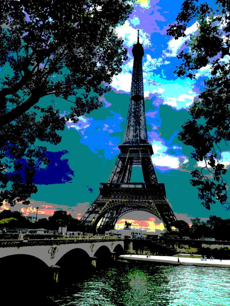
In surveys about travel bucket lists Paris still reigns. Of all the world’s cities Paris has inspired more notable personalities to praise it than virtually any other…
“We will always have Paris” is one of the movies most memorable lines. Spoken by Rick (Humphrey Bogart) to Ilsa Lund (Ingrid Bergman) in the movie classic Casablanca.
“Paris is so very beautiful that it satisfies something in you that is always hungry in America.” — Ernest Hemingway
“The shopping, the food, the views! Paris is a city that entrances us all—and I’m no exception.” —Michael Kors
”Paris is always a good idea.” — Audrey Hepburn
“If you are lucky enough to have lived in Paris as a young man, then wherever you go for the rest of your life, it stays with you, for Paris is a moveable feast.” — Ernest Hemingway
Join us as we explore historic treasures, natural wonders and vibrant cities all set against backdrops that are endlessly changing and visually interesting.
Join Us • We understand that the last thing you want is more emails cluttering up your inbox, but we promise we’ll work hard to make this worth while. Give us a try and if we don’t live up to our promise all you need do is click the unsubscribe link in our emails.
Don’t Miss Out, SubscribeNow
Receive notices of new posts, special features and updates right in your inbox…
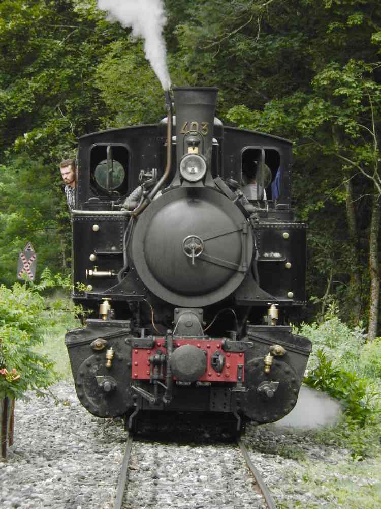
Mastrou, or Ardèche Train, on the Vivarais railway line is a metre gauge railway excursion line, over 20 miles long, connecting Lamastre and Saint-Jean-de-Muzols, near Tournon-sur-Rhône. The steam train and engine, both listed Historic Monuments, offer a chance to explore the rugged canyon while experiencing a bygone steam era.
The Ardèche is a French department in the Auvergne-Rhône-Alpes region of central France. It is named after the Ardèche River, known for its natural beauty, including the Gorges de l’Ardèche, a canyon carved by the river.
Join us as we explore historic treasures, natural wonders and amazing cities all set against backdrops that are endlessly changing and visually interesting.
Join Us • We understand that the last thing you want is more emails cluttering up your inbox, but we promise we’ll work hard to make this worth while. Give us a try and if we don’t live up to our promise all you need do is click the unsubscribe link in our emails.
Don’t Miss Out, SubscribeNow
Receive notices of new posts, special features and updates right in your inbox…
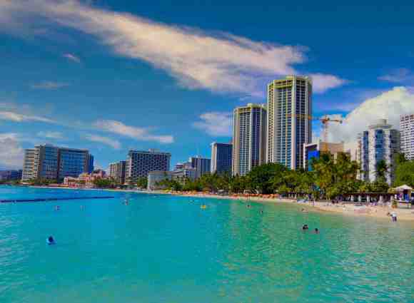
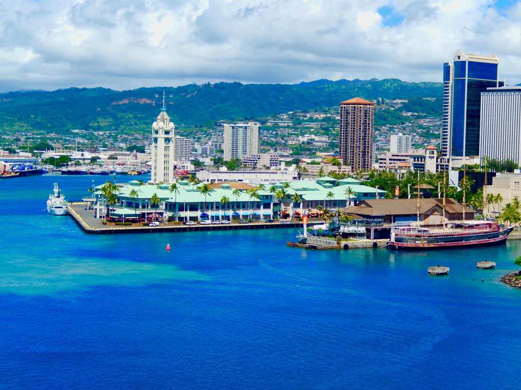
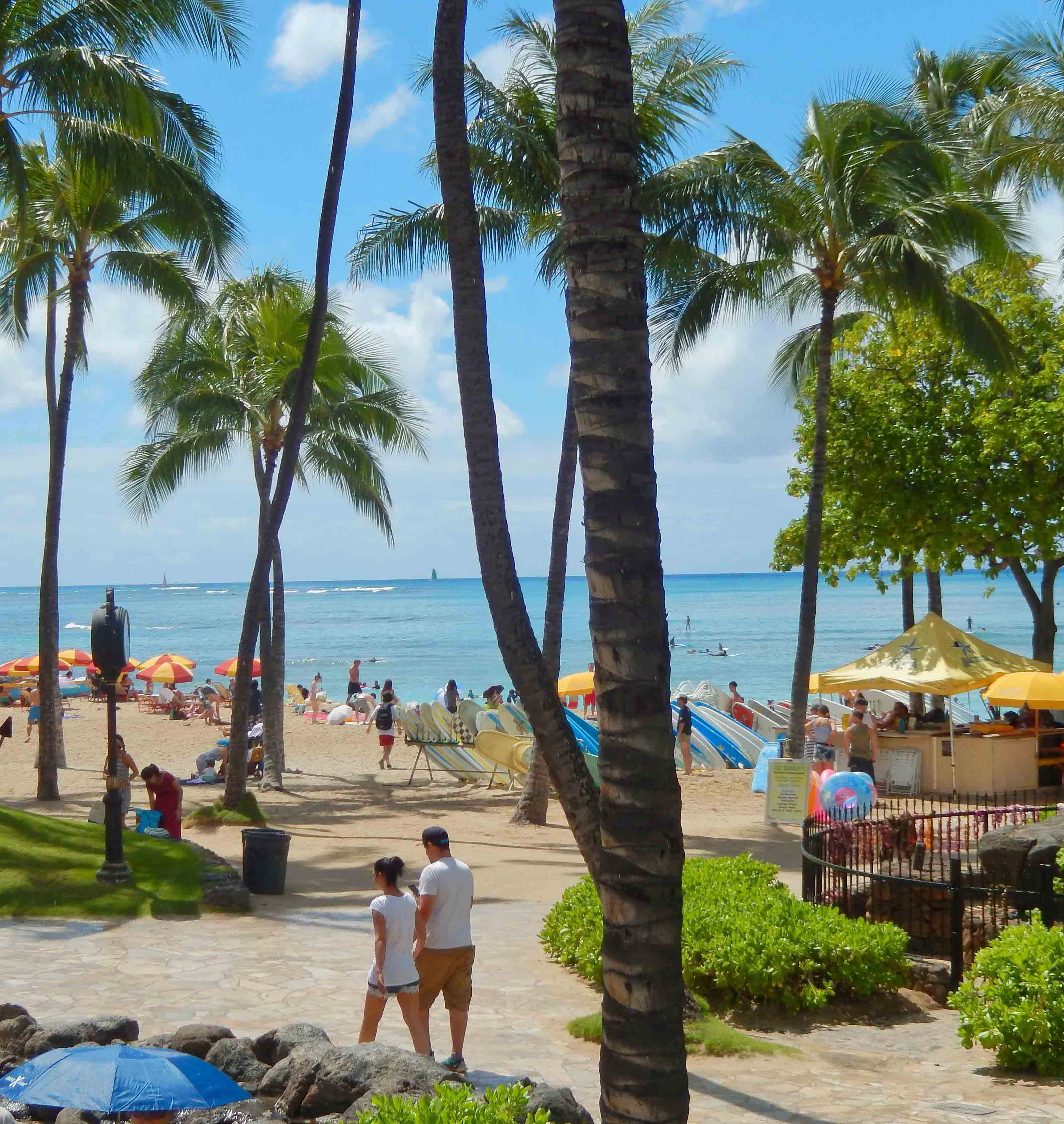
Honolulu is a frequent stop for cruise ships repositioning in the Pacific, cruises going out of the west coast of the U.S. and Canada as well as cruising the Hawaiian Islands. It is the largest city in the islands, the states Capital and gateway to Hawaii’s most developed island Oahu.
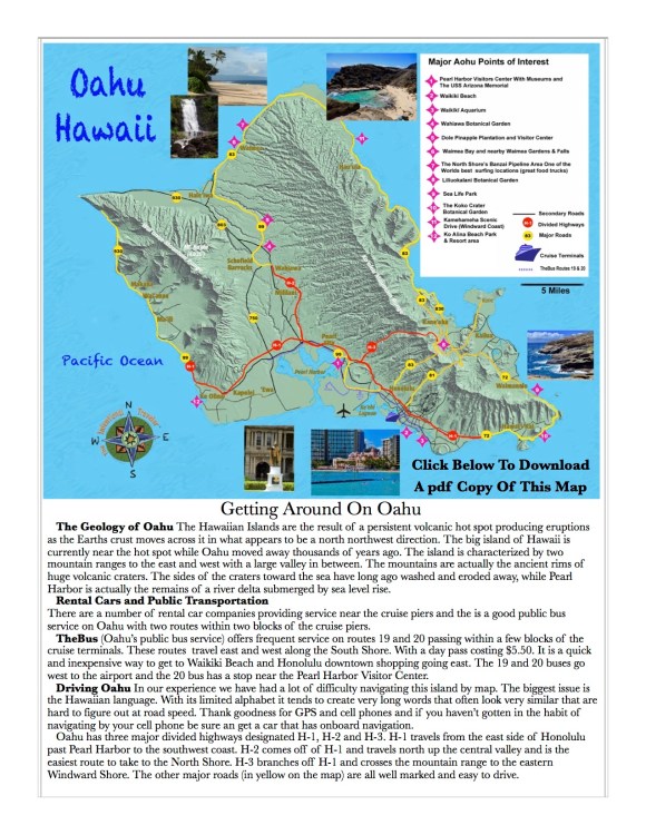
Honolulu is located on the island of Oahu with a number of areas to visit and sights to see. Nearby the cruise dock is Pearl Harbor with the museums and memorials and in the other direction is world famous Waikiki Beach with the hotels and shopping. This island and city are major tourist destinations and to get a feel for Oahu you need a number of days.
Where The Ships Dock
The cruise piers are located on the northwest side of Honolulu between Waikiki Beach and the International Airport. Cruise ships dock at either the Aloha Tower (pier 11) or Pier 2 about a quarter mile more to the south (primarily used by NCL for Hawaiian cruises). Aloha Tower is conveniently located not far from the downtown area and the Aloha Tower Marketplace. There are facilities located at the cruise terminal and you can walk out without much difficulty. “Downtown” with its shopping and “Waikiki Beach” are not the same location so if you want to visit this famous beach area you will need transportation.
Cruise Ship Piers Oahu
Transportation
For a short port visit we would recommend sharing a cab with others if you only want to go to Waikiki Beach. Local public transportation is with TheBus and the ride to the beach doesn’t take very long. If you want to use TheBus a 1-Day Pass is $5.50. Ask the bus operator for the 1-Day Pass before placing your money in the farebox. It’s valid 12:01 a.m. To 2:59 a.m. the next day, for up to 27 hours of unlimited rides..
Our preference to really see the island is to rent a car. Rates are usually very reasonable and since you are in the United States your insurance covers the rental car. Oahu is a pretty big island with 3 major highways (H-1, H-2 and H-3) and we would strongly suggest that you use GPS navigation or navigate by your phone. The street names are difficult to pronounce and remember and the roads tend to wind around.
Wheelchair Accessibility
Embarking/Disembarking – This port has a developed cruise ship pier but the ease of disembarking varies by the individual ships gangway designs. For passengers using wheelchairs there can be a moderate ramp incline to deal with in both locations. From the pier it is several miles into downtown.
Port City Characteristics – This port has a well developed wheelchair friendly infrastructure. The port area is flat or has few inclines. Intersection crosswalks have few issues with curbs or other wheelchair obstacles.
Currency
This is the 50th state and the US Dollar is currency. Most major credit cards are welcome and you will find plenty of ATM machines.
Transportation
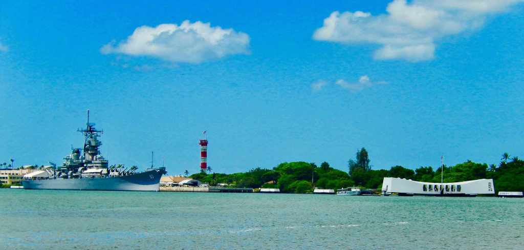
The primary comment on the Waikiki Trolley is it’s way overpriced for what you get to see. Again “TheBUS” Day Pass is much less expensive and covers the same routes. To see more of the island you’ll need to rent a car and there are several rental agencies near the pier. A short taxi ride into the center of Waikiki Beach is also good investment. If it’s going to be a first trip don’t miss a visit to Pearl Harbor with the USS Arizona Memorial and the USS Missouri.
Attractions
In Honolulu there are almost too many attractions to count, from shows to an aquarium and zoo. The best view on the island requires a car for a drive up to Hawaii Puu Ualakaa State Park with an overlook above Honolulu on Mount Tantalus.
Pearl Harbor
A must visit is Pearl Harbor and the Arizona Memorial. It is a popular tourist destination and is visited by millions of people each year. It is a powerful reminder of the attack on Pearl Harbor with its Visitor Center and museum.
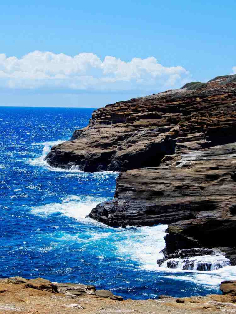
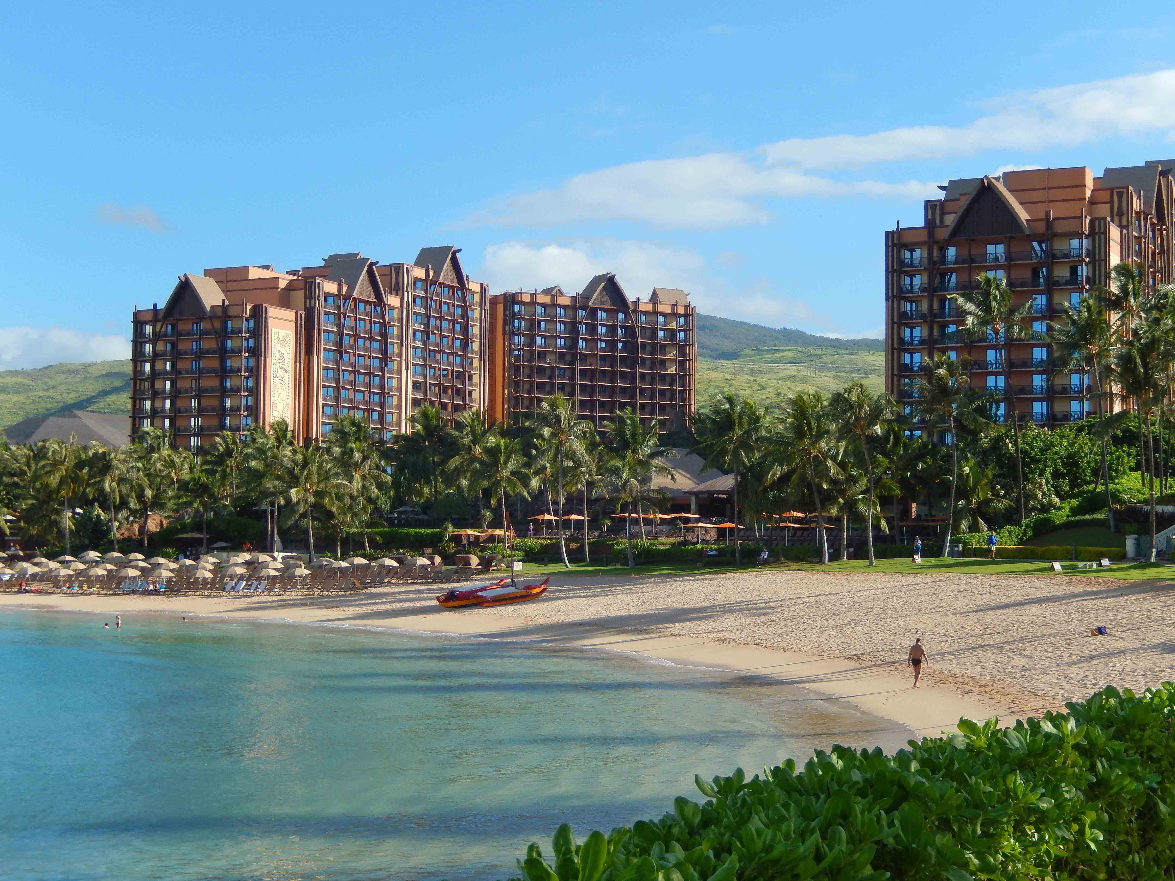
If you have the time and a car the North Shore with the surf at the Banzai Pipeline and Waimea Bay, a number of great small towns to explore (look for the food trucks) and Waimea Falls Park are great destinations. There is also The Dole Plantation (don’t miss having a Dole Whip) in mid-island and a couple of beautiful gardens to check out. Above all is the ocean and the beaches and the reefs. Snorkeling and diving opportunities abound and depending on the season you can go out on a tour boat for whale watching.
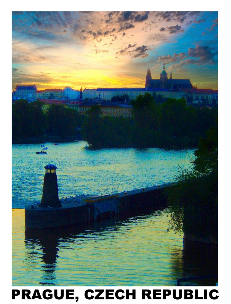
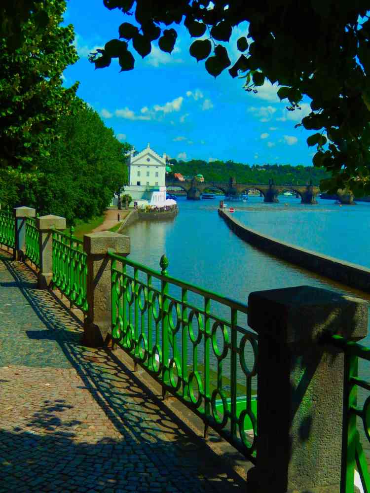
Prague, the capital of the Czech Republic, an incredible city steeped in history and culture. The Vltava River is a prominent feature of the city’s landscape and plays a significant role in its history and culture. It divides the city into two main parts: the Old Town and the Lesser Town, which are connected by several bridges, including the famous Charles Bridge. The river is a popular place for recreation in Prague with weekends filled with boating and along the riverbank are numerous parks. The Vltava River is also lined with historical buildings, churches, and palaces, making it a popular destination.
Major Sites In Prague Include:
Prague Castle: This is the largest ancient castle in the world, and it is a UNESCO World Heritage Site. It is home to the Czech crown jewels, and it offers stunning views of the city. Charles Bridge: This is a beautiful bridge that crosses the Vltava River. It is lined with statues, and it is a great place to take a walk and enjoy the views. Old Town Square: This is the main square in Prague, and it is home to many historical buildings, including the Old Town Hall and the Astronomical Clock. Jewish Quarter: This is a historic neighborhood that is home to many synagogues and other Jewish landmarks. Vyšehrad: This is a hilltop park that offers stunning views of the city. It is also home to the Vyšehrad Castle, which is a popular tourist destination.
I’ve always thought that black and white photographs simplify images and draw you deeper into the actual image depicted. This forces us to pay special attention to the underlying composition and significance of the subject being presented. I recently visited a gallery showing of historic images that mostly were sepias that seemed to add an additional weight to the images displayed.
Looking for good information on ports of call? Descriptions on using public transportation or visiting international cities? Sign up and follow us as we explore the world.
Sure, we understand that the last thing you want is more emails cluttering up your inbox, but your subscription means a lot to us. We promise we’ll work hard to make this worth your while. Give us a try and if we don’t live up to our promise all you need do is click the unsubscribe link in our emails.
Don’t Miss Out, SubscribeNow!
You’ll receive notices of new posts, special features and updates right in your inbox…