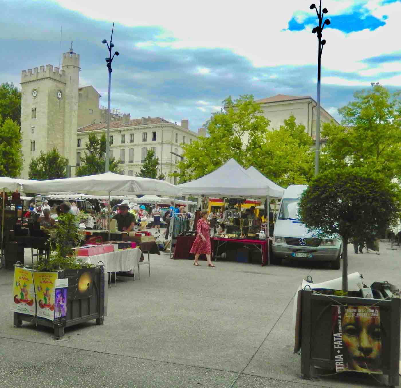
Look familiar? It has a surprising similarity to the The Yellow Submarine in the 1968 animated musical fantasy film by the Beatles based on the song sung by Ringo.
This Yellow Submarine sits outside the Oceanographic Museum of Monaco in Monte Carlo. It is named Submarine Anorep 1 and was built in 1966, which was the same year that the Beatle’s song was released as a single. It also has a striking similarity to the art in the Beatles 1969 album and movie. This one is actually the first submarine of famous oceanographer Jacques Cousteau.
The connection between this submarine, Ringo Starr and the popular song and movie are more legend than fact. We had a tour guide once suggest that Ringo lived in an apartment overlooking the square holding this submarine and it inspired him to write the song. Both are not true. Paul wrote the song and Ringo lived a couple of miles away. But, it does make a good story 😉
Join us as we visit historic treasures, natural wonders and vibrant cities set against backdrops that are endlessly changing and visually magnificent.
We understand that the last thing you want is more emails cluttering up your inbox, but we promise we’ll work hard to make this worth your while. Give us a try and if we don’t live up to our promise all you need do is click the unsubscribe link in our emails.
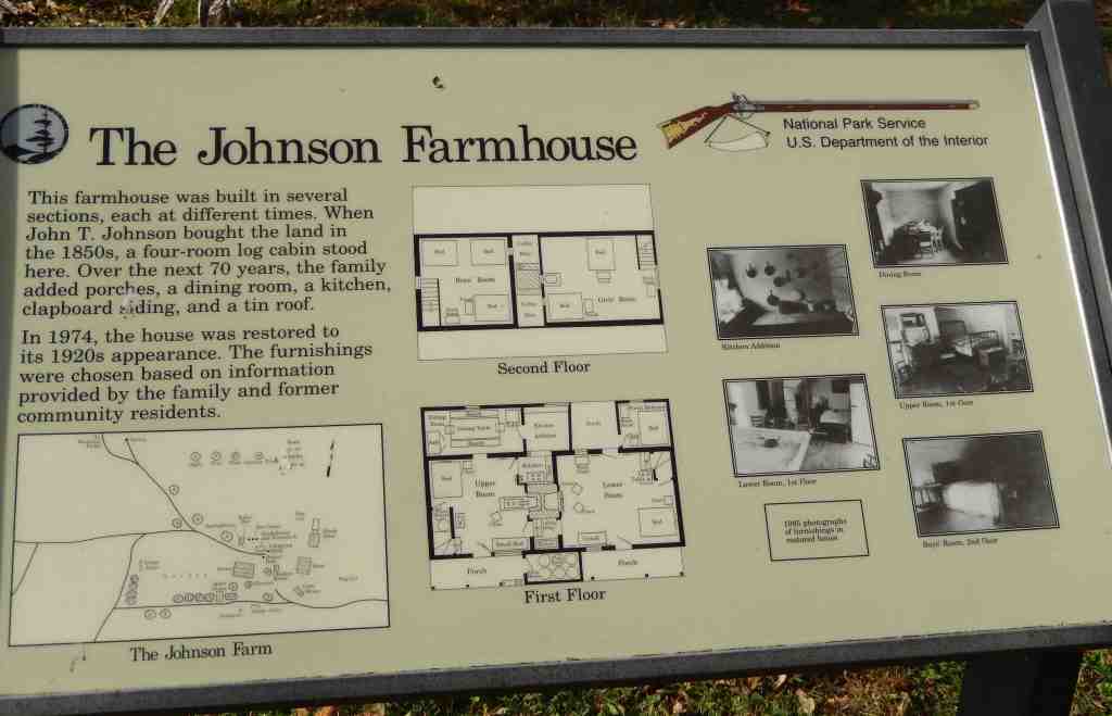
One of the first developed tourist centers on the Blue Ridge Parkway was The Peaks of Otter and it dates back to the mid-nineteenth century. Today it includes camping, a hotel, restaurant and Visitors Center with a number of trails to hike.
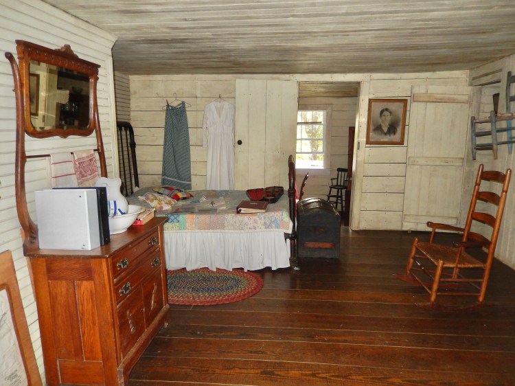
One hike, the Johnson Farm Trail takes you past a restored mid-1800s farm. The Johnson Family homestead includes the farmhouse, a barn, a spring house, antique farm equipment, a garden and orchard. While the grounds are always open for those hiking the trail, if you go during operating hours, park volunteers are on hand to answer questions and give tours of the farmhouse. Ask at the Peaks of Otter Visitor Center about current hours.
The Meadow
There are a number of hiking trails at Peaks of Otter but The Johnson Farm Trail is a favorite because of the farm and because it connects to the Harkening Trail which passes Balance Rock. If you stop at the Peaks of Otter Visitor Center (MP 85.9) a .3-mile connector trail leads to the start of the Johnson Farm Loop Trail. But starting there adds an extra .6-mile, round trip to that hike. To save that half mile park at the lower lot of the Peaks of Otter Lodge, which is just a half mile north of the Visitor Center. From there look for a paved path that leads through a tunnel under the Blue Ridge Parkway. You will find the start of this trail on the other side. You can also access the Abbott Lake Loop Trail from this parking lot but instead of crossing under the Parkway, keep walking along the paved path for this easy, 1-mile hike that circles the lake.
Because The Johnson Farm Trail is a loop, you can hike either a clockwise or counterclockwise direction, but if you want to have less steep uphill climbing, hike in the counterclockwise direction, which is the way the trail sign is pointing. The farm is a reasonably moderate .75 mile hike up the trail, which is near the halfway point on this hike. If you continue on past the farm on the loop trail there is a fork off to the right that is the Harkening Hill Trail that will will take you to Balance Rock which is about a mile one way. Taking in the entire Harkening Loop Trail back to your start will be an additional 3.6 miles.
Spring house
Abbott Lake
Shortly after starting the Johnson Farm Trail counterclockwise, the trail forks and you need stay on the left fork. Soon after that you will find yourself crossing an expanse of meadow and passing the site of the old Hotel Mons which dates back to the mid-1800s.
In 1857, a father and son named Benjamin and Leyburn Wilkes purchased the land, including the mountains around the Peaks of Otter area. They had been running a small boarding house since 1849 and believed that tourism was the future. The same year they purchased the land, they began construction on the first true hotel in the area, the Otter Peaks Hotel. Up until then, any lodging for tourists was done in private homes or small boarding houses. The most popular was run by Polly Wood, widow of Jeremiah Wood who was a grandson of the original settler of Peaks of Otter, Thomas Wood. The inn was known as Polly Wood’s Ordinary, and it still stands today on the shore of Abbott Lake near the Peaks of Otter Picnic Area. Polly Wood’s ordinary closed in the early 1850s not being able to compete with the new hotel.
Click this map to download a printable copy
Sharp Top Trail (1.5 miles to the summit)Strenuous3 hours
Originates at the Nature Center across the Parkway from the Visitor Center. This is a steep route and you should be in good health. There is no drinking water on the trail, so take water with you. The summit offers an impressive 360-degree view of the Peaks of Otter area, the Piedmont to the east, and the Shenandoah Valley with the Allegheny mountains to the west. Add an extra half-hour to take spur trail to Buzzard’s Roost, large rock formations offering good views of the area. Note: There is concession-operated bus service (one-way or round trip) to within 0.25 mile of the top seasonally.
Elk Run Loop (0.8 mile)Moderate to strenuous 1 hour
Begins behind the visitor center. It is a moderately strenuous trail and is self-guiding with written displays describing the forest environment.
Harkening Hill Loop Trail (3.3 miles) Moderate 5+ hours
This trail begins behind the visitor center and across from the amphitheater. This woodland trail climbs to a ridge with good views. A spur trail near the summit leads to Balance Rock, an immense boulder balanced on a small rock. Connects to Johnson Farm Loop Trail.
Johnson Farm Trails(1.8+ miles)Moderate 2+ hours
A loop trail, approximately two miles long, which follows a section of the Harkening Hill loop trail. Beginning at the north end of the visitor center parking area, the trail leads 1.1 miles to the Johnson Farm, originally built in the 1850s.
Flat Top& Fallingwater Cascades Trails(6.5 mile)Moderate to strenuous
Was designated a continuous National Recreation Trail in April 1982. Flat Top rises to an elevation of 4,004 feet with many scattered rock outcrops. On this trail, hikers climb and descend 1,600 feet from the Parkway trail heads. Fallingwater Cascades Trail is a loop trail which takes hikers along cascades on Fallingwater Creek with its huge rock outcrops with rhododendron and hemlock forest. This trail descends 260 feet from the Fallingwater Trail Parking Area and experiencing this mountain cascade is well worth the effort.
Abbott Lake Trail(1 mile)Easy under 1 hour
The least difficult of Peaks of Otter trails, is a one-mile loop around Abbott Lake. The trail through a woodland forest and open field, offering close-up views of the lake. Trail is ADA Accessible.
We understand that the last thing you want is more emails cluttering up your inbox, but we promise we’ll work hard to make this worth your while. Give us a try and if we don’t live up to our promise all you need do is click the unsubscribe link in our emails.
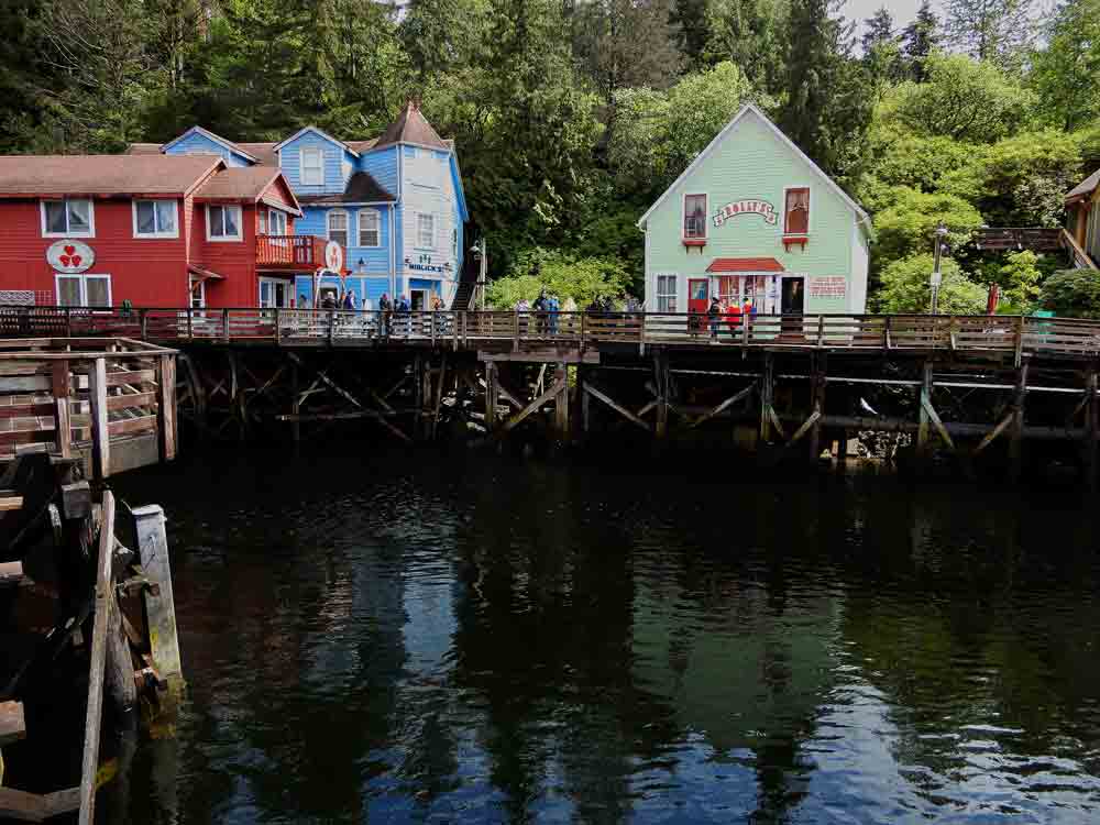
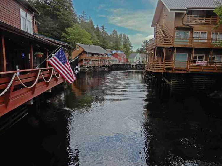
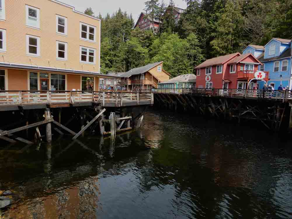
Creek Street is a historic boardwalk in Ketchikan, Alaska that was once the city’s red-light district. The street is famous being built on pilings over Ketchikan Creek, and many of the original buildings have been restored and converted into shops, galleries, and restaurants.
Dolly’s famous brothel pictured above in green
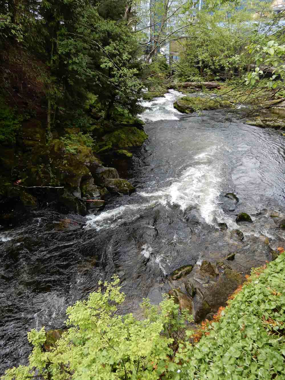
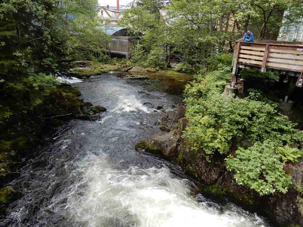
Creek Street has a colorful history that dates back to the early 1900s. At that time, prostitution was legal in Alaska, and Creek Street was home to more than 30 brothels. The street was a popular destination for fishermen and loggers who came to Ketchikan for work and entertainment. During the heyday one Dolly Arthur was the most popular madam and her establishment is still there and restored (pictured above). There were many other women of negotiable affection on Ketchikan’s infamous Creek Street. Spouses looking for a quick exit to avoid being caught at one of the brothels would quickly climb the stairs up the hill. The boardwalk and stairs soon became known as Married Man’s Trail and while famous as an escape route protecting many reputations it is also still a beautiful walk.
During Prohibition in the 1920s, Creek Street became a hub for bootleggers who smuggled alcohol from Canada into Alaska. The street was also a popular spot for gambling, and several of the buildings even housed illegal casinos.
In the 1950s, Ketchikan began to crack down on vice, and the brothels on Creek Street were all closed. The street fell into disrepair until the 1960s, when it was restored and transformed into an attractive Ketchikan neighborhood.
Today, Creek Street is a popular destination for visitors to Ketchikan who come to see its historic buildings, climb the hillside up Married Man Trail to the scenic views of Ketchikan Creek and to visit the unique shops and restaurants.
The Married Man’s Trail is still there and has been restored heading upward from Creek Street, winding through the trees it provides scenic views of the creek, town and harbor below. At the top of the Married Man’s Trail is Cape Fox Lodge. There you can take in panoramic views of the Tongass Narrows waterway, Deer Mountain, and the Thomas Basin Marina through the large glass windows in the rustic lobby.
Please Note: If your plans are to spend some time in Ketchikan the Cape Fox Lodge is unquestionably the most recognized name in this towns hospitality business. It’s perched on a hill overlooking Creek St. offering modern comforts like king size beds, big tubs, and free wi-fi along with a restaurant with a good reputation. In recent years its reviews have become somewhat mixed so if you’re interested we recommend that you check out recent reviews before booking.
Overlooked in favor of Paris, Rome, the Mediterranean beaches and the Alps, the Rhône region of France extends up the heart of France from Marseille on the Mediterranean, through historic Avignon, and includes Arles, the Roman city of Vienne, Lyon, France’s culinary heart and west of the Rhône in the Beaujolais wine region.
In this region the Rhône River winds its way west and south from Switzerland into France with it beginning at the Rhône Glacier in Valais, and flows to join the Saône River in the city of Lyon. From there it winds on past some of the region’s most significant landmarks dating back to the Roman era. Going on south past the Ardèche, the river moves past expanses of lavender and sunflower fields before it empties into the Mediterranean west of Marseille.
Most people, when they think of France, picture Paris, the French Riviera – Cote d’Azur, the beaches of Normandy, but not Roman ruins and Medieval castles. Travel up the Rhône through the heart of France and you will discover Avignon, the “City of Popes,” and the historic Papal palace, the massive Roman Colosseum of Arles, still hosting bull fights today, the ancient Roman city of Vienne, a number of castles and riverside villages dating back almost a thousand years.
If you’re considering a trip the best time to visit is in late June or early July. Usually the temperatures are moderate, the skies are clear and there are a remarkable number of seasonal festivals well worth investigating.
Avignon
Avignon, is the “City of Popes” and a good starting point going north. This walled city’s name dates back to the 6th century BC. The first citation of Avignon (Aouenion) was made by Artemidorus of Ephesus. The historic walled city, which includes the Palais des Papes, the cathedral, and the Pont d’Avignon, became a UNESCO World Heritage Site in 1995. The Papal Palace, the medieval monuments and the annual Festival d’Avignon have helped to make the town a major centre for tourism.
The Festival d’Avignon is an annual festival held every summer in July in the courtyard of the Palais des Papes along with other locations in the city. Founded in 1947 it is the oldest festival in France and one of the world’s largest. In addition to the official festival, often hundreds of theatrical shows are presented in Avignon at the same time of the year adding to the festivities.
The Avignon Papacy
The Avignon Papacy began when Pope Clement V, a Frenchman, was elected in 1305. Clement was under pressure from the French king, Philip IV, to move the papacy out of Rome. Philip was concerned about the growing power of the papacy and wanted to keep it under his control.
Clement agreed to move the papacy to Avignon, which was a small town in the south of France that was under the control of his Holy Roman Emperor. The move was met with protests from many Catholics, who believed that the pope should reside in Rome.
The Avignon Papacy was a time of great scandal and corruption. The popes lived in luxury and extravagance, and they were often more interested in French politics than in the spiritual needs of their flock and the church.
In 1377, Pope Gregory XI returned the papacy to Rome and stabilized the Papacy.
Arles
The Roman Colosseumof Arles
Near to Avignon is Arles. The Arles Colosseum and Amphitheater are one of the most popular tourist attraction in this city. They were built around the 1st century BC and the Colosseum was capable of seating over 20,000 spectators on three tiers. Today it has been mostly restored and is actually home to regular bullfights. After the Roman Empire fell the amphitheater became a shelter for the population of Arles and the Colosseum was transformed into a fortress with four defensive towers added.
Tournon Lamastre Steam Railroad
In the Rhone valley you’ll also discover the Tournon Lamastre Steam Railroad line. Enjoy full day or half day excursions on the Train of Ardèche as it travels through the mountainsides and the rugged gorges. It features open-air cars (in the warm months), beautifully restored old steam engines and incredible scenery. The train travels through rugged scenery in Doux Gorges, in Saint-Jean-de-Muzols. At the station of Colombier le Vieux – Saint-Barthélémy le Plain, the locomotive has to be turned round on a turntable and placed at the front of the train for the return trip.
The Wines of the Rhône
The Heart Of France’s Wine Country
Nobody should spend time visiting this region of France without sampling French wine. Some of the more widely recognized names include Côtes du Rhône, Châteauneuf-du-Pape and Beaujolais.
Côtes du Rhôneare the basic AOC (Appellation d’Origine Contrôlée) wines of the Rhône region, and exist as red, white and rosé wines, generally dominated by Grenache for reds and rosés, or Grenache blanc for whites.
Châteauneuf-du-Pape Not far from Avignon is a region famous for the production of red wine classified as Châteauneuf-du-Pape Appellation d’origine contrôlée which is produced from grapes grown in the commune of Châteauneuf-du-Pape and in portions of four adjoining communes. The name comes from the designation of the wine of the Pope. A ruined medieval castle sits above the village and was built in the 14th century for Pope John XXII, the second of the Popes to reside in Avignon. None of the subsequent Avignon Popes stayed in Châteauneuf but after the schism in the church in 1378 the antipope Clement VII sought refuge in the castle.
Beaujolais Our trip included time visiting the Beaujolais wine region to the north of Lyon along with a number of quaint Provençal villages. Today the region is known world wide for the popular Beaujolais nouveau. It is the most popular vin de primeur, fermented for just a few weeks before being released for sale on the third Thursday of November. This ‘Beaujolais Nouveau Day’ is recognized everywhere, with races to get the first bottles to different markets around the globe.
The Village of Beaujeu
The village of Beaujeu is the heart of the region and where the famous Beaujolais gets its name. The French tradition is to name a region after a central town. This region is famous for its growing conditions with lots of sunshine and its granite-based soils lending a unique character to their wines. The Gamay grape is used to make all Beaujolais wines with the exception of white Beaujolais, or Beaujolais blanc, which is made of Chardonnay grapes. Most of the harvesting is made manually in the Beaujolais region. Handpicking means entire bunches are vatted to allow a specific sort of maceration. This winemaking is specific to the Beaujolais region.
Traveling through the hilly Beaujolais you’ll be struck by the shear number of acres devoted to vineyards. From whole hillsides down to small backyard vineyards, grapes are growing everywhere and most everything seems to involve wine. Visited the Chateau de Varennes for a wine tasting. It’s an estate that is listed as a “VMF Historic Heritage” site and has been in the same family since 1809 with buildings dating back to the 11th Century. The Château itself is a beautiful period castle from the 16th century located in the heart of vineyards and overlooking the Samson valley. It’s a beautiful location with panoramic terrace views and an impressive Renaissance entry court.
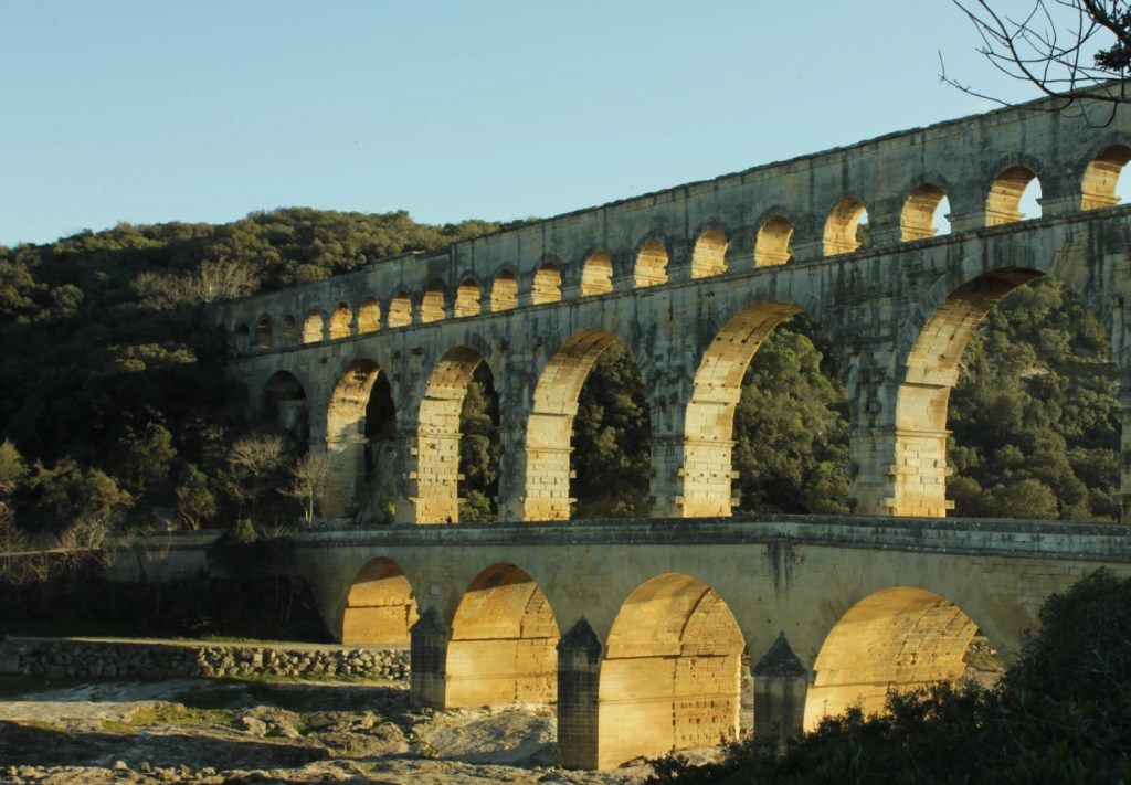
Roman Ruins in the Rhône Valley
From the 1st century AD for several hundred years the Rhône region was the commercial heart of the Roman Empire and today you’ll see signs of its importance everywhere you travel.
The Pont du Gard: This aqueduct, pictured above, is one of the most well-preserved Roman structures in the world. It was built in the 1st century AD to carry water from the Eure River to the city of Nîmes.
The Colosseum and Amphitheatre of Arles: This amphitheater was built in the 1st century AD and could seat up to 20,000 spectators. It was used for gladiatorial contests, animal fights, and public executions. Today it still holds bull fights.
The Theatre Antique of Orange: This theater was built in the 1st century AD and could seat up to 10,000 spectators. It is still used today for performances of opera, ballet, and classical music.
The Maison Carrée in Nîmes: This temple, pictured below, was built in the 1st century BC and is one of the best-preserved Roman temples in the world. It is now a museum.
The Alyscamps in Arles: This necropolis was used for burials from the 3rd century AD to the 19th century. It is now a public park.
Castles On The Rhône
In addition to the remains of a number of Roman cities the region is also famous for its castles. Dating from the 12th-century through the 16th-century many are open to the public.
Château de Pierreclos: This 12th-century castle is located in the Beaujolais wine region. It is now a hotel and restaurant, but visitors can still explore the grounds and gardens.
Château de Tournon-sur-Rhône: This 14th-century castle is located in the city of Tournon-sur-Rhône. It is now a museum, and visitors can see the restored state rooms and the castle’s gardens.
Château de Grignan: This 16th-century castle is located in the town of Grignan. It is now a popular tourist destination, and visitors can see the castle’s state rooms, gardens, and the nearby lavender fields.Opens in a new windowTripAdvisorChâteau de Grignan castle on the Rhone
Château de Suze-la-Rousse: This 12th-century castle is located in the town of Suze-la-Rousse. It is now a museum, and visitors can see the castle’s state rooms, dungeons, and the nearby vineyards.
Château de Rochemaure: This 12th-century castle is located in the town of Rochemaure. It is now a museum, and visitors can see the castle’s state rooms, dungeons, and the nearby waterfalls.
If you’re considering a trip to the Rhône region of France a great way to experience it is to take a river cruise. Most take a week or more and will travel between Lyon and Marseille offering lots of opportunities for interesting exploration.
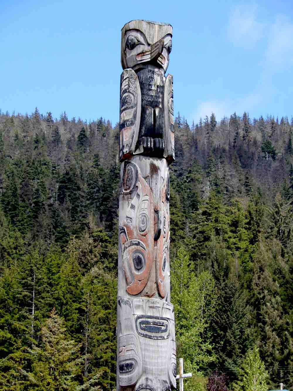
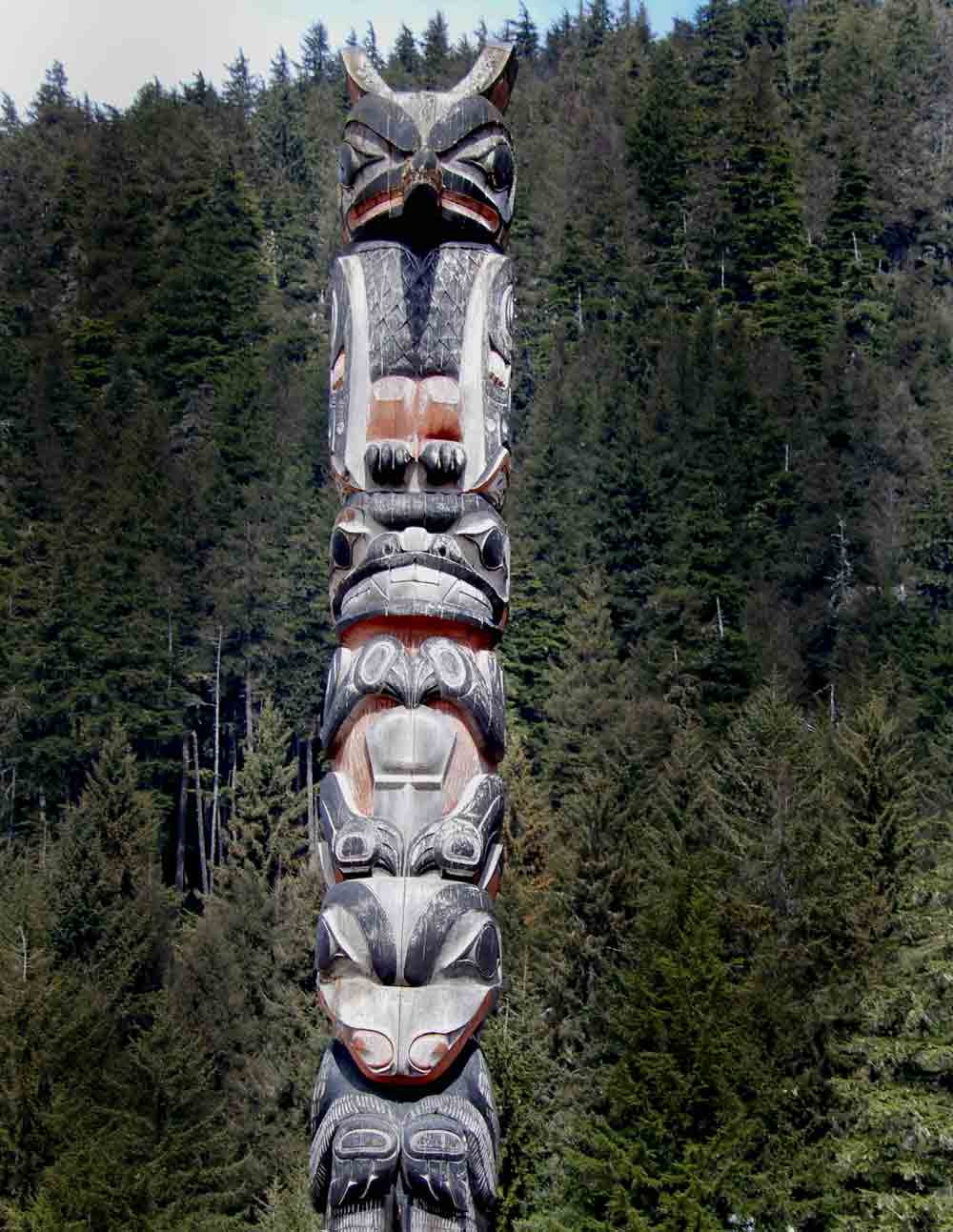
The totem pole is often the graphic symbol representing Alaska but what exactly are these totems about? The history of totem poles is long and complex, dating back thousands of years. The first totem poles were likely created by the Haida people of the Pacific Northwest Coast, and the practice spread to other First Nation’s groups in the region, including the Tlingit, Tsimshian, and Kwakwaka’wakw.
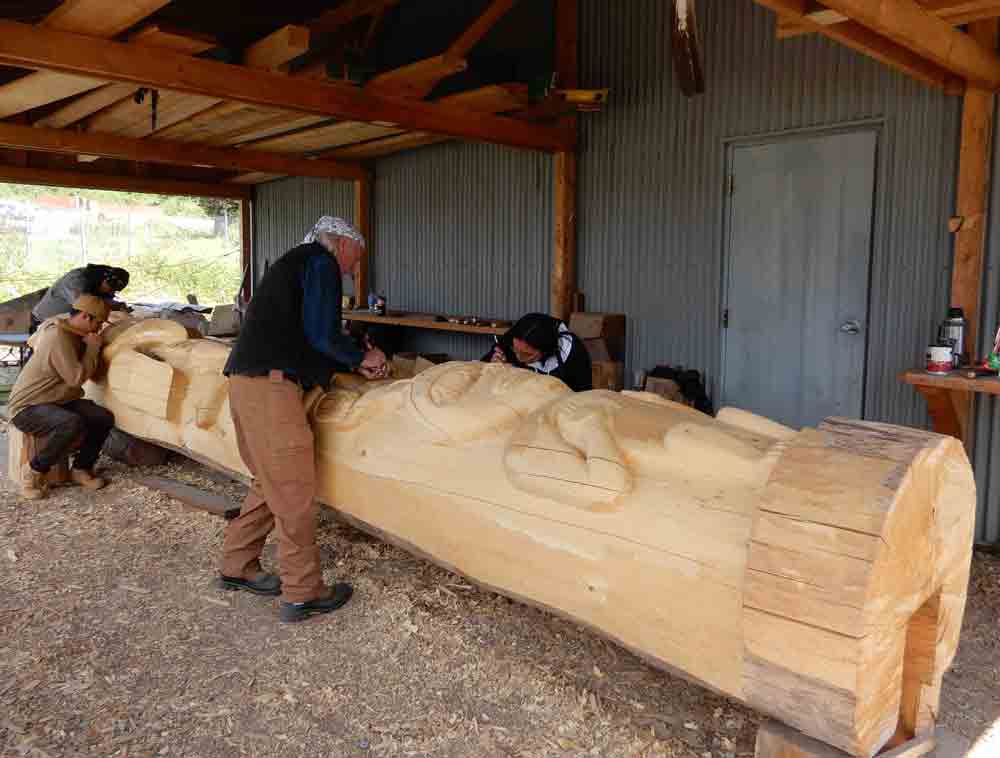
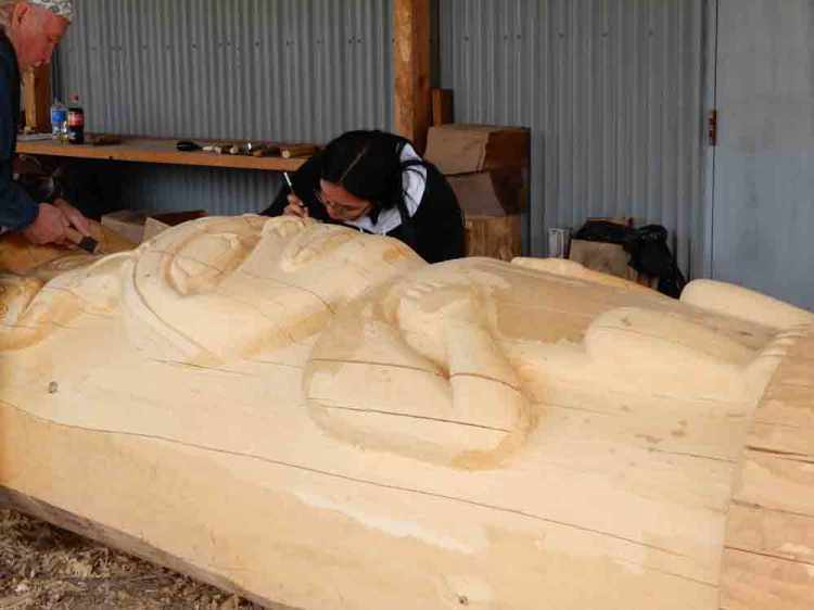
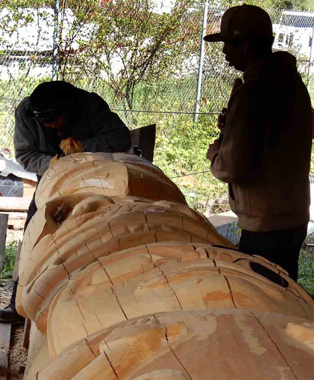
Totem poles are actually a tangible expression of a Native community’s history, values, and traditions. They are individual and group memories and stories being passed through families, clans and communities from one generation to another. These graphic carvings have, over the ages, developed a recognizable symbolism in hundreds of specific elements from the shapes in eyes, beaks, noses and different pictured animals. They are deeply imbedded into the identities of several Alaskan Native clans in the Southeast region. The word “totem” seems to refer to totemism, which was once believed to be part of the native American religion. While often the design may provide the totem pole a spiritual character it is inaccurate to ascribe a religious purpose as it is not considered a religious icon. Each aspect of a totem pole is as important and individualized as the animal it is based on. The most common clan associated with the totem poles seen in Alaska today are the Tlingit.
The actual purpose of a pole fills a number of different situations. It can tell the story of a family, celebrate an occasion and memorialize an event. A number are actually ordered or commissioned by individuals or clans from carvers. Some totem poles have even been created as an insult toward an individual. Consider it public shaming. The general structure of a totem pole includes a moiety, a clan animal, with various passive and aggressive animals being part of a clan crest. They can communicate a narrative, but mostly they celebrate a family’s lineage, validating the powerful rights and privileges that the family holds.
The tradition of totem pole carving declined in the late 19th century, as First Nations peoples were forced to adopt European lifestyles. However, there has been a resurgence of interest in totem pole carving in recent years, and there are now many active totem pole carvers in the Pacific Northwest. There are currently several projects in Alaska to keep the tradition of pole carving alive and to train young people in the traditions and skills of the craft.
Hoonah Alaska is one of these totem carving projects teaching Tlingit Natives the process. Cruise guests visiting Icy Straight Point have the opportunity to watch a carving in process. It is a little over a mile from the cruise docks and there is an inexpensive shuttle bus available.
Totem Pole Park
Visitors to Sitka, Alaska have an opportunity to walk through Totem Park administered by the National Park Service. The totem pole collection was installed in 1906 and over the years, caretakers patched, painted and finally re-carved many of the poles. Although many of the original poles are gone their stories live on – along with the opportunity for visitors to discover them along the quiet wooded paths of the park.
Today, totem poles are still used by First Nations peoples to commemorate important events, tell stories, and mark clan ownership. They are also popular tourist attractions, and can be found in many museums and parks throughout the Pacific Northwest.
Around the world in less than 2 minutes with The Intentional Travelers
Stumbled upon this video from a couple of years ago and was thinking maybe it’s time for an update. 92 countries, 7 continents, 2 dozen seas and oceans and still counting…
Join Us – We understand that the last thing you may want is more emails cluttering up your inbox, but we promise we’ll work hard to make this worth your while. Give us a try and if we don’t live up to our promise all you need do is click the unsubscribe link in our emails.