Our Ultimate Guide to Visiting Sydney Australia

One of the worlds great natural harbors, see where you’ll dock, local attractions, transportation and history of this fantastic port of call.

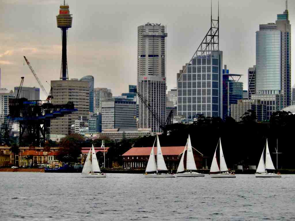
If the world has a perfect port of call, this is it. Besides being the worlds greatest natural harbor, the harbor is surrounded by a truly remarkable city. The center of the Sydney harbor area is Circular Quay with ferries leaving regularly for dozens of destinations like Manley Beach, Watson’s Bay and Luna Park. In addition the Circular Quay is located near the Sydney Opera House, the harbor bridge, the Rocks and metro transportation hubs (links to more info below). The great news is that cruise ships dock just across from Circular Quay.

Where Your Ship Docks

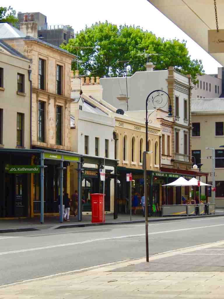
One of the great things about Sydney as a port of call is the pier location. Cruise ships dock right next to The Rocks, a great historic neighborhood with restaurants, shops and a museum. Less than a half mile walk west The Rocks is Darling Harbor which is a modern centerpiece to the area featuring more fantastic attractions and great restaurants. A short walk in the opposite direction from tThe Rocks is Circular Quay where you can catch any number of ferries to destinations all around this huge harbor.

Wheelchair Accessibility

Embarking and Disembarking – This port has a developed cruise ship pier but the ease of disembarking varies by the individual ships gangway designs. The cruise pier disembarks right into the downtown area. For passengers using wheelchairs there can be a moderate ramp incline to deal with but Sydney is a modern city with good infastructure for people using wheelchairs.

Transportation

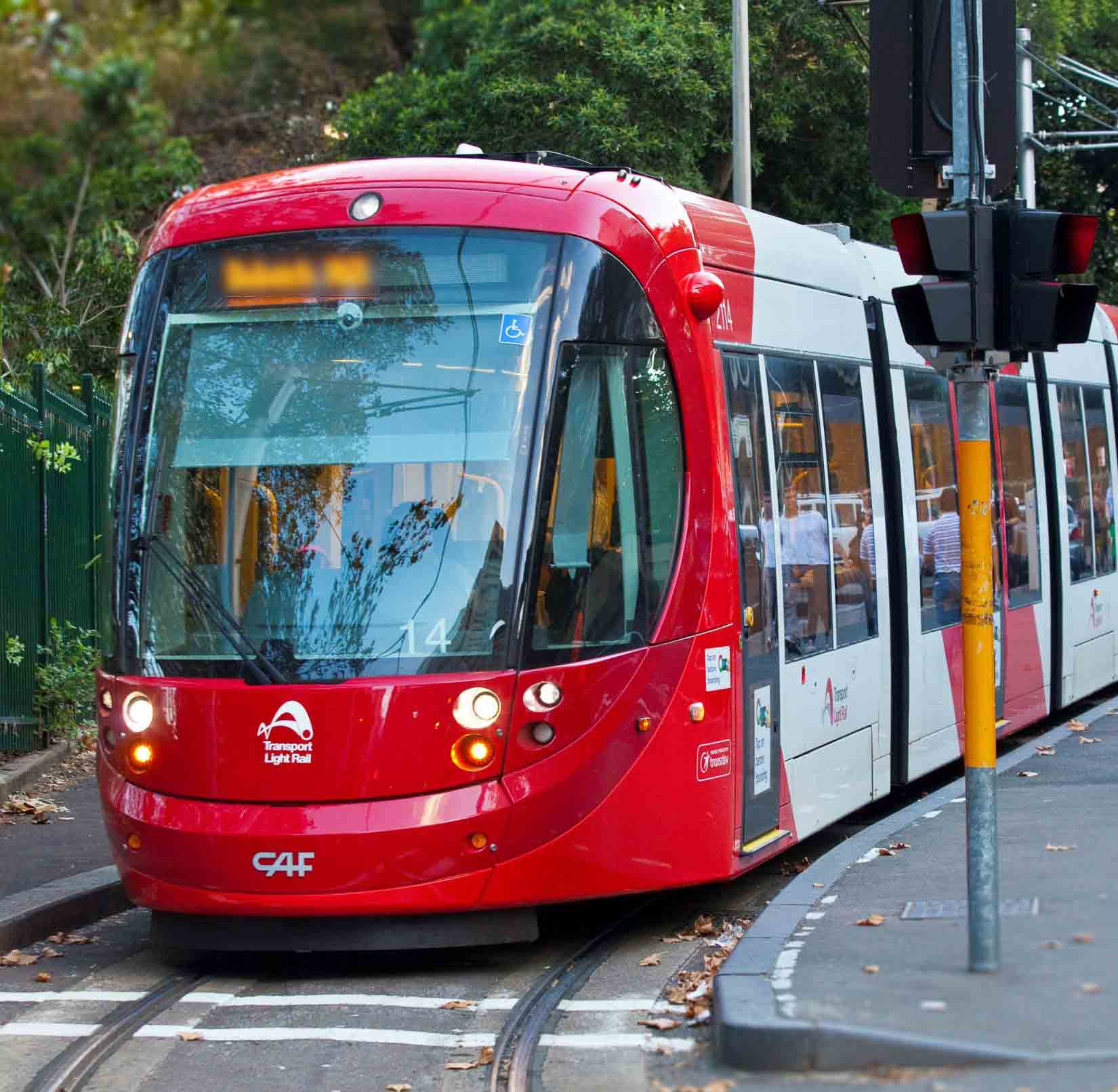
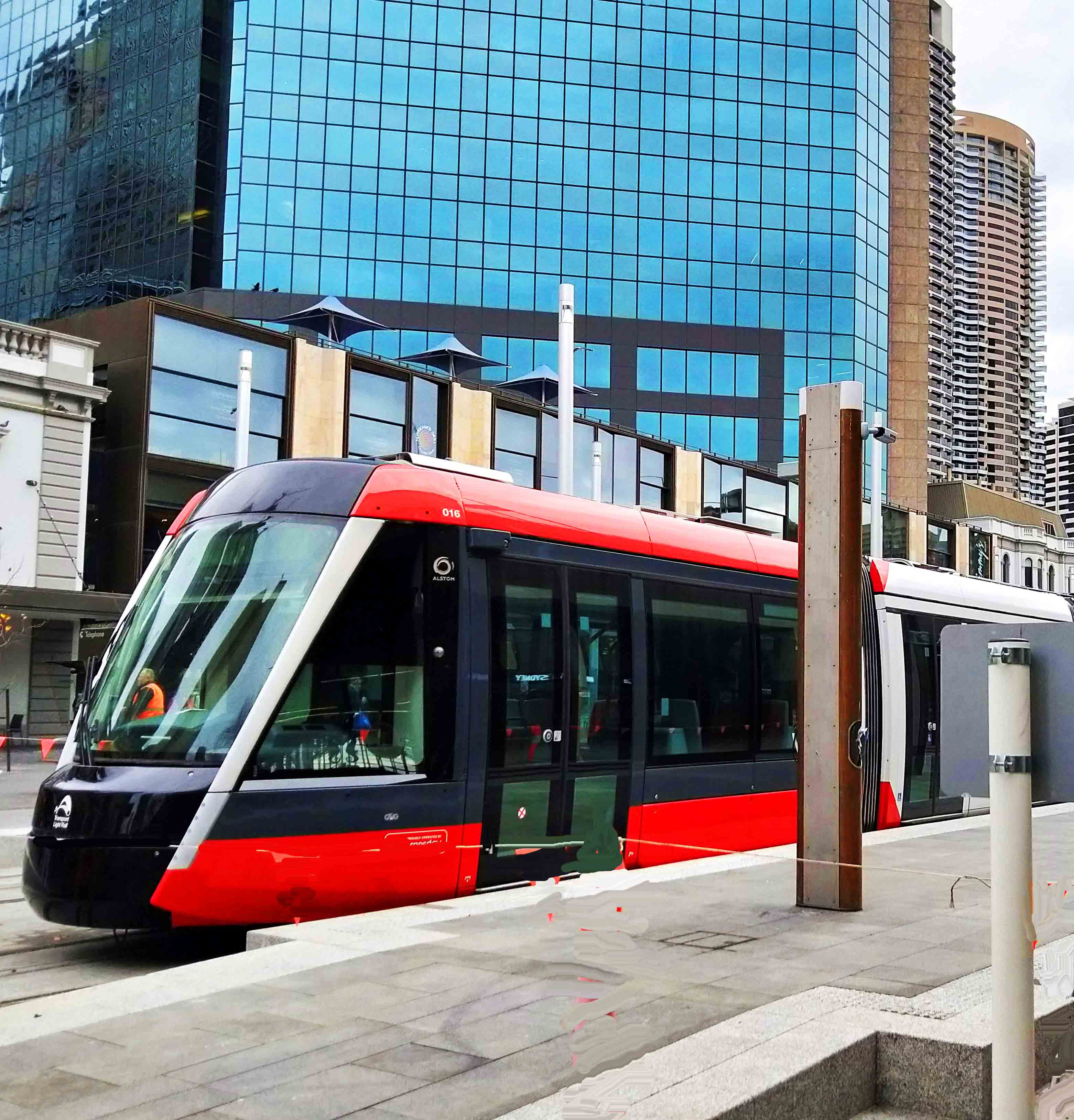
Getting into the central city is just a short walk from the pier and the mass transit options are really good. If you are going to be in Sydney for a while or if you want to spend your day traveling on your own, be sure and get an Opal Card (More on the Opal Card HERE). Because ships dock very near Circular Quay you can also catch a ferry to any number of locations around the harbor (Opal Card works on the ferries too).

Circular Quay

Currency

You should get some currency exchanged even if you plan on relying on credit cards just just to buy incidentals. Currently the Australian dollar is equal to 76¢ U.S. Most credit cards are welcome and ATM machines are plentiful.

Tipping

It’s important to understand that Australians just DON’T tip for any reason. If you go to a restaurant and the menu says $10.00 that is exactly what you should expect to pay. Most listed prices include all taxes and gratuities.

History

Sailing westward from New Zealand across open sea in April 1770 Capt. Cook became the first known European to reach the east coast of Australia, making landfall near present-day Point Hicks. He then proceeded north and landed at Botany Bay.

Australia became an English colony in 1788 when the first prisoners assigned to the new penal colony of Australia arrived at Botany Bay inside the area of todays Sydney Harbor. When America won its freedom, England lost the ability to assign criminals to their American colonies and switched to Australia to deposit people they thought unfit to live in England. While thousands of criminals were banished to Australia on 16 January 1793 a ship arrived at Sydney Cove carrying the first few hundred free settlers looking for opportunity and they were soon followed by waves of thousands more.

The Rocks

Local Highlights

Within a couple of blocks of the pier are two museums, the Museum of Contemporary Art and the Discovery Museum, both worthy of a visit.

The Sydney Opera House – It dominates the harbor right across from where cruise ships dock. Even if there are no productions scheduled there are still guided tours ($) of this architectural masterpiece.

The Harbour Bridge – This structure dominates the harbor and there are actually tours that will walk you up the suspension cables to the very top if you feel brave enough.

Luna Park – This is an amusement park located across the harbor from Circular Quay with a stop on two ferry routes. It is mostly an evening and night destination if you are spending a couple of days in the harbor area.

In addition to the famous sites, Sydney’s vibrant culture is highlighted at Darling Harbour and The Rocks, where visitors can explore markets and local cuisine.

Darling Harbor – Less than a half mile west of the pier through The Rocks is Darling Harbor with a number of very good restaurants, shops and Sea Life the Sydney Aquarium.

The Rocks – As you leave the ship and begin walking you have two choices; off to the left you are heading toward Circular Quay and the downtown district and the Opera House on the other side of the Quay. If you go straight ahead and up some large stairs you will find yourself in the middle of The Rocks. The Rocks became established shortly after the English colony’s formation in 1788. The original buildings were timber with thatched roofs, and later many were replaced with local sandstone block, this limestone is where the area derives its name. This neighborhood is the original foundation of the city of Sydney. From the earliest history of the Rocks, the area had a reputation as a slum and the convicts’ side of town and was often frequented by visiting sailors because of the numerous rum bars and prostitutes.


For wildlife lovers, Taronga Zoo and SEA LIFE Sydney Aquarium provide engaging experiences with Australia’s unique fauna. The city also features historical attractions like the Queen Victoria Building (featuring a number of shops) and the Art Gallery of New South Wales, showcasing both heritage and contemporary art.

Royal Botanic Gardens – Just to the east of Circular Quay is a large park that includes The Gardens along with The Rose Garden and Pavilion.

Catch a Ferry – Don’t miss an opportunity to grab a ferry at Circular Quay and see Sydney from the water, the night skyline is spectacular. Visit Manley Beach, a popular surfing beach and Watson’s Bayif your exploring by ferry..

Manley Beach

If you are spending a few days in Sydney we’d recommend getting an Opal Card for public transportation. You can catch a metro and bus out to Bondi Beach which is one of the worlds more famous surfing beaches and has a remarkable walking trail along the cliffs. You can also take a train on the Opal Card out to the Blue Mountains which is about an hour and a half out of Sydney.


Additional button links for more information on visiting Sydney:


Hike

Photo Editing Secrets on iPhones and Androids

Another Cellphone Miracle

Everybody carries a cellphone and almost everyone uses it to take pictures, but not everyone is aware of the immense photo editing potential built in. Comparing iPhones and Androids there is very little difference between the two systems photo editing built into the cameras photo aps.

They both offer AI-powered editing features, that in Android are named Magic Editor, Magic Eraser, and Photo Unblur, accessible through the phones photos app, allowing users to enhance photos by moving, removing, or resizing objects, changing backgrounds, and more. Also included are adjustments for contrast, color enhancing, cropping and brightness.

If you haven’t explored this potential you really need to take a look. In modifying an image they both start by duplicating the photograph so you can always return to the unedited image. Without a lot of explanation here are a few of my recent exercises:


A Very Scary Road In Utah

A Short Story
Utah’s Hogsback on Route 12

Several years ago we spent a couple of weeks checking off items on our bucket list in the National Parks of Utah. We rented a car in Salt Lake City, toured the parks and dropped off the car in Las Vegas.

One afternoon halfway through the trip we left Capital Reef National Park headed for our next hotel in the town of Panguitch near Bryce Canyon National Park. We came out of Capital Reef on Route 24 headed west and soon hit an intersection with Route 12 and 24. At the intersection Rt. 24 headed to the north, which is the way we had been told to go while Rt. 12 headed south. Just looking at the map it seemed like Route 12 was a much shorter trip. We turned left and headed south.

At this point I should add that the older I get the more nervous I am about heights. Already on this trip I had driven a couple of roads that had given me reason to pause. The entrance road up into Arches National Park was a bit scary to me. I’m not sure where this fear of heights has come from but when I was much younger I was fearless. Today I find it hard to believe that decades ago I hung one handed off high catwalks and jumped out of hovering helicopters into the ocean. I must admit that my wife has almost no real fear of heights.

The Anasazi State Park and Anasazi excavations

Some distance along this two lane Route 12, near Boulder Mountain we came across the Anasazi State Park and archaeological site. This was a lucky find and well worth stopping for a visit. It is the site of an excavation of an ancient Anasazi village with an interesting museum*.

Back on the road we headed southwest again and soon came upon one of the scariest bit of road I can remember. Its called the Hogsback (or Hog Back) and it’s a narrow two lane road with, at times, barley any shoulder on either side. It rides along a ridge for about four miles with often steep drops of over a hundred feet on one side or the other and sometimes both sides at once. There were few guard rails and almost no room to pull off. The speed limit was between 25 and 35 mph and with my fear kicking in that seemed way too fast.

The good news was there was almost no traffic and the driver in the car ahead of us seemed really terrified. He crept along at 15 mph and never reached 20. Just fine with me. Not only did I feel safer but he gave me an excuse when eventually another car caught up to us.

A video of a drive along the Hogsback.

More About the Anasazi State Park

Anasazi State Park, located in southeastern Utah, is a fascinating archaeological site that showcases the history and culture of the Ancestral Puebloans, commonly referred to as the Anasazi. The park features excavations of a well-preserved ancient village and showcases reconstructed dwellings along with artifacts that illuminate the lives of these early inhabitants .

The site includes a museum that provides educational exhibits about the Anasazi’s agricultural practices, architecture, and social structures, enhancing the understanding of their sophisticated civilization . Additionally, the park is known for its scenic landscapes, making it a popular destination for hiking.

Visitors can engage in various activities, including guided tours and interpretive programs, which aim to foster appreciation for the cultural heritage of the region. Overall, Anasazi State Park serves as a vital resource for both education and recreation while preserving the rich history of the Ancestral Puebloans.

Who Were The Anasazi?

The term “Anasazi,” established in 1927, refers to the Ancestral Puebloans, an ancient Native American culture that thrived in the Four Corners region of the United States, encompassing areas such as Mesa Verde and Chaco Canyon. This term is often considered controversial, as it translates to “ancient enemies” in Navajo, and many prefer the term Ancestral Puebloans to honor their descendants.

At their peak in the late 11th century, the Anasazi, particularly those in Chaco Canyon, dominated a vast territory in the American Southwest, which was larger than many contemporary European regions. This cultural center was pivotal for trade and ceremonial activities, influencing surrounding areas. The Anasazi culture is characterized by its impressive architectural achievements, including multi-story dwellings and intricate road systems that allowed for commerce and communication across the region.

Overall, the Anasazi represent a significant chapter in Native American history, showcasing advanced societal structures and cultural practices that have left a lasting legacy in the American Southwest.

Explore More of The Intentional Traveler

This image has an empty alt attribute; its file name is Cruise-port-Banner-Ad-1024x245.jpg

This image has an empty alt attribute; its file name is Hike-Banner-Ad24-1024x263.jpg

Getting from Sydney Airport to CBD: A Complete Guide

Sydney International Airport (SYD) To Circular Quay And Beyond

When arriving at Sydney International Airport most visitors will be wanting to get into the CBD (Sydneys downtown). While there are a number of options

  • Fastest – Airport Link Train takes 12 minutes and costs US$11.00 to US$13.00. Trains run every 10 minutes
  • Least Expensive – Take the bus from the International Airport to Central Sydney that takes about 30 minutes and costs about US$1.00
  • Taxis – Take a taxi from Sydney Airport to downtown Sydney, takes about 14 minutes and costs US$30.00 to US$40.00
  • Uber (Ride Share) – In 2023 the Sydney City Council designated zero pick up and drop off areas in the Sydney CBD for Uber drivers. Ubers who use taxi, bus zones or delivery areas for loading can be ticked. That has resulted in fewer Uber drivers and those who are still driving have developed a questionable reputation.

Use The Sydney Airport Link

To get downtown from Sydney Airport using Airport Link, take the train from either the International or Domestic terminal station, which runs every 10 minutes, and disembark at Central Station, Museum, St James, Circular Quay, Wynyard, or Town Hall stations, depending on your destination.

Here’s a more detailed breakdown:

The Airport Link is a train service connecting Sydney Airport to the city center and beyond.

You can access the Airport Link train from the arrivals level of both the International and Domestic terminals.

You can either buy an Opal Card and load it in either terminal or use a credit card (Amex, Visa, or Mastercard) to tap on and off the train. Learn more about the Opal Card HERE.

Airport Link Stations

Central Station: The main hub for Sydney’s train network.

Museum Station: Located near the city’s museums.

St James Station: Near the Opera House and Circular Quay.

Circular Quay Station: Offers access to ferries, the Opera House, and the Harbour Bridge.

Wynyard Station: A major station in the city center.

Town Hall Station: Located at the government complex.


The Silver Surfer Goes Diving

Oslo Harbor, Norway

Discovered sculpture of a diver in Oslo harbour, Norway. The Dykkaren is a metal statue of a shiny scuba diver. It is located on the harbour promenade of the ferry terminal in Oslo. The diver looks out over the magnificent Oslo fjord and is fully suited in scuba gear. Have not discovered the sculptures name?


Todays Image • Street Art in Chefchaouen

Chefchaouen, Morocco is best known as the Blue City because of the numerous houses painted in shades of blue. Walking up through the old city there was this striking piece of street art. Her name is Fatima which is usual in Morocco to give the first born daughter the name of Muhammad’s daughter.

Chefchaouen, Morocco