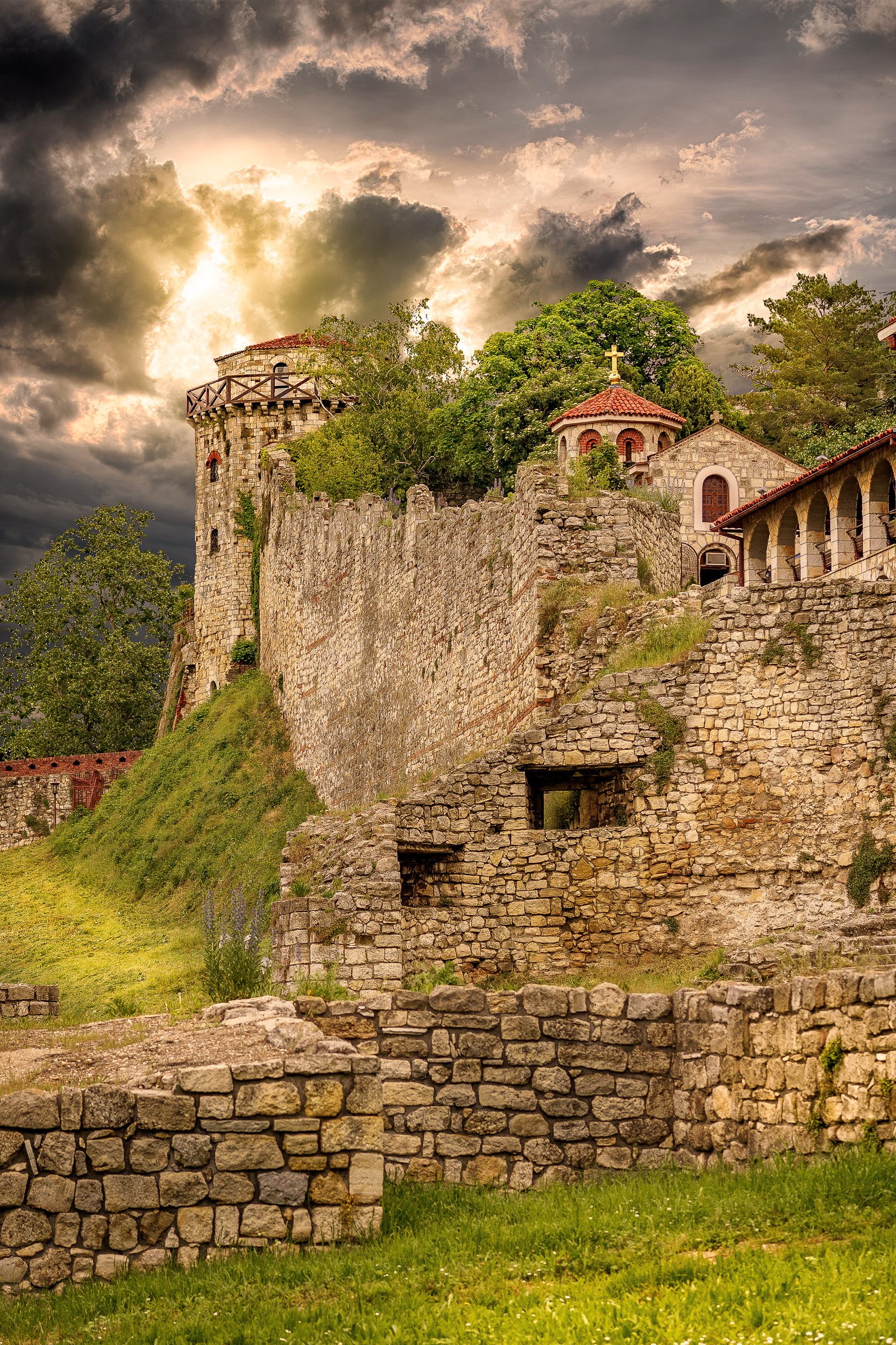
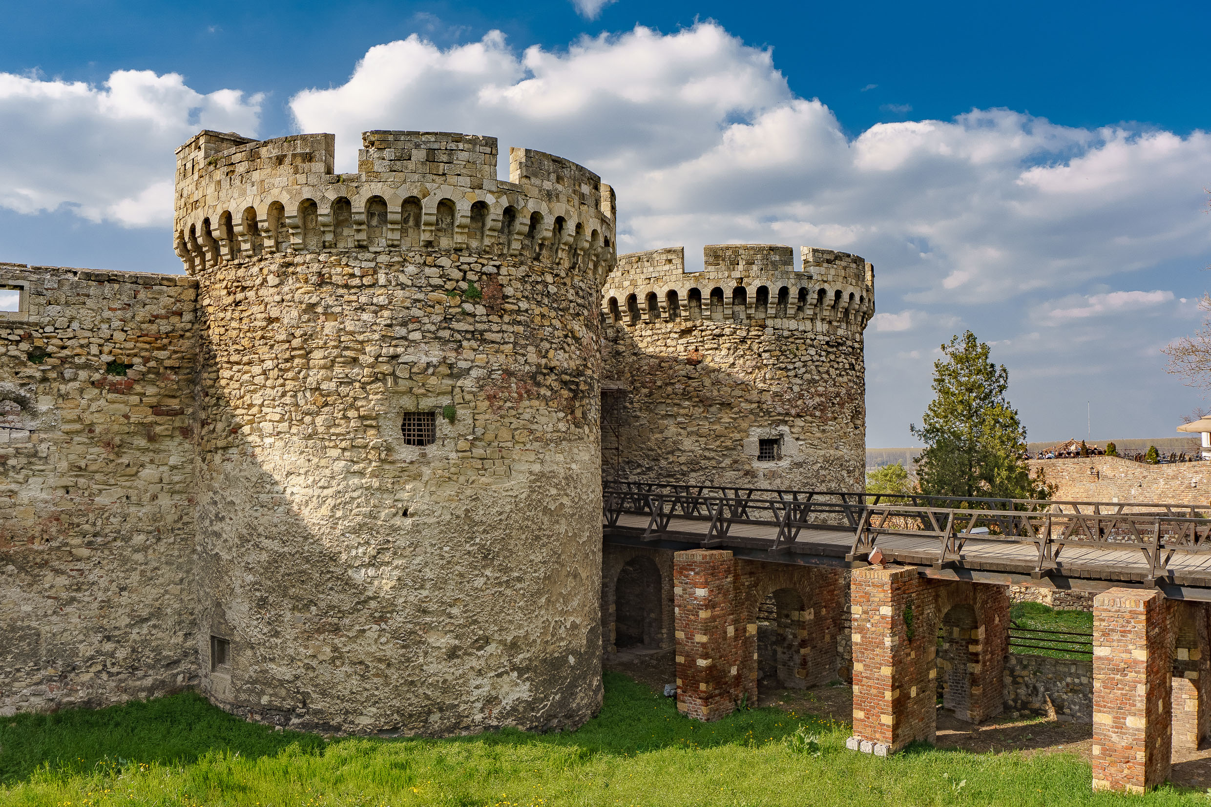
Any Visit to Belgrade, Serbia should start with the Belgrade Fortress. Today it is a huge complex that consists of the old citadel (Upper and Lower Town) the Kalemegdan Park (Great and Little Kalemegdan) occupying high ground above the confluence of the Sava and Danube rivers. The fortress constitutes the historical center of Belgrade and once represented the original boarders of old Belgrade. The fortress area was declared a Monument of Culture of Exceptional Importance in 1979, and is protected by the Republic of Serbia. The area is very popular with the locals and admission is free.
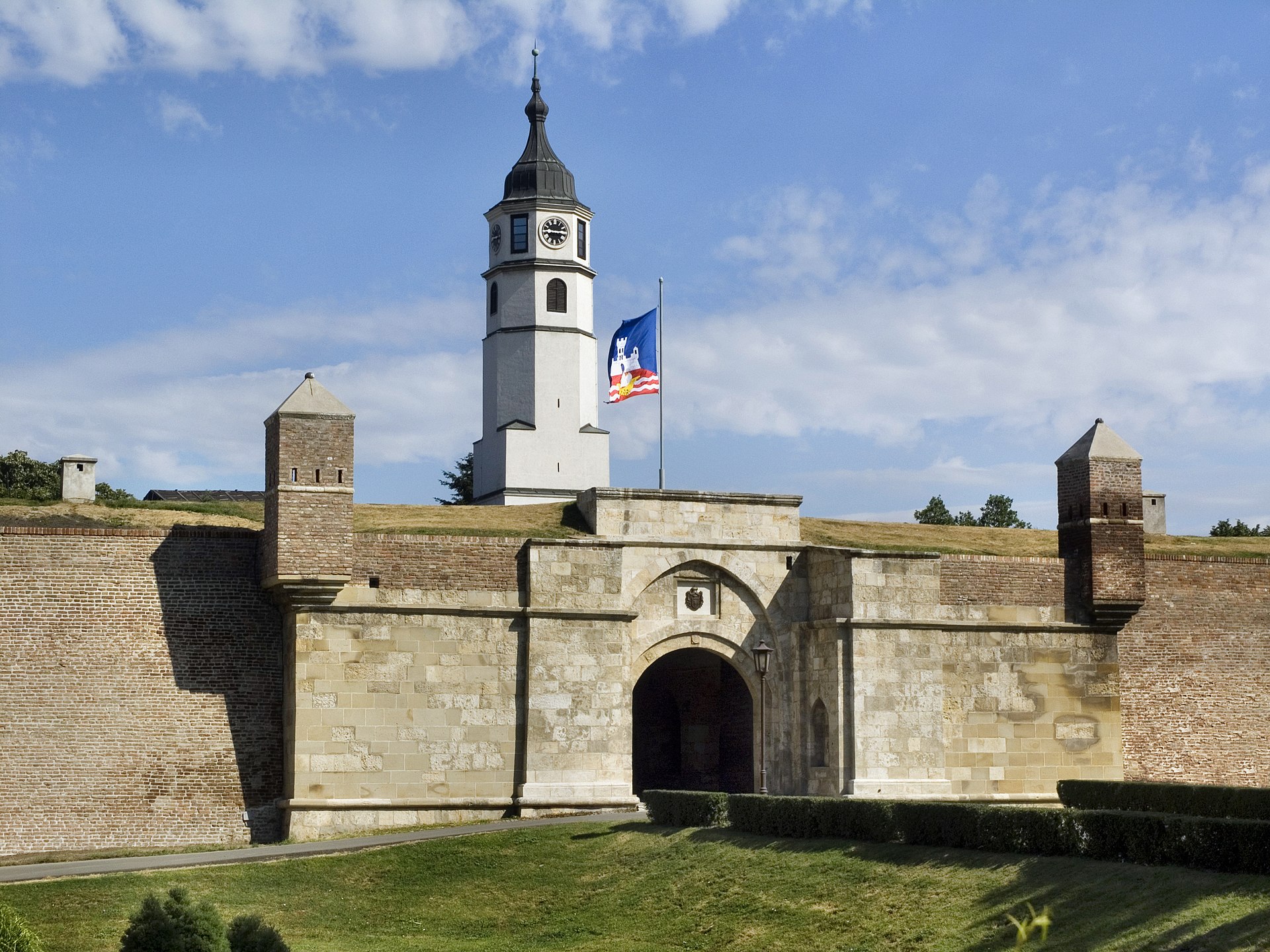
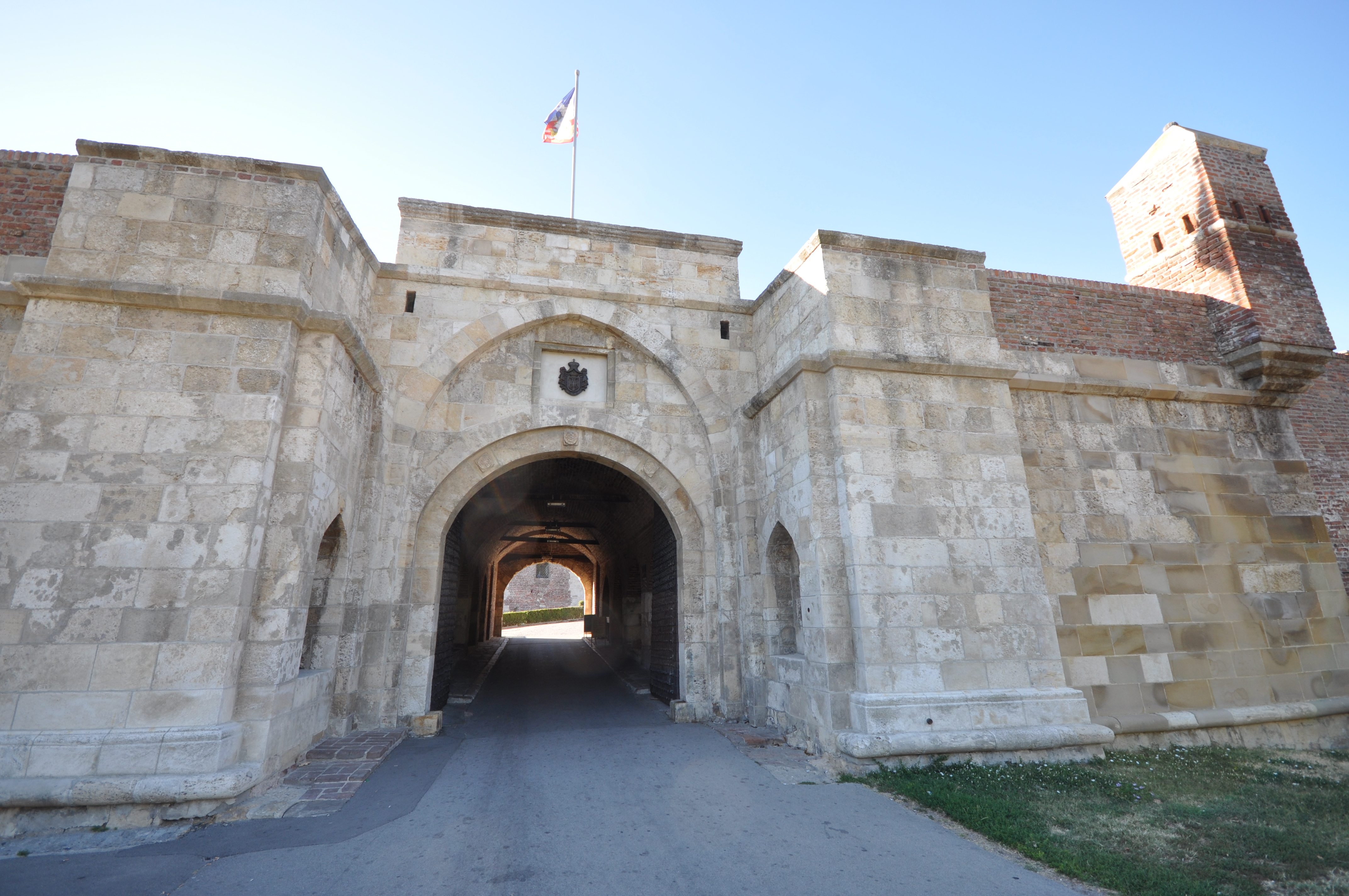
The Belgrade Fortress – the massive Belgrade Fortress complex has four primary sections. The four sections, two of which include the fortress itself are Donji and Gornji Grad with two that make up Kalemegdan park today.
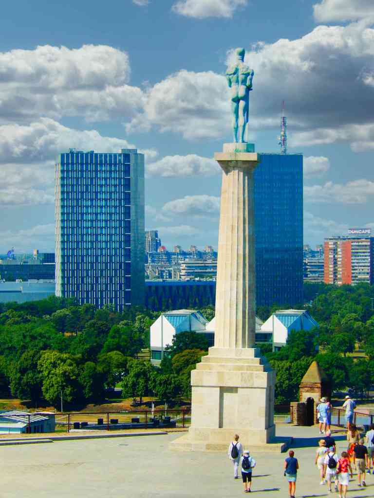
Gornji Grad, the upper section of the fortress was turned into a park, with promenades and the statue of “The Victor”, the “Roman well” actually built by the Austrians, the an Observatory in the Despot Stefan Tower, the Mehmed Paša Sokolović’s Fountain, with tennis and basketball courts.
The Statue of the Victor
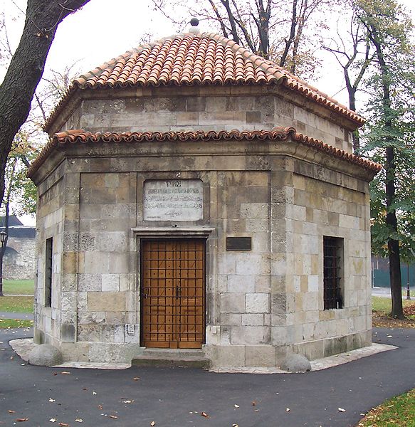
Donji Grad occupies the ground above the rivers, from the location of “The Victor” statue*. Between the lower section and the river is the”Impregnable, Fearless, or Daredevil Tower”, which is a museum about the Greek revolutionary Rigas Feraios, who was strangled by the Turks. The Orthodox churches of Ružica and Sveta Petka are also located in this area, as is the Belgrade Planetarium.
Kalemegdan Park and the Military Museum Area – Veliki Kalemegdanski park occupies the southern corner of the fortress, with major promenades that include the Military Museum, the Museum of Forestry and Hunting, and the Monument of Gratitude to France.
*The Statue of the Victor is one of the most famous landmarks in Belgrade, located in the Belgrade fortress at the place where the medieval castle once stood. It was erected in 1928 to commemorate the Kingdom of Serbia’s war victories over the Ottoman Empire.
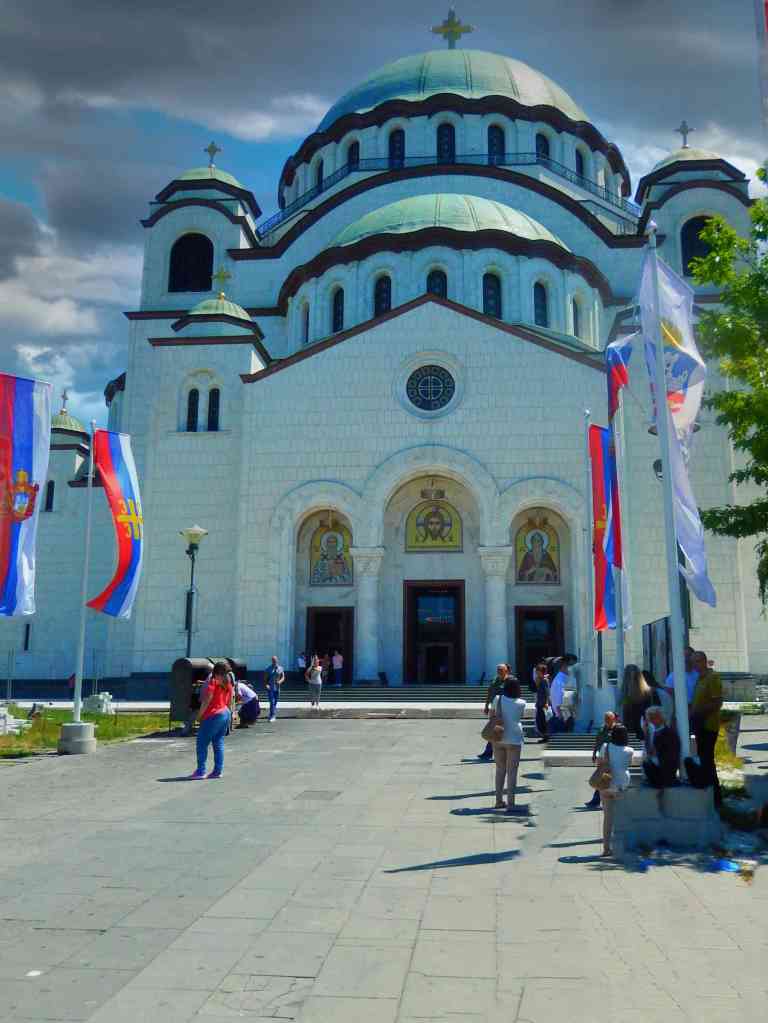
The Temple of Saint Sava
The Cultural heart of Belgrade is the Temple of Saint Sava is a Serbian Orthodox church located on the Vračar plateau in Belgrade, Serbia. It is today the main cathedral of the Serbian Orthodox Church. The church is dedicated to Saint Sava, the founder of the Serbian Orthodox Church and an important figure in medieval Serbia. It is erected on the presumed location of St. Sava’s grave. During the Muslim occupation the Ottoman Grand Vizier Sinan Pasha had the coffin of St. Sava been moved from the Mileševa Monastery to Belgrade where it was placed on a pyre and burnt in 1595 to crush the faith of Serbian Christians. The Serbs recovered the ashes and dirt from under the pyre and saved them so when the new church was built the remains of St. Sava could be reenturned.
The first stone for the church was laid in 1935. During WWII the incomplete building was used as a depot by the German army and Tito’s communist partisans. After the war, the Orthodox Church was denied permission to complete the building by the Communist government. On May 12, 1985, a liturgy was held at the temple with 100,000 people in attendance and the communist authorities backed down from the ban on the construction of the church. In June 1989 after the fall of the government, the temple’s concrete dome weighing 4,000 tons and constructed entirely on the ground, was raised to its present position. The temple is now nearing its final completion.
Belgrade is now very proud of the new Ada Bridge. It is a cable-stayed suspension bridge over the Danube at the tip of Ada Ciganlija island. The Ada Bridge was opened in 2012 and features a unique offset suspension tower anchored on the island’s tip.
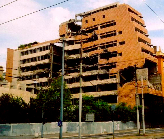
There are few traces of the 1990s Balkan war to be seen in Belgrade with the exception of the ruin of the Serbian Army Headquarters. It was hit several times with cruise missiles and is now left standing as a reminder of the war.
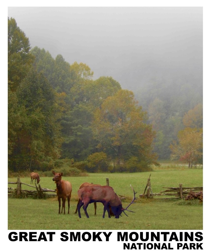
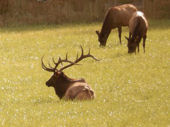
It’s been some time since I read anything about the reintroduction of elk into the North Carolina mountains and I hadn’t given it any thought when planning our Blue Ridge mountain trip. It was an unexpected encounter when we found elk in the forest.
Reintroduction of elk into Great Smoky Mountains National Park began in 2001 when 25 elk were brought from the Land Between the Lakes National Area of Tennessee. In 2002, the National Park Service imported another 27 animals.
Right now reports indicate the elk are improving the mountain forest environment as the elks’ grazing is active enough to stimulate good plant regrowth. They keep fields clear by keeping the grasses shorter and make it easier to navigate for smaller animals, such as rabbit or turkey. It also makes it easier for birds of prey to search through the shorter grasses. They are also adding to the network of game trails in the forest. However the elk have been missing from this environment for over a hundred years and researchers are still studying the impact of their reintroduction watching for signs of stress in the ecosystem.
It was a surprise at finding the elk grazing near the Oconaluftee Visitors Center in the Smokeys on our first evening in the mountains. We returned to hike a nearby forest trail early the next morning.
As we got to the Visitors Center there were again a number of elk cows in the meadow and within a half hour on the trail we could hear bull elk calls and vocalizations across the river. As we approached the Oconaluftee river a cow approached along with three calves and began to ford the river.
Within minutes a bull came out of the forest calling to the cow and the four turned and disappeared into the forest.
What an amazing beginning to a Appalachian expedition!
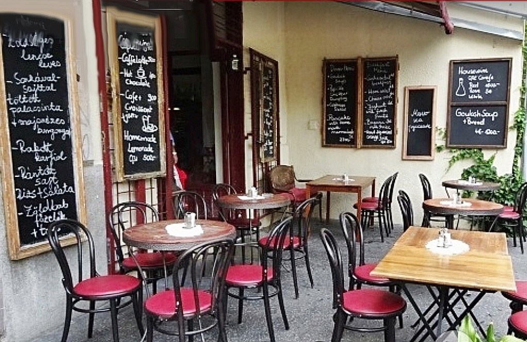
Klauzál Café & Restaurant – Klauzál u. 23, 1072 Budapest, Hungary
Spending time with friends in Budapest recently our plan was to try Hungarian food as much as possible. Our hotels were located in Lipótváros and Inner City districts, both near St. Stevens Cathedral. Most of the popular restaurants in the area were located on the large pedestrian malls or near Erzsébet tér and the Budapest Ferris Wheel. Getting tired of long waits and higher prices on Saturday evening we went exploring for neighborhood local restaurants and found reviews on Klauzál Café. After making reservations online we headed out for Klauzál U and the Klauzál Café & Restaurant.
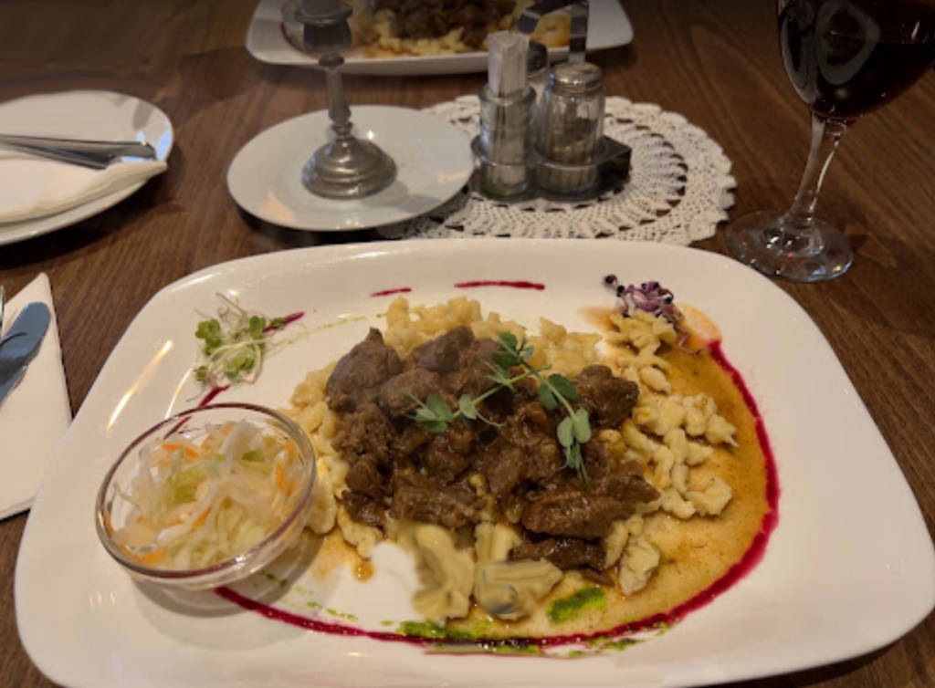
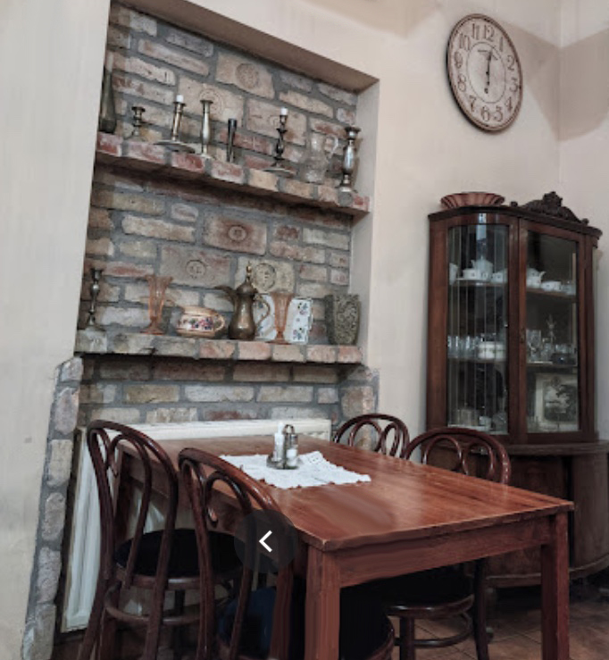
It turned out to be a simple, old-fashioned neighborhood restaurant preparing traditional homestyle Hungarian dishes. The staff was friendly and accommodating and they provided menus in English with great descriptions. The food was excellent with really large portions and with wine the check was much less than the previous nights meal. Out on the sidewalk there were a number of tables and in the main dining room, where we ate, a pianist added to the evenings experience.
We all agreed that this jewel was more than worth that few extra block walk.
The Blue Ridge Parkway is actually the most visited of all American National Parks. The Parkway extends 469 miles mostly along the crest of the Blue Ridge mountains through North Carolina and Virginia. It encompasses some of the oldest sites of both prehistoric and early European settlement in the country. Colonel Joseph Hyde Pratt first suggested the parkway in 1912, and it was begun during the administration of President Franklin D. Roosevelt. The project was a major contributor to helping the people of the area get through the Great Depression with significant work done using the Civilian Conservation Corp. Originally called the Appalachian Scenic Highway it wasn’t actually completely finished until 1987. The Blue Ridge Parkway contains almost 400 miles of hiking trails that aren’t just a natural wonderland but offer a remarkable window into the history of the first hundred years of this country as settlers moved west seeking land and opportunity and leaving their mark on these mountains.
Below you will find a directory of the hiking trails along the Parkway and a copy of The National Park Service map of the parkway in one complete downloadable HD pdf.
We hope you find our copy of the map and the trail guide useful.
Please Note: A Blue Ridge Parkway trip is measured by mile markers starting at MP 0 at the entrance in Virginia all the way to MP 469 at its end in Cherokee, North Carolina and the location of trails are marked by these mile posts (MP).
VIRGINIA TRAILS BY MILEPOST
Milepost 5.9 – Mountain Farm Trail (self-guiding, from Humpback Visitor Center to pioneer farmstead) Length: 0.25 Miles Skill Level: Easy
Milepost 6 – Appalachian Trail (Humpback Gap parking area to Humpback Mtn., elev. – 3650 feet) Length: 2 Miles Skill Level: Strenuous
Milepost 8.8 – Greenstone Trail (self-guiding; Greenstone geology formation; oak hickory forest) Length: 0.2 Miles Skill Level: Moderate
Milepost 17.6 – The Priest (view) Length: 0.1 Miles Skill Level: Easy
Milepost 18.5 – White Rock Falls Trail Connection Length: 2.9 Miles Skill Level: Moderate
Milepost 20 – White Rock Falls Trail (follows stream to small falls) Length: 0.9 Miles Skill Level: Moderate
Milepost 26.3 – Big Spy Mountain (view into Shenandoah Valley; good for stargazing) Length: 0.1 Miles Skill Level: Moderate
Milepost 34.4 – Yankee Horse (to logging RR exhibit & small waterfall) Length: 0.2 Miles Skill Level: Moderate
Milepost 38.8 – Boston Knob (leg stretcher) Length: 0.1 Miles Skill Level: Easy
Milepost 47.5 – Indian Gap (to Indian Rocks; good seasonal rhododendron display) Length: 0.3 Miles Skill Level: Moderate
Milepost 55.2 – White Oak Flats (leg stretcher) Length: 0.1 Miles Skill Level: Easy
Milepost 60.8 – Otter Creek Trail (begin at Otter Creek Campground) Length: 3.5 Miles Skill Level: Moderate
Milepost 63.1 – Otter Lake Trail (around Otter Lake) Length: 0.8 Miles Skill Level: Moderate
Milepost 63.6 – James River Trail (Self-guiding to canal locks) Length: 0.2 Miles Skill Level: Easy
Trail of Trees Trail (self-guiding to James River Overlook) Length: 0.5 Miles Skill Level: Moderate
Milepost 74.7 – Thunder Ridge Trail (leg stretcher loop to view of Arnold Valley) Length: 0.1 Miles Skill Level: Easy
Milepost 78.4 – Apple Orchard Falls Trail (Sunset Field Overlook to view of Apple Orchard Falls; National Recreation Trail) Length: 1.2 Miles Skill Level: Strenuous
Milepost 79.7 – Onion Mountain Loop Trail (leg stretcher through Appalachian deciduous forest with rhododendron display) Length: 0.1 Miles Skill Level: Easy
Milepost 83.1 – Fallingwater Cascades Trail (National Recreation Trail; loop to view of cascades) Length: 1.6 Miles Skill Level: Moderate
Milepost 83.5 – Flat Top Trail (leads to highest of three prominent peaks in area) Length: 4.4 Miles Skill Level: Moderate
Cross Rock Trail (spur off Flat Top Trail; unique geological features) Length: 0.1 Miles Skill Level: Moderate
Milepost 85.7 – Abbott Lake Trail (loop around Abbott Lake) Length: 1.0 Miles Skill Level: Easy
Milepost 85.9 – Elk Run Trail (self-guiding loop nature trail from Peaks of Otter Visitor Center) Length: 0.8 Miles Skill Level: Easy
Johnson Farm Loop Trail (loop to restored mountain farm) Length: 2.1 Miles Skill Level: Moderate
Harkening Hill Trail (elevation -3300 feet; begin at Peaks of Otter Visitor Center) Length: 3.3 Miles Skill Level: Moderate
Balance Rock (spur trail off Harkening Hill Trail; unique geological formations) Length: 0.1 Miles Skill Level: Moderate
Milepost 86 – Sharp Top Trail (from camp store to summit of Sharp Top Mtn.; elevation – 3875 feet; (360 degree panoramic view) Length: 1.5 Miles Skill Level: Strenuous
Milepost 91 – Appalachian Trail (VA 695 to Sharp Top Mtn. Overlook) Length: 1.9 Miles Skill Level: Moderate
Milepost 92.5 – Appalachian Trail (Sharp Top Mtn. Overlook to Harvey’s Knob Overlook) Length: 2.9 Miles Skill Level: Moderate
Milepost 95.4 – Appalachian Trail (Harvey’s Knob Overlook to Motvale Overlook) Length: 0.6 Miles Skill Level: Moderate
Milepost 95.9 – Appalachian Trail (Montvale Overlook to Taylor’s Mountain Overlook) Length: 1 Miles Skill Level: Moderate
Milepost 96 – Spec Mine Trail (USFS Trail begins near Montvale Overlook, to State Rt. 645 in Botetourt County) Length: 2.8 Miles Skill Level: Strenuous
Milepost 97 – Appalachian Trail (Taylor’s Mtn. Overlook to Blackhorse Gap) Length: 0.8 Miles Skill Level: Moderate
Milepost 167.1 – Rock Castle Gorge Trail (loop from campground along ridge over Rocky Knob and into gorge for 7-mile return to campground) Length: 10.8 Miles Skill Level: Strenuous
Hardwood Cove Self-Guiding Nature Trail (part of Rock Castle Loop) Length: 0.8 Miles Skill Level: Moderate
Milepost 169 – Black Ridge Trail (Rocky Knob Visitor Center to Black Ridge to Grassy Knoll and back to Visitor Center) Length: 3.1 Miles Skill Level: Moderate
Rocky Knob Picnic Loop Trail (leg stretcher around picnic area) Length: 1.0 Miles Skill Level: Easy
Milepost 176.2 – Mountain Industry Trail (Mabry Mill) Length: 0.5 Miles Skill Level: Easy
Milepost 179.2 – Round Meadow Creek Loop Trail (walk through a stream bottom forest) Length: 0.5 Miles Skill Level: Moderate
Milepost 213 – High Meadow Trail (leg stretcher) Length: 1.35 Miles Skill Level: Easy
Fisher Peak Loop Length: 2.25 Miles Skill Level: Moderate
Milepost 382 – Mountain-to-Sea Trail/MTS Trail (from Folk Art Center to Milepost 365, spring wildflowers and views, parallels parkway, many accesses) Length: 7.5 Miles Skill Level: Moderate
Beer, History, The Czech Republic, Prague And Bohemia
There are dozens of funny T-shirts and bumper stickers claiming that you should drink beer rather than water but it seems in Prague they take the notion seriously. In addition to a centuries old tradition there is a very practical reason to do so in the Czech Republic – beer is almost as cheap as water and in some situations it’s cheaper. Often when examining a menu we discovered that beer is half the price of a Coke.
Czechs are serious beer drinkers with a regional tradition that goes back five centuries. The most famous beer name in the world is Budweiser and in the Czech Republic it’s from the Budvar brewery in České Budějovice or the Budweis area of Bohemia. The brewery was founded by Czechs in 1895 based on the tradition of brewing beer in České Budějovice and that dates back to the 13th century, when monks brewed beer in local monasteries.
The worlds two Budweiser beers actually have a singular origin. The name Budweiser is German, meaning “of Budweis”. In 1876, German-born Adolphus Busch and his friend Carl Conrad developed a “Bohemian-style” lager in the United States that was based on a beer discovered on a trip to Bohemia. They started producing their Budweiser style beer in their brewery in St. Louis, Missouri. Ever since the two Budweiser brands have been fighting in courts all around the world.
The most popular beer in Prague though is Pilsner Urquell. Although it is usually the least expensive it is also a highly rated beer. Urquell beer is sometimes thought to be Polish, but it’s exclusively brewed in Plzeň, a Czech brewery. For a while, it was brewed in Poland and Russia under license but the Czechs now own exclusive brewing rights. It’s also known as the world’s first pilsner beer, invented by Josef Groll in 1842.
Prague’s famous beer pubs
The oldest beer pub in Prague is U Fleků that actually opened in its current location in 1499 and has welcomed countless generations of Czechs along with foreigners for over 500 years. This brewery and its enormous beer hall has space for up to 700 customers in eight large rooms filled with long tables. Its craft beer, which has a high alcohol content (13%), and it’s the only variety they serve. This historic establishment also offers some of the best traditional Czech food in Prague.
U Fleků
Another good choice is U Supa, the House of the Vulture, which like U Fleků, has been in business since the fifteenth century. Dark beers are not that common in Prague but unlike U Fleků, U Sup does offer a semi-dark lager that is very popular with locals. A centerpiece in the U Sup brewery is an unusual glass brewing tank, one of the few in the world. From Spring through Fall patrons enjoy the outdoor patios and garden with a range of beers and light fare.
Additional Pubs & Beer Halls
U Glaubicu – Located in the medieval quarter of Prague near the Charles Bridge inside a 700-year-old cellar. A historic beer hall offering reasonably priced pints, a great atmosphere, and a remarkable goulash.
U Medvidků – Also established more than 500 years ago, U Medvidku it offers a popular bittersweet dark lager with an 11.8% alcohol strength. Service is on long communal tables, offering classic Czech fare.
U Tří Růží – Located near the Old Town Square, it is a restored traditional Czech brewery, dating back to 1405. Popular with locals it provides a wide selection of beers that includes a famous Monastic beer.
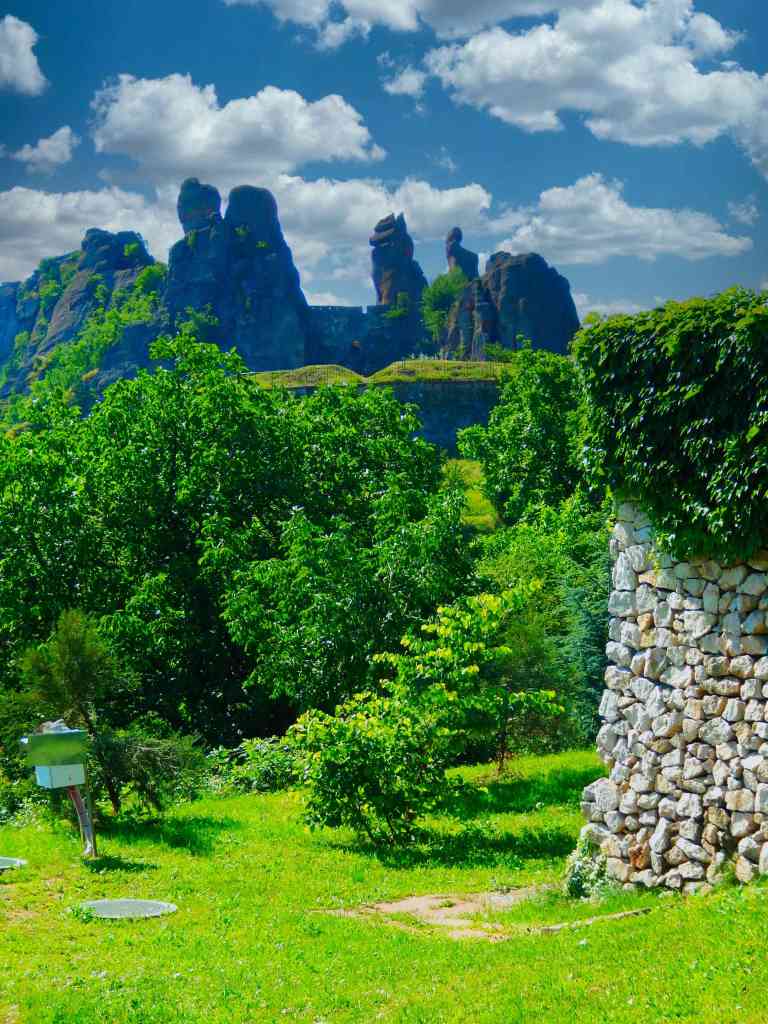
About 230 million years ago, tectonic platres were folding to create the Balkan Mountains and elevating the region of Belogradchik. Later the region became the floor of a shallow sea littered with enormous quantities of gravel, sand and clay. The sediment piled up and gradually became thicker layers of this conglomeration with sandstone mixed in. Pushed up during the formation of the Balkan Mountains these massive rocks were worked on by erosion that left behind the odd formations of the Belogradchik Rocks.
Beginning with the Roman Legions a number of armies found these rock formations the perfect defensive backdrop for fortifications.
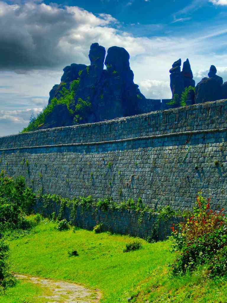
The Belogradchik Fortress
The Belogradchik Fortress is an ancient fortress situated on the north slopes of the Balkan Mountains, near the northwestern Bulgarian town of Belogradchik and is the town’s primary cultural and historical attraction. The fortress encompasses the Belogradchik Rocks and is one of the best-preserved strongholds in Bulgaria. The complex is a cultural and natural monument of Bulgaria.
The fortress’s walls are over 6 feet thick at the foundation and stand up to forty feet in height. It includes three separate protected yards connected with each other through gates. The fortress has a total area of 110,000 square feet. The Belogradchik Fortress was reconstructed to later become a proclaimed cultural monument. It is managed by the local historical museum authority.
The fortress and surrounding area have been defended by and added to bys the Romans in the first century, the Ottoman-Turks and several Bulgarian armies.
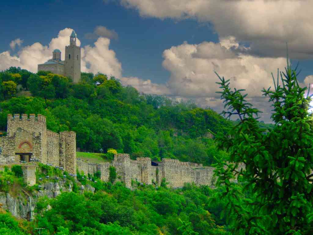
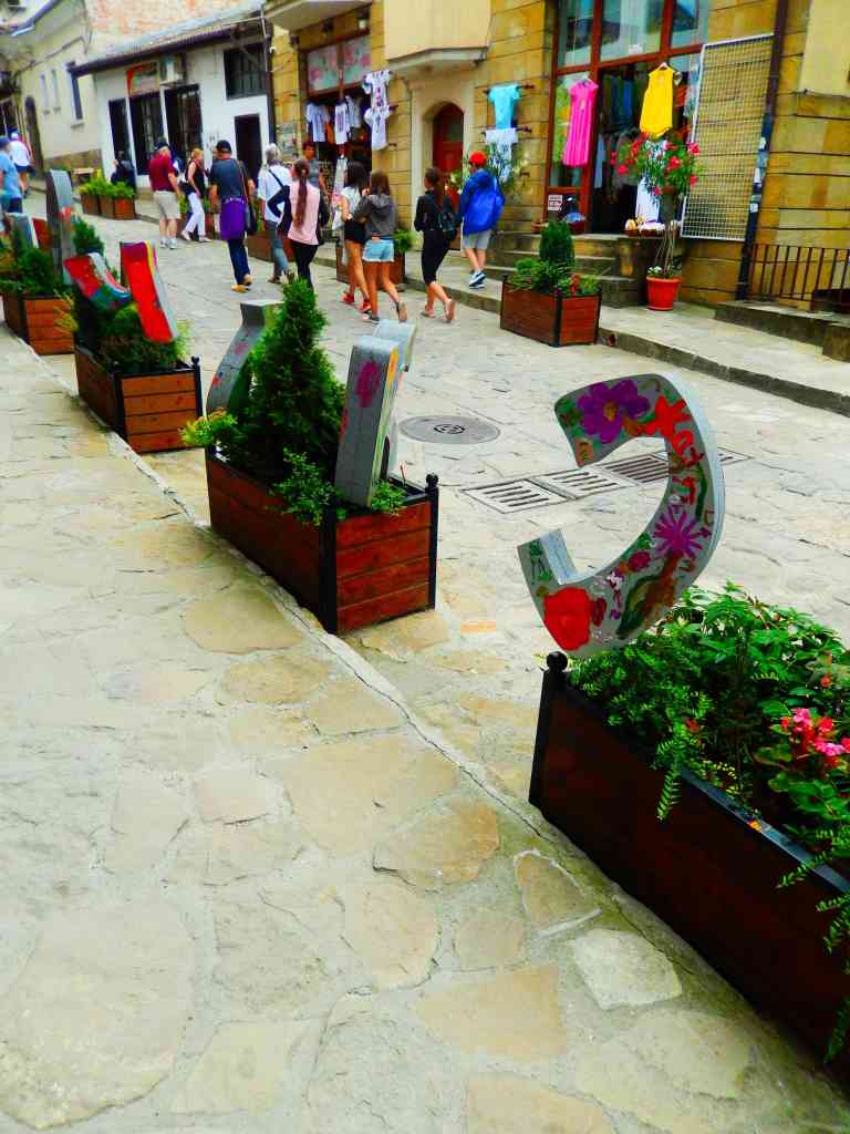
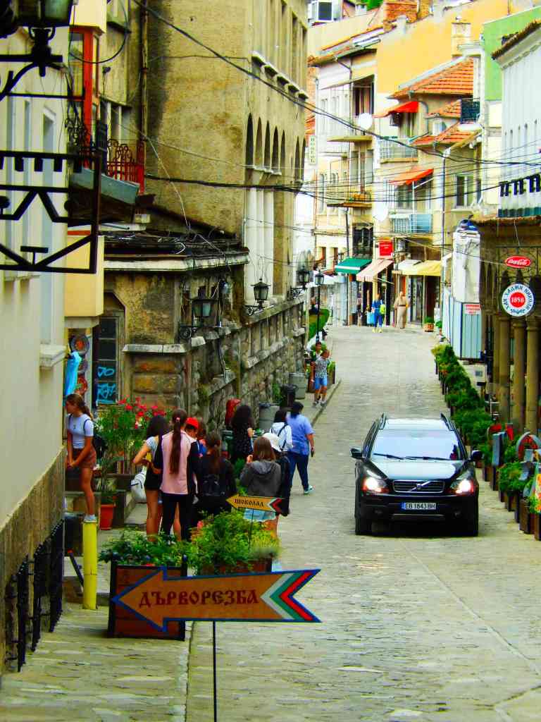
Veliko Tarnovo
Veliko Tarnovo is in north central Bulgaria and is often referred to as the “City of the Tsars”. It is located on the Yantra River and is best known as the historical capital of the Second Bulgarian Empire. The old part of the town is situated on three hills, upon which there are the palaces of the Bulgarian emperors and the Patriarchate, the Patriarchal Cathedral, and a number of administrative buildings surrounded by thick walls.
With the establishment of the Second Bulgarian Empire with its capital in Veliko Tarnovo, the fortress became the most important one in Bulgaria, often compared with Rome and Constantinople in magnificence. The fortress and castle complex has three entrances. The main entrance is located in the easternmost side of the hill. The castle is located in the centre, surrounded by an internal stone wall, two battle towers and two entrances – north and south. It consists of a throne hall, castle church and the king’s chamber. The restoration of the fortress Tsarevets began in 1930 and was completed in 1981 in honour of the 1300 anniversary of the Bulgarian state. Kings Petar, Asen, Kaloyan and Ivan Asen the second lived there. The castle was the biggest one in the 14th century.
Trapezitsa is known for its many churches and as the former main residence of the nobility. During the Middle Ages, the town was among the main European centers of culture and gave its name to the architecture of the Tarnovo Artistic School, painting and literature.