The Bucharest Romania the Government Palace is notable for being one of the largest office buildings in the world, with a height of 242 feet and an area of over three and a quarter millio square feet, making it the second-largest building, after the Pentagon.
The Government Palace in Bucharest is a significant architectural landmark and the seat of the Romanian government . Built between 1937 and 1944, the palace showcases a blend of modernist and traditional styles, reflecting Romania’s historical and cultural context . The building is named after the Victoria Square where it is located and has undergone several renovations to accommodate the needs of the government
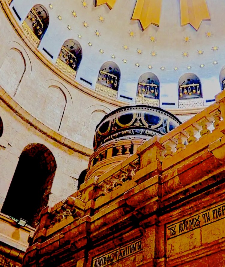
Images From Around Bucharest
The palace not only serves as the office for the Prime Minister but also houses various ministries . Its strategic location in Bucharest makes it a central point for political activities and public demonstrations . Additionally, the Government Palace is notable for its extensive gardens and surrounding architecture, contributing to the city’s aesthetic appeal . Overall, the Government Palace stands as a symbol of Romania’s governance and architectural heritage.
This is the current telling the story but in truth the building has a very dark past. Nicolae Ceaușescu, the Romanian dictator, initiated the construction of the Palace of the Parliament to be a symbol of his vision and power. This ambitious project aimed to reshape the urban landscape and reflect the nature of a powerful and modern Romania. The construction of this colossal building was part of Ceaușescu’s broader agenda to showcase the might of his communist regime, but it came at a significant cost to the Romanian people and their heritage, as many neighborhoods were demolished to make way for this project while the construction cost brought the country to the edge of bankruptcy. Labor was conscripted from all over Romania and high taxes were levied. Today, the Palace stands as a controversial symbol of Ceaușescu’s legacy, representing both architectural ambition and the excesses of his authoritarian rule.
Planning A Cruise? Start With The Intentional Travelers Port Guides
Some More Recent Posts From The Intentional Travelers You Might Find Interesting:
It was on June 6th, 1944 when the largest military invasion in history landed on the beaches of Normand, France. The landing against German controlled France involved 73,000 American troops and 83,115 British and Canadian troops. The massive naval armada consisted of 6,939 vessels and 11,590 Allied aircraft. Allied troops killed on the beaches during the Normandy invasion included 2,501 Americans and 1,913 Allied soldiers from other nations. Additionally, over 5,000 were wounded. During the Battle of Normandy, which followed, a total of 73,000 Allied killed and 153,000 were wounded.
Should your travel plans bring you to the western coast of France or if you’re visiting Paris you should consider adding a trip to the beaches of Normandy to your itinerary. There are a number of tours available from Paris to Normandy and many can be booked through hotels. Another option is to rent a car and spend a couple of days in Normandy on your own. The countryside is beautiful and the French people here are incredible welcoming.
There are also a number of other cemeteries in the area honoring those that gave their lives from the British Commonwealth and other countries.
Shell Craters at Pointe du Hoc
France, as a travel destination, doesn’t have the best reputation for the friendliness of its people. That is not the case in Normandy as you’ll discover most people friendly, talkative and still eager to express gratitude for the American and allied sacrifices on D-Day. Be sure and spend some time at Pointe du Hoc where you’re likely to encounter French school tours visiting as there is serious effort to keep that moment in history alive for successive French generations.
Normandy American Cemetery
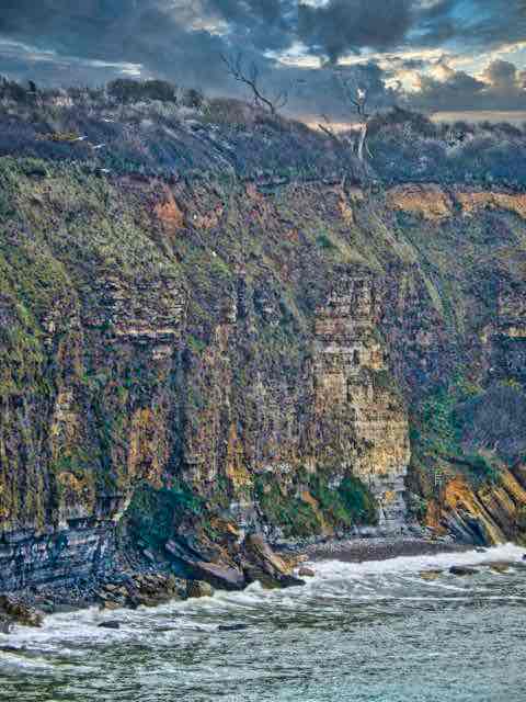
90 Foot Cliffs at Pointe du Hoc
Even today, visiting the quiet beaches and the cliffs of Pointe du Hoc, the enormity of that day in 1944 still has an emotional impact. It is overwhelming to walk thru the Normandy American Cemetery with the almost 10,000 head stones standing in row after row, like the fallen soldiers they mark. Walking in the cemetery it is hard to process the number of lives lost in only a couple of days. The land beneath the cemetery is actually considered U.S. soil and the cemetery is maintained and operated by Americans.
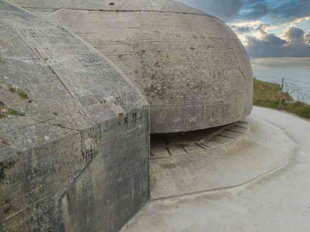
Along the coast and especially at Pointe du Hoc you can still see the craters gouged out by the Allied naval gun barrages on June 6th along with those immense concrete German defensive bunkers dotting the landscape. At Pointe du Hoc it is difficult to look down those shear ninety-foot cliffs and believe that 225 American Rangers climbed them in bad weather while under attack by German gunfire from above.
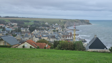
Save some time for lunch at the village of Arromanches which sits in the middle of the invasion beaches or taking a drive through the beautiful French Normandy countryside. There are farms and villages dotted with yellow canola fields, bordered by oak trees thick with clusters of mistletoe. All-in-all an unforgettable experience.
Our port guides provide a quick overview of local attractions, cruise port facilities, money, local transportation and more designed to help you plan your day in port.
Exploring Those Caribbean Ports Of Call
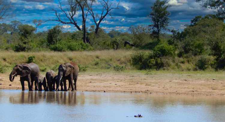
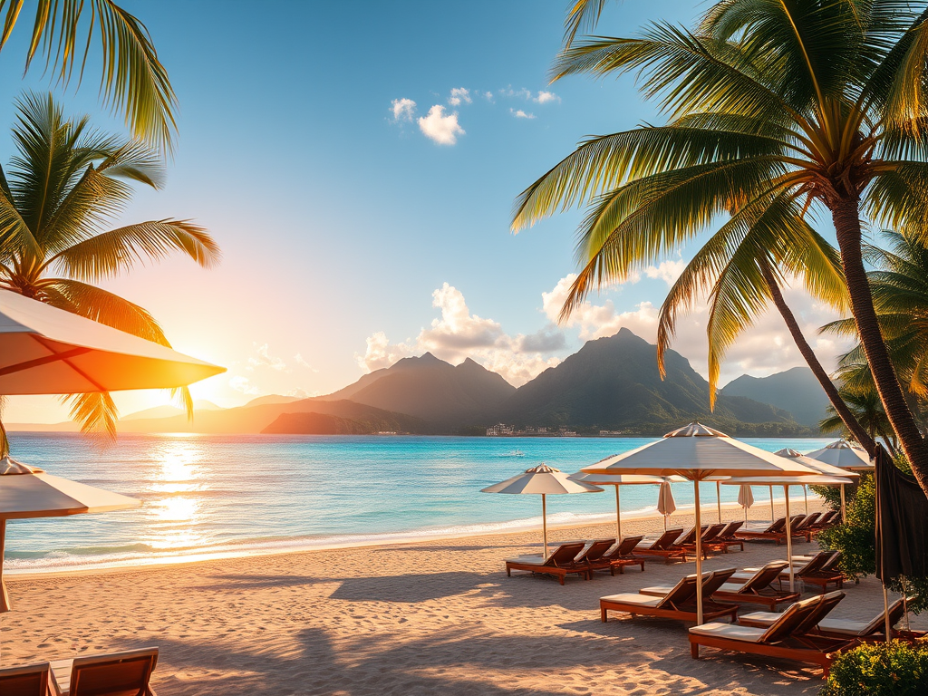
Amazing islands and fun adventures are awaiting you along with beautiful beaches, tropical Sun and crystal clear water. Islands with diverse cultures and steeped in history wherever you go, you’re going to love cruising the Caribbean.
SITESUBSCRIBERS PLEASE NOTE: If you’re viewing this post in an email, please take a moment to click the Read On Blog text located in the upper right of this page.That is the only way to record your visit in our sites traffic data.
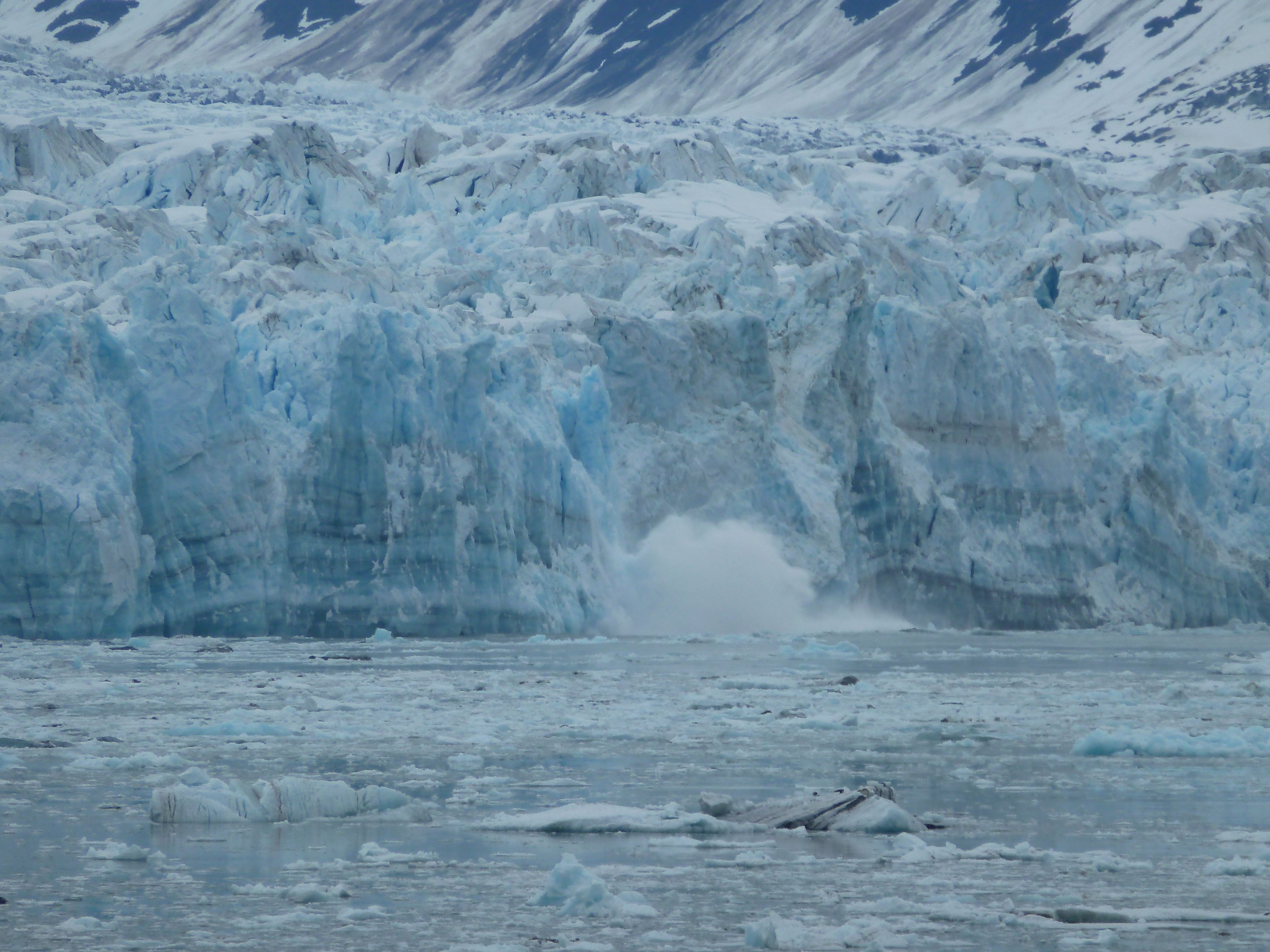
Hubbard glacier is one of the world’s largest glaciers terminating at the sea. A popular destination for cruise ships as large sections of the glacier calve massive sections of ice into the bay. A really unique experience not to be missed.
If you’re planning an Alaska cruise be sure and check the itineraries to confirm that Hubbard Glacier is included as only a limited number of cruise ships are permitted in each year,
Hubbard Glacier
You’ll find a great deal of worthwhile and interesting travel information jn The Intentional Travelers, and the best way to find what you’re looking for is to SEARCH for it here…
Some More Recent Posts From The Intentional Travelers You Might Find Interesting:
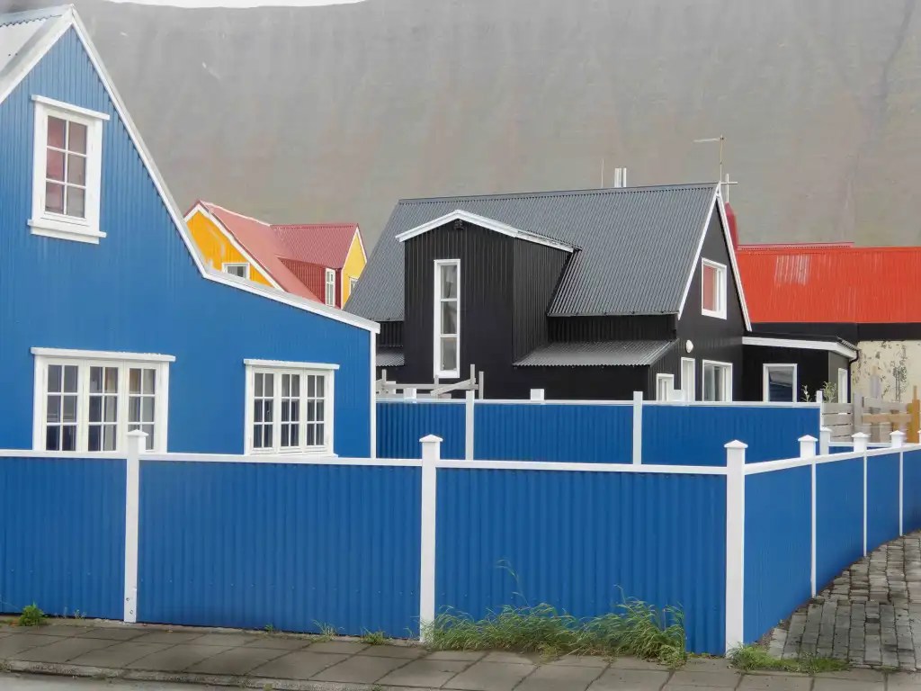
Ísafjörður, the largest town in Iceland’s Westfjords region, is renowned for its stunning natural landscapes and vibrant history. This charming settlement offers a variety of attractions, making it an appealing destination for travelers seeking both adventure and relaxation. Visitors can explore the unique local culture, enjoy outdoor activities, and appreciate the breathtaking scenery that characterizes the area. For those interested in luxury travel, Ísafjörður provides tailored experiences to help plan an unforgettable vacation, showcasing the beauty and heritage of this remarkable location. Overall, Ísafjörður stands out as a captivating spot for tourists looking to immerse themselves in Icelandic culture and nature.
Where Your Ship Docks
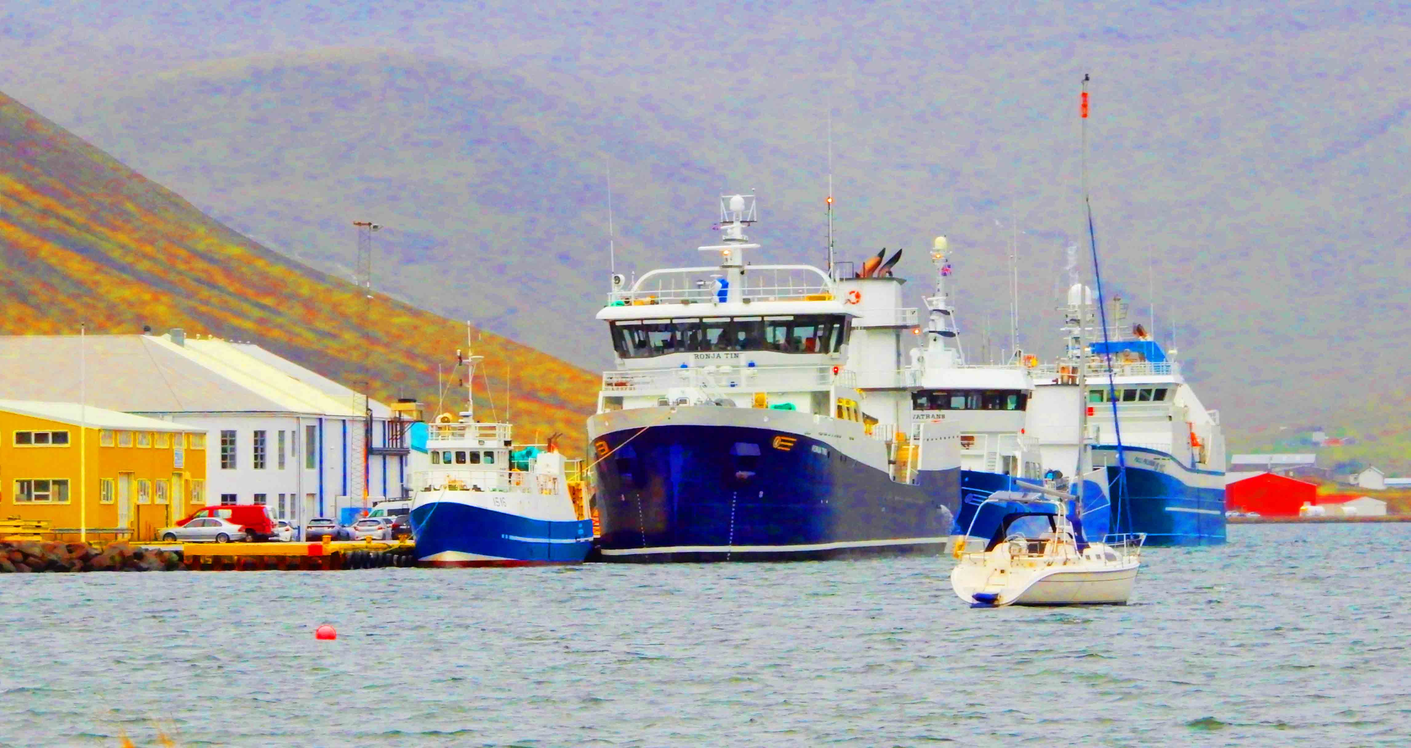
Ísafjörður has a large dock used by cruise ships only about a third of a mile from the town center. There are no public facilities at the pier but when cruise ships visit there is a town information office right at the port.
Wheelchair Accessibility Disembarking
This port has a largr cruise ship pier but the ease of disembarking varies by the individual ships gangway designs. The Ísafjörður pier disembarks only a short distance from downtown. For passengers using wheelchairs there can be a moderate ramp incline disembarking to deal with. has a well developed wheelchair friendly infrastructure. Ísafjörður is flat with few inclines. Intersection crosswalks have few issues with curbs or other wheelchair obstacles.
Transportation
In Ísafjörður there is a taxi service and limited buses for transportation. The main taxi operator is Leigubílar Ísafirði, which can be booked in advance (+354 666 6950 and stigurberg@gmail.com) There’s also a bus service between the airport and Ísafjörður town, connecting with flights. Additionally, buses operate to other nearby towns like Flateyri, Þingeyri, and Suðureyri.
Currency
Iceland uses the Icelandic Kronur and $1.00 US Dollar = 127.08859 Icelandic Kronur. There are ATMs located in most cities and all major credit cards are welcome.
Tipping
Tipping is generally not expected in Iceland. Service charges are often included in the bill, and workers are typically paid fair wages, so they don’t rely on tips. However, if you feel you’ve received exceptional service, you can tip 10% or round up the bill. Tipping is especially appreciated for tours, especially those longer than 8 hours, and with free tours.
Attractions
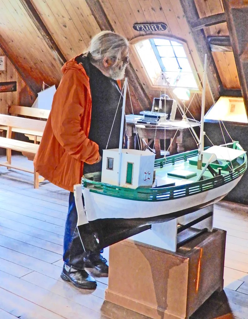
The old town has wooden houses with corrugated tin roofs built by fishing merchants in the 18th and 19th centuries. The Westfjords Heritage Museum has exhibits on the town’s maritime history, including a collection of old fishing boats. The old hospital, now a cultural center, contains archives and photography exhibits.
Tours are usually available out to Dynjandi Waterfall a famous waterfall near Ísafjörður also known as Fjallfoss, and is the biggest attraction in the Westfjords region. Dynjandi is a series of seven cascades, with the main fall being 300 feet high and 90 feet wide at the top. It’s located in Arnarfjörður fjord, about 65 miles from Ísafjörður.
Ísafjörður’s history is a tale of Norse settlement, burgeoning trade, and a shift toward tourism. The area, specifically the Skutulsfjörður fjord, was first settled in the 9th century, according to the Book of Settlement. It grew rapidly during the 16th century as a trading post and fishing center, thanks to its natural harbor. The town gained municipal status in 1786. While known for its fishing history, economic shifts due to declining fish stocks and the rise of Reykjavík’s fisheries led to a new focus on tourism, solidifying Ísafjörður’s role as the capital and tourism hub of the Westfjords.
Often ignored and even discounted, the Polynesian Empire was one of the largest geopolitical regions on Earth. Established by seafaring navigators thousands of years ago having a broad range of Polynesian peoples moving freely between thousands of Pacific islands. Their migration into the Pacific Ocean began as early as 50,000 years ago, thousands of years before humans populated the American continents. Originating with peoples from Southeast Asia and Korea, they moved out to sea settling lands east of a line that runs between Borneo and Sulawesi, that included Australia. 30,000 years ago, they had reached New Zealand, New Guinea, the Bismarck Archipelago, and the northern Solomon Islands. By 3,000 years ago, these seafaring people began expanding into the furthest regions of the Pacific, settling islands like Vanuatu, Fiji, Samoa, and Tonga, north to Tahiti and Hawaii and the far eastern extent of the Polynesian Pacific Ocean perhaps even included the southwest coast of South America.
The Polynesian islanders didn’t experience any major population and cultural changes until just 500 years ago when the European explorers, traders and colonialists appeared in the Pacific. Over just a couple of hundred years colonial outposts, plantations and mining operations introduced forced labor and slavery to the region. Many islanders were relocated to places like Australian sugar plantations, while hundreds of thousands of Indian laborers were relocated onto a number of South Pacific islands to supplement local populations.
In addition to the designation of Polynesia, the Pacific region is divided into two additional cultural, geological and political regions named Micronesia and Melanesia.
Micronesia is a region in the western Pacific Ocean that comprises thousands of small islands, divided into several countries and territories, including the Federated States of Micronesia, Palau, the Marshall Islands, and Guam. These islands are known for their rich cultural heritage, diverse ecosystems, and strategic geopolitical importance.
Melanesia is a subregion , consisting of several islands located in the southwestern Pacific Ocean. It includes countries such as Papua New Guinea, Solomon Islands, Vanuatu, and Fiji. The region is known for its rich cultural diversity, with over 1,000 distinct languages spoken across the islands, making it one of the most linguistically diverse areas in the world. Geographically, Melanesia is characterized by its mountainous terrain and tropical rainforests.
Modern day Polynesia’s mixed racial populations are a result of those colonial processes, along with the upheavals in the region that resulted from World War Two. Still the islands of the Pacific are popularly viewed as paradise thanks to books like Michener’s Tales of the Pacific, Hollywood movies and television shows like Adventures in Paradise.
Cruising The South Pacific
A number of cruise ships regularly offer itineraries that cross the Pacific, often visiting Hawaii, Tahiti and the South Pacific islands. Many are repositioning cruises going or returning from Australia to Hawaii and repositioning from Alaska to Hawaii.
Hawaiian Islands – the only Polynesian islands north of the Equator theycomprise an archipelago of eight major volcanic islands, including Kauaʻi, Oʻahu, Molokaʻi, Lānaʻi, Maui, and the island of Hawaiʻi itself, which is geologically the youngest as well as the largest among them.Each island showcases a unique character with their own unique attractions; Oʻahu is famous for its legendary surf spots, while Kauaʻi is celebrated for its breathtaking mountainous landscapes with the island of Hawaiʻi featuring massive and frequently erupting volcanos. After Japan the Hawaiian archipelago is the most populated and developed in the entire Pacific Ocean.
The Galapagos Islands – an archipelago located in the Eastern Pacific, are renowned for their unique biodiversity and volcanic origins. This group consists of 13 major islands, along with several smaller islands and numerous islets, covering a vast area with sizes ranging from 5.4 to 1,771 square miles. The islands are situated about 740 miles from the mainland of Ecuador and near the equator, making them a unique ecological wonder.
New Caledonia – a French overseas territory located in the southwest Pacific Ocean, known for its unique blend of Melanesian and French cultures. The territory comprises several islands, with the largest being Grande Terre, where the capital city, Nouméa, is situated. New Caledonia is recognized for its stunning biodiversity and extensive coral reefs, which are part of the UNESCO World Heritage-listed lagoon system.
The Samoan Islands – a beautiful archipelago located in the central South Pacific, covering an area of approximately 1,170 sq miles. This group of islands is part of Polynesia and consists of two main territories: Samoa and American Samoa. The islands are situated about 1,600 miles northeast of New Zealand, making them a significant geographical feature in the region.
Fiji – an archipelago located in the South Pacific Ocean, known for its stunning natural beauty and unique culture. Comprising over 300 islands, the country features diverse landscapes, including mountains, lush rainforests, coral reefs, and beaches, making it a popular destination for tourists. The capital city, Suva, is situated on the largest island, Viti Levu, and serves as the political and economic center of the archipelago nation.
The Society Islands – a stunning archipelago located in the South Pacific Ocean, are a part of French Polynesia. Comprising 14 islands, the most notable among them being Tahiti, Moorea, and Bora Bora, each renowned for their breathtaking landscapes, coral reefs and vibrant cultures.
Vanuatu – a South Pacific Ocean nation made up of roughly 80 islands that stretch for 900 miles. The islands are famous for scuba diving coral reefs, its underwater caverns and wrecks of WWII-era ships. Harborside Port Vila, the nation’s capital and economic center, is on the island of Efate. The city is home to the Vanuatu National Museum, which explores the nation’s Melanesian history and culture.
Tonga – an archipelago known for its stunning natural beauty and rich cultural heritage. Comprising over 170 islands, the country is divided into three main groups: Tongatapu, Haʻapai, and Vavaʻu. The capital city, Nukuʻalofa, is situated on Tongatapu. Tonga’s unique culture is heavily influenced by its Polynesian roots, which are reflected in traditional music, dance, and art. The Tongan language is widely spoken, and the country maintains a strong sense of community and family values.
Recent Posts From The Intentional Travelers You Might Find Interesting: