As we travel, one of our favorite things to do is hike. From wilderness trails to hiking through urban landscapes it is a fantastic way to get exercise. While we explore the world at our pace and from ground level we get the opportunity to see a lot more. While I’m not sure that either of us is up anymore to a forced march it isn’t unusual for us to still do three to six miles on a day hike. Here we offer a selection of some of our favorite finds.
Hiking In Haleakala National Park Hawaii
Hiking back country trails near Old Faithful
One of America’s Greatest Walking CitiesThere’s a lot more to explore in Florida than beachesOne of America’s great hiking National Parks
A complete listingTrails at Linville Falls Wilderness Area
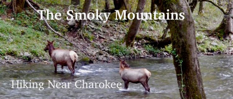
Several hikes near Cherokee, NCA number of great hikes near Peaks of Otter
Great day hikes in Western North Carolina
Amicalola Falls State Park In Georgia
Hiking At Amicalola Falls State Park in the North Georgia mountains.
There isn’t a better urban hike anywhere than in Florence Italy
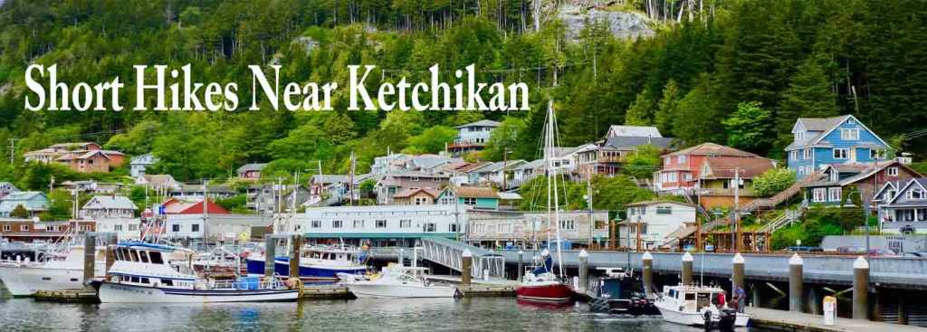
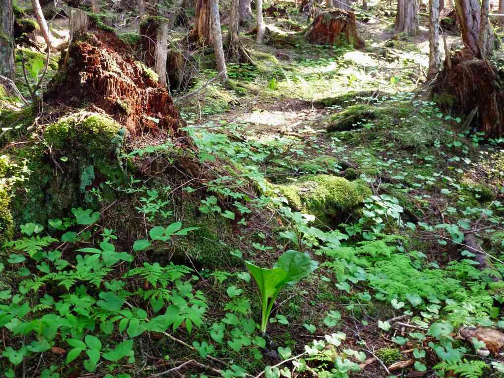
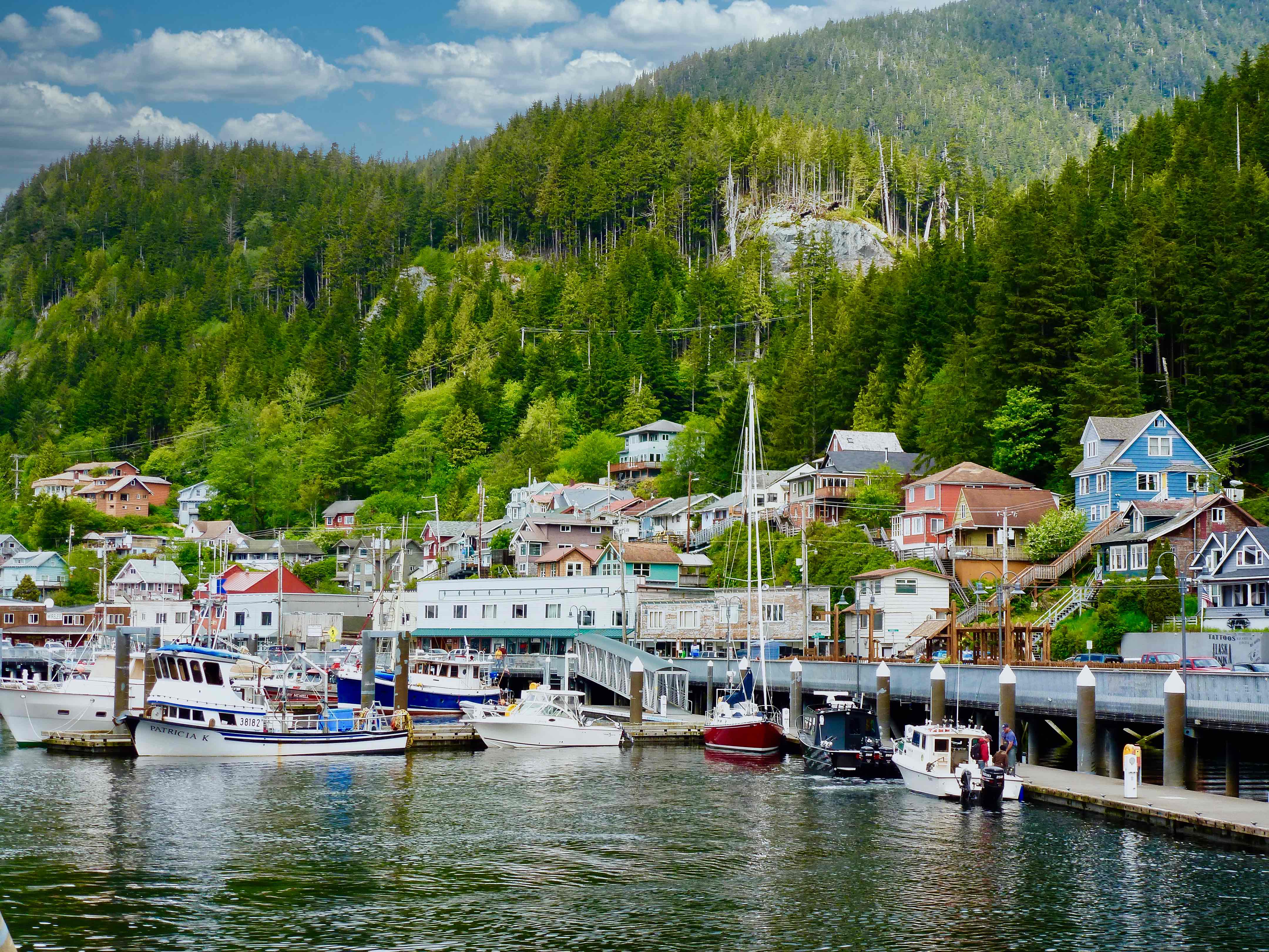
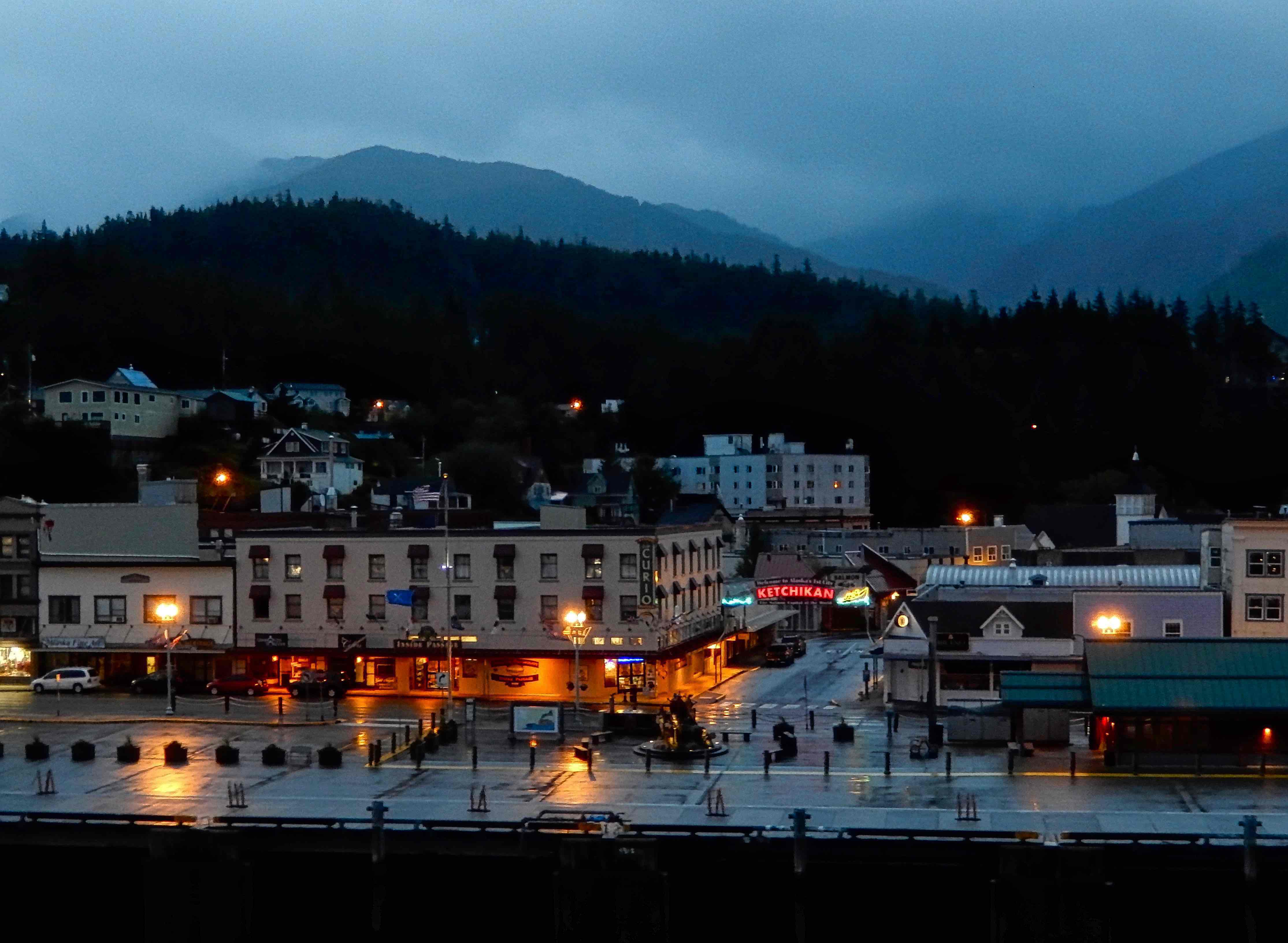
Great hikes in the Tongass near Ketchikan and Skagway
Trails for casual walks and long hikes at Mendenhall Glacier Alaska
A great Rails to Trails project from Hattiesburg to Prentiss The Longleaf Trace
A walkway into Charlotte Amalie, U.S. Virgin Islands
A beautiful beach walk in Barbados
Surprising ancient discoveries in Utah’s Nine Mile Canyon.
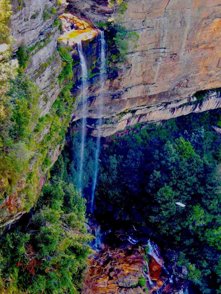
Australia’s Blue Mountains
Trails in Australia’s Blue Mountains. An easy day trip from Sydney.
Tierra del Fuego
Hikes literally at the end of the Earth, at the tip of Argentina in Tierra del Fuego National Park.
Pine Mountain Georgia
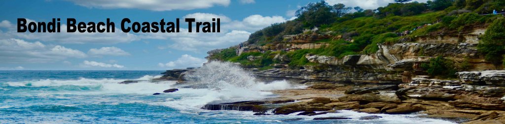
The Pine Mountain trails in Southwest Georgia feature 100 miles of great hiking trails on the mountain along with the trails in Callaway Gardens Resort.The Coastal Trail In Bondi Beach Australia
Oahu’s North Shore
Oahu’s North Shore and Waimea Waterfall, an easy hike/walk along a paved trail through some beautiful tropical botanical gardens.
One of the Natural Wonders Of The World
Iguazu Falls,Argentina is the worlds largest waterfall complex with miles of hiking trails.
Northern Irelands Giants Causeway is an incredible natural wonder. A place of myth and remarkable geology. Featuring thousands of spectacular basalt columns formed through the rapid cooling of lava from an underwater volcano.
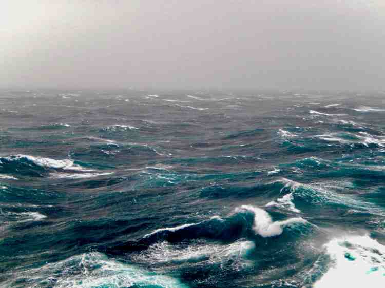
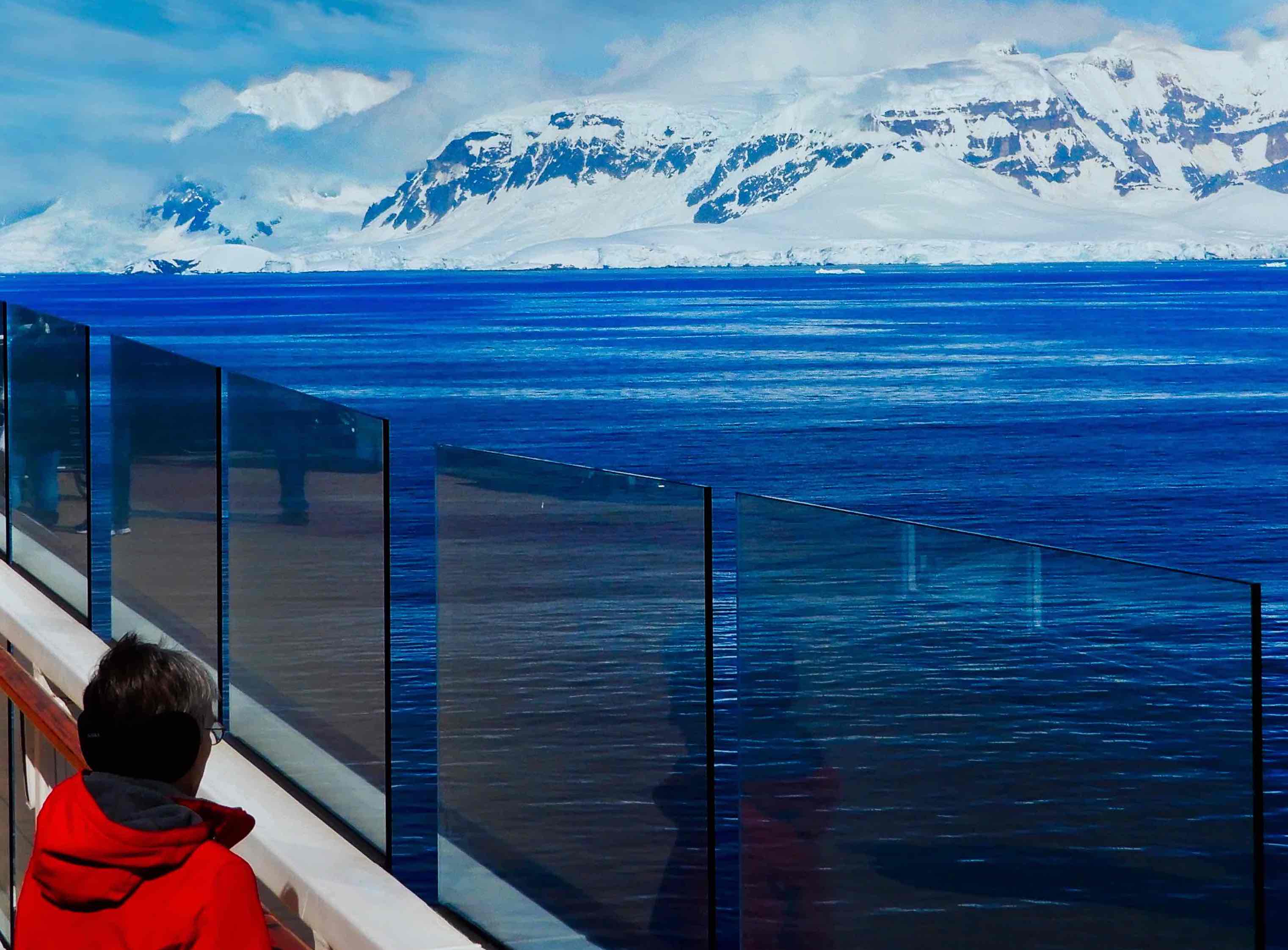
Just within the last year we’ve come across a few articles discussing heavy seas in Drake Passage and the problems encountered by cruise ships under way to Antarctica. It’s not really clear what the message being sent is attempting to convey but we’re left with the likely message being that some regions are just too dangerous for recreational cruising.
Is the Drake Passage crossings really too dangerous for cruise itineraries? Perhaps they are attempting to warn potential passengers that this is a cruise that shouldn’t be taken. Whatever the intent of the reporting it is misplaced.
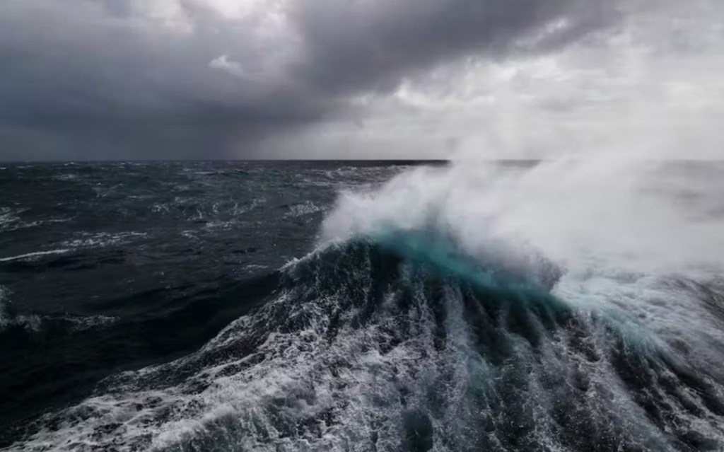
It is true that the currents circling Antarctica make for one of the world’s most treacherous cruise itineraries. The Drake Passage is the gap between the tip of South America and Antarctica .Generally the currents circling Antarctica meets very little resistance from landmass until they are squeezed into the Drake Passage. The waves can often top 40 feet giving it the reputation as “the most powerful convergence of seas” on Earth.
The real question that needs to be answered is how serious can the waves be, how dangerous is the crossing and is the trip really worth the risks?
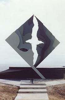
The memorial to lost mariners stands above the Drake Passage near to the End of the World lighthouse.
How Dangerous Is Cruising?
First, everyone should understand that the world is unpredictable and at times a dangerous place. Getting into your car or even staying at home come with a level of risk. Last year about 32,000 people died in automobile accidents in the United States alone. Another 9,500 people died in the their bathrooms (slip and fall in the shower or bath being the most common). Everyone needs to accept the fact that life does not come with any guarantees.
Recently, there have been about 200 annual deaths involving cruise ships at sea, If that seems bad consider that that’s out of 30,000,000 yearly passengers. That equates to 1 death in 150,000 passengers. To put that into perspective, consider a large majority (72% to 77%) of onboard cruise deaths are actually from natural causes. We people of that certain age love to cruise. Over the past five years an average of 244 people have died in airplane accidents per year and an average 25,000 Americans per year are taken to ER’s for amusement park accidents. Airplanes experience turbulence, road trips encounter dangerous weather, people have accidents in their homes and cruise ships at sea have fires break out, have collisions with piers and yes ships experience occasional heavy seas can even be hit by rogue waves.
In our lives we are often faced with serious decisions regarding safety and how much risk we are willing to accept and weighed against the potential benefit. Each of these choices is a personal one and everyone comes with their own set of things that make them nervous, including heights, closed spaces, air travel, disease or being at sea. The biggest choice becomes how hard do we want to overcome a fear in order to have a desired experience? Some people have serious issues with seasickness or have a real fear of the ocean to the point that they won’t take any cruise. Others are nervous but occasionally take a cruise. While it seems that the farther you cruise from home, weather conditions, political unrest and more have impact in you deciding to cruise. It’s all risk versus reward.
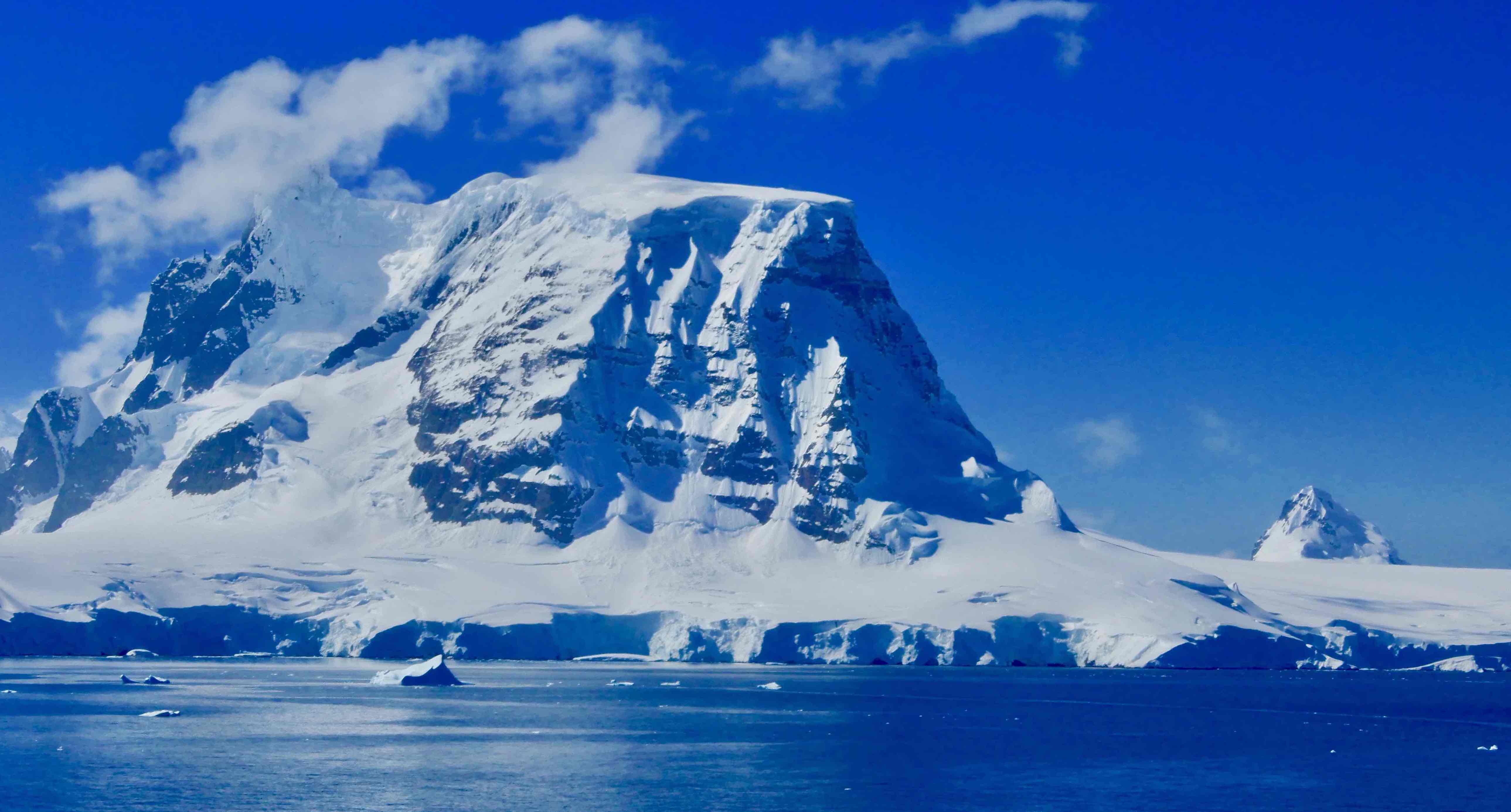
Is Antarctica Worth The Risk Of High Seas?
On average there are about twenty four, large cruise ship itineraries into Antarctica each year with a much larger number of much smaller “expedition” ship itineraries. So even the opportunity to go is very limited. Our short answer is a resounding yes! While there is actually a chance of just gliding across a calm Drake Passage, the likely situation you’ll encounter is twenty to thirty foot seas. The crossing normally takes eight to twelve hours and most modern cruise ships are actually in very little danger. You may experience a period where the best policy is to sit or lay down for awhile but don’t let the risk prevent experiencing a day or two sailing through the waters of the frozen continent. Heck, bragging rights alone are worth taking the trip.
We have taken over sixty cruises on every one of the world’s major bodies of water, We have experienced heavy seas perhaps a dozen times and never have they caused us to give up cruising. By far the one cruise that sits at the top of our list is that cruise to Antarctica – period, full stop.
“A ship in harbor is safe, but that’s not what ships are built for.”
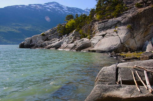
The Tongass (Tongas) National Forest in Alaska is the largest U.S. National Forest with 16.7 million acres (26,100 sq mi). Most of its area is temperate rain forest and remote from population centers. The Tongass, which is managed by the United States Forest Service, encompasses islands of the Alexander Archipelago, fjords and glaciers, and peaks of the Alaska Coast Mountains. Alaska cities and towns with access to the Tongass include Craig, Hoonah, Juneau, Ketchikan, Petersburg, Skagway, Sitka, Thorne Bay, Wrangell, and Yakutat and all have United States Forest Service Ranger Offices except Skagway which provides a National Park Service Visitors Center.
Tongass Forest Hiking Trails Near Skagway Alaska
If you are cruising Alaska and making a port call on Skagway, there are a number of good hiking trails to take advantage of with great scenery to explore only short distances from the cruise dock.
The Chilkoot Trail is the most well know Skagway trail following the gold miners route over the mountains into the Klondike gold fields. Currently (Early 2023) the trail is closed, having been washed out by floods and may take over a year to restore.
Yakutania Point Distance: 1 – 2 miles round trip, Rated Easy. (This trail connects to the Smuggler’s Cove trail.) To get to the trailhead walk west along 1st Ave., turn left at Main St. and travel south two blocks. Follow the sidewalk west past the airport terminal. Start by crossing the Skagway River footbridge and turn left, following the clearly marked trail into the forest and past a number of exercise stations. After exercise station #4 the footpath narrows and ascends rock steps. Continue along past the restroom and down more rock steps, past a picnic shelter where a rock outcropping provides a view looking down the Lynn Canal toward the Chilkat Mountains.
Smuggler’s Cove Distance: 4 miles. Time: 1-2 hours round trip, rated Easy. To get to the trail follow the Yakutania Point route to the rocky plateau and follow the trail off to the right. This trail goes through mixed coastal forest to a tidal inlet with the legendary name of “Smuggler’s Cove.” There is a picnic shelter and a restroom at the cove. Return to Skagway by the route back through the forest or walk up the grassy slope to a dirt road.
Lower Dewey Lake Distance: 0.9 mile to the lake and 3.6 miles around lake. To get to the trailhead go east on 2nd Ave. past the railroad depot. Where the railroad tracks cross the road turn left and follow the tracks 500 feet north to the trailhead. A short distance up the hill the trail branches off to the right (continuing straight up the hill is a steep power company maintenance road). Descend the wooden staircase, duck under the water pipe, and continue up the hill. The trail jogs left and crosses a short footbridge. Here the trail continues on a steep main uphill for about 300 feet. There is a clearing and rock bench at the top of this incline with a view of town and the harbor. Continue up the steep switchback trail staying to the right at each fork. Notice where the trail appears to be going straight ahead but actually turns sharply right. Going straight here leads to a reservoir and trail to the north end of the lake. It is advised to take the sharp right to access the lake. Shortly ahead at the junction sign the terrain levels out. At the lake turn right and walk along the west shore of the lake. Follow the rolling trail to the south end of the lake. Turn left here across the earthen levy and spillway to hike the rougher trail around the east side of the lake, where you will have to scramble over a few rocks before bearing left to rejoin the main trail and return to the trailhead.
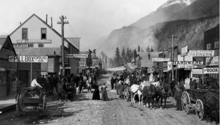
Skagway’s main street
Gold Rush Cemetery and Lower Reid Falls Distance 4 miles round trip Rated Easy. To get to the trailhead follow Main St. or Alaska St. north, cross over S. Klondike hwy and follow the gravel road around behind the railroad yards. Continue following the road and across the railroad tracks. The cemetery is located in the woods just beyond the parking area. A short forest trail behind the cemetery leads to a spectacular view of Lower Reid Falls. Beware of vehicles and trains when walking to the cemetery! There is a restroom located at the parking area.
The Big Easy, Bourbon Street, St. Louis Cathedral, Beignets are all associated with America’s most notorious city and it’s waiting for you to visit.
NOLAThe Big Easy
To begin with New Orleans is a destination virtually in a class all by itself. The city and its famous French Quarter are celebrated for history but even more for its traditions and incredible food.
The city was settled first by French trappers in the seventeenth century, than ceded to the Spanish in 1762 by Treaty. Following a number of fires in the late eighteenth century the Spanish rebuilt the French Quarter using mostly fired brick, including the most impressive structure in New Orleans, St. Louis Cathedral. The architectural character of the French Quarter, including multi-storied buildings with inner courtyards, arched doorways, and the extensive use of decorative wrought iron, were actually characteristic of the Spanish colonies.
Beginning in 1800 the countries of Spain and France signed a series of treaties stipulating that Spain gave Louisiana back to France, these confirmed and finalized the retrocession of Spanish Louisiana to France. Just three years later, Napoleon sold Louisiana which then included portions of more than a dozen present-day states along with New Orleans to the U.S. in the Louisiana Purchase.
Involved in a war with England, in 1814 New Orleans defended itself against a large English force sent to take the city. Marshaling forces (regular, militia, and naval) and recruiting pirates led by Jean Lafitte, Maj. Gen. Andrew Jackson routed the British in a decisive battle in the early morning of January 8, 1815.
The city grew out from the famous French Quarter with its iconic architecture, but the downtown area wasn’t big enough to hold all that was going on so it continued to spread out into the adjacent neighborhoods like the warehouse district, full of famous eateries, clubs and trendy galleries and even across the Mississippi River.
Famous for throwing one of America’s biggest parties each year called Mardi Grau, the truth is the party virtually never stops in this city’s French Quarter. The sidewalks of Bourbon Street are packed at night and some of its bars and restaurants virtually never close. Home to a musical tradition second to none and a restaurant scene famous around the world, New Orleans isn’t just a cruise port it’s an unforgettable destination.
Where Your Ship Docks
The Mississippi waterfront runs along the French Quarter and on into the growing Warehouse District and in the middle of it all is the Riverwalk Mall where the cruise ships tie up. Virtually in the heart of everything the cruise terminal is attached to the outlet shops of the Riverwalk Shopping Mall and only blocks from Canal Street hotels, restaurants and The French Quarter.
Transportation
If you are flying into New Orleans to catch a cruise, expect to pay a little over $50 for a taxi ride to the cruise terminal. There is a public bus route that will take you into downtown from the airport for less that $4 but the trip takes about forty minutes. We have found an advertised shuttle to be unreliable but the airport has a very convenient ride share pick-up area. A recent Lyft ride cost $32.
In downtown New Orleans, the French Quarter and Warehouse District feature numerous good hotels and if you aren’t up to walking there are pedicabs, street cars and easy to catch taxis.
Currency
Being the United States the currency is the Dollar and if you are visiting from out of the country you will find a number of conveniently located currency exchange outlets along with ATM machines.
Attractions
New Orleans is an attraction in itself. Just walking the French Quarter, listening to street music, eating Creole food, visiting Jackson Square and doing some window shopping is a true experience but there are some other things to consider:
St. Louis Cathedral built in 1789 is the oldest cathedral in the United States.
Saint Louis Cemetery is a famous New Orleans cemetery (actually 3) where most of the graves are above-ground vaults constructed in the 18th and 19th centuries.
Preservation Hall is a jazz venue in the French Quarter. The building is famous for a house band, a record label, and a music foundation.
The National WWII Museum, formerly The National D-Day Museum, a military history museum located in the Central Business District. New Orleans was the manufacturing center for the landing craft used for WWII beach assaults. The museum focuses on the contribution made by the United States to Allied victory in World War II.
The Audubon Aquarium of the Americas located on the waterfront is run by the Audubon Institute, which also operates the New Orleans Audubon Zoo and the Insectarium on Canal Street.
Food
When it comes to food New Orleans has more than its share of famous chefs including Emeril Lagasse, Paul Prudhomme, John Besh, John Folse,, Donald Link, and many many more. With restaurants like Emeril’s New Orleans, K. Paul (the creator of Blackened Redfish), Commanders Palace (a city institution), Brennen’s (the originator of Banna’s Foster) and Emeril’s Delmonico. You’ll run out of time before you run out of great restaurants. On the more casual front visit Mom’s for a Shrimp Poorboy and don’t miss Cafe du Monde for Beignets and chicory coffee.
The Tongass (Tongas) National Forest in Alaska is the largest U.S. National Forest with 16.7 million acres (26,100 sq mi). Most of its area is temperate rain forest and remote from population centers. The Tongass, which is managed by the United States Forest Service, encompasses islands of the Alexander Archipelago, fjords and glaciers, and peaks of the Alaska Coast Mountains. Alaska cities and towns with access to the Tongass include Craig, Hoonah, Juneau, Ketchikan, Petersburg, Skagway, Sitka, Thorne Bay, Wrangell, and Yakutat and all have United States Forest Service Ranger Offices except Skagway which provides a National Park Service Visitors Center.
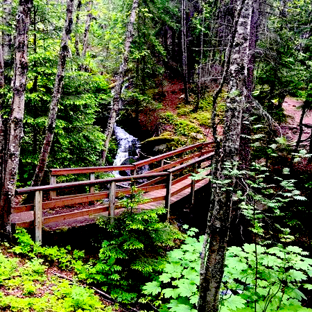
Ketchikan Hiking Trails
Ketchikan is a great location to access a number of great hiking trails in the Tongas National Forest. The town is also a popular cruise port of call. Below are a few trails near to downtown to consider if your cruise ship stops for a day.
In just two or three hours you can hike through some fantastic forests, explore local history and have an opportunity to take in some fantastic vistas. Below are maps and descriptions of four trails in or near town.
Schoenbar Trail (0.25 miles) Description: This trail goes through the Ketchikan Park District which contains City Park and the Totem Heritage Center. The trail connects Schoenbar Road to both Harris Street and Grant Street, providing a pleasant forested walk. This trail offers a forest experience right in town with access to Ketchikan Creek between from Harris Street Bridge and the trailhead parking lot.
Married Man Trail (0.20 miles) – A historic trail used by men to get to Ketchikan’s historic red-light district on Creek Street without being seen. It is now a nice walk around the rocky gorge area of Ketchikan Creek. Just before the Creek Street trailhead is a viewing platform looking up the narrow, rock gorge of Ketchikan Creek. The trail ends at Park Avenue and has nice views of the roaring creek and the fish ladder. It’s a nice walk through a dense, shaded forest right in town.
Rainbird Trail (1.3 miles, one way), 1 hour (one way). This is a more Difficult hike starting on Water Street, near the Berth 4 dock, follow Jefferson Street up a steep hill to Madison Street (6th Ave). Once you have reached the top, head west (left) onto Third Avenue and follow to the trailhead on the north side of the road. Another trailhead is located at the University of Alaska Southeast parking lot, accessed by following Jefferson Street up from Tongass Avenue past Ketchikan High School to College Avenue. The trail starts at the rear of the parking lot. The trail is a natural path with some sections of stairs and boardwalk. Access via the UAS and Third Avenue trailheads will have a steep climb, but then levels off with several small stream crossings on the trail route. The trail offers easily access to the rainforest close to downtown Ketchikan. A number of places along the trail offer great view of Ketchikan and surrounding area.
Waterfront Promenade (1.3 miles (one way) 1 hour (one way) The waterfront promenade can be accessed from a variety of locations in the downtown Ketchikan area. This trail passes two boat harbors (Thomas Basin and the Casey Moran Harbor) with moorage for numerous commercial and recreational boats. There are great shopping opportunities for locally-crafted items along the Promenade, including with native, marine and wildlife themes. Two visitor information centers are along the trail, as well as the Southeast Alaska Discovery Center. It features interpretive signs with information on Ketchikan’s past and businesses along the Promenade offer items of interest to visitors.
There is something about the sights and sounds of falling water in nature that seems to attract us. It isn’t unusual for us to have hiked for miles and even taken long air trips just to experience a particular waterfall. Maybe it is a combination of the pure power of falling water combined with a feeling of its endurance and consistency that draws us to the spectacle. Here we take this opportunity to offer a few of our favorites.
KATOOMBA FALLS in the Blue Mountains of Australia can be seen easily from the Katoomba Cascades walk as well as the Scenic World overlook.
GIBBON FALLS Yellowstone. Located in an environment of rocky cliffs and scrubby pines. It’s just off the road between Madison and Norris Junctions, the stunning Gibbon Falls is an easy drive from the park’s entrance at West Yellowstone. If you’re lucky, you may be able to glimpse (and hear) the falls from your vehicle. But do yourself a favor and park. It only takes a few steps into the woods to reveal the full beauty of the falls, which cascade 84 feet into a small, clear pool.
HICKORY NUT FALLS, Chimney Rock, North Carolina is a 404 ft. tall falls at Chimney Rock State Park is one of the highest waterfalls east of the Mississippi. Take a woodland hike on an easy 3/4-mile trail to enjoy an up-close view at its base from a platform.
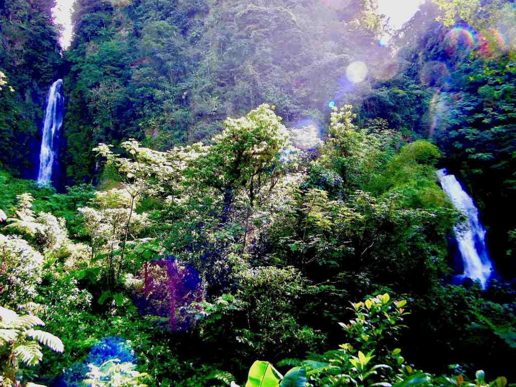
TRAFALAGRAR FALLS, Dominica, W.I. These famous twin waterfalls are a 20-minute drive from Roseau. It’s a short 10 to 15 minute walk along a well-maintained path to the visitor reception area, where you can photograph both falls from a viewing platform. As you walk the path, be sure to stop at the warm spring that flows across the trail.
SNOQUALMIE FALLS Washington state is a 270 foot waterfall and the state’s most popular natural attraction. The falls is a two-acre park with observation deck along with the Salish Lodge.
SLIDE ROCK CASCADE in Slide Rock State Park, Arizona. It features a natural rock water slide located in Oak Creek Canyon and is just 15 minutes from the town of Sedona. Probably the most fun you can have outside an amusement park.
MONTMORENCY FALLS, Canada. The falls are at the mouth of the Montmorency River where it puts on a major show as it drops over the cliff into the Saint Lawrence River. It’s opposite the western end of the Île d’Orleans where the waterfall drops 272 feet.